


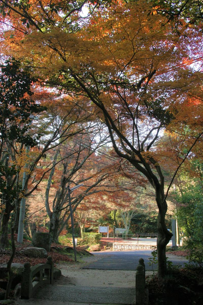
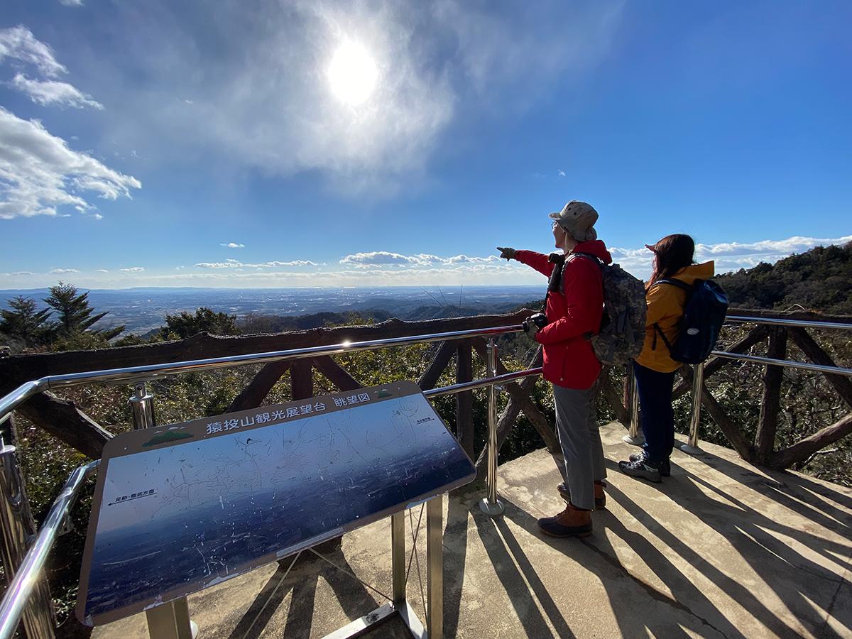
Mt. Sanage


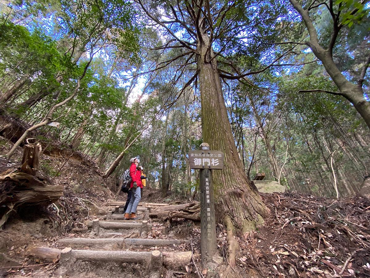
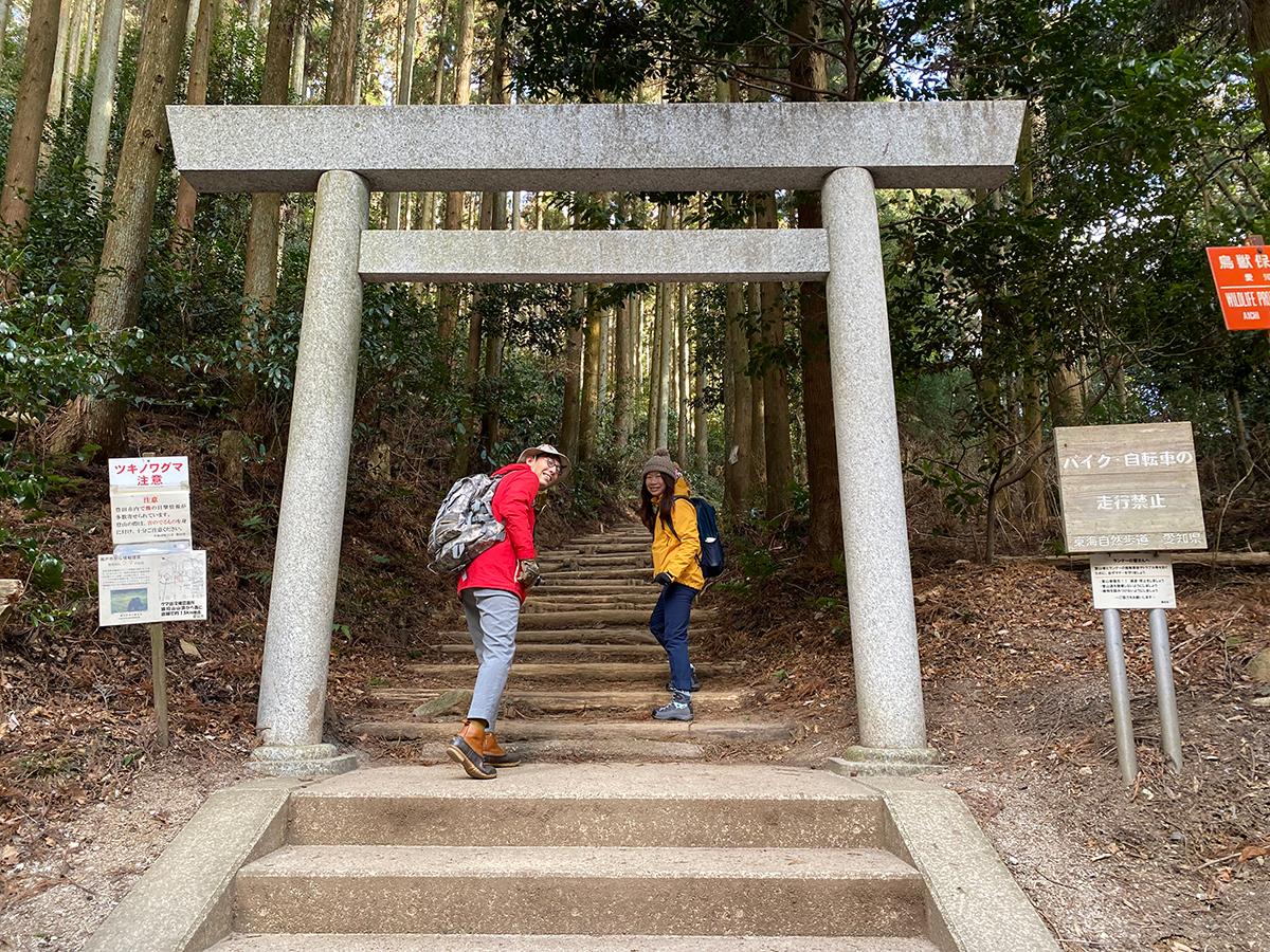
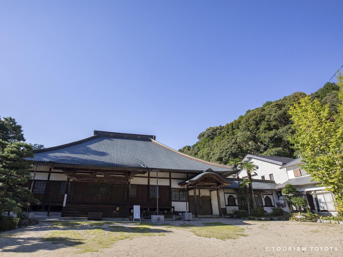
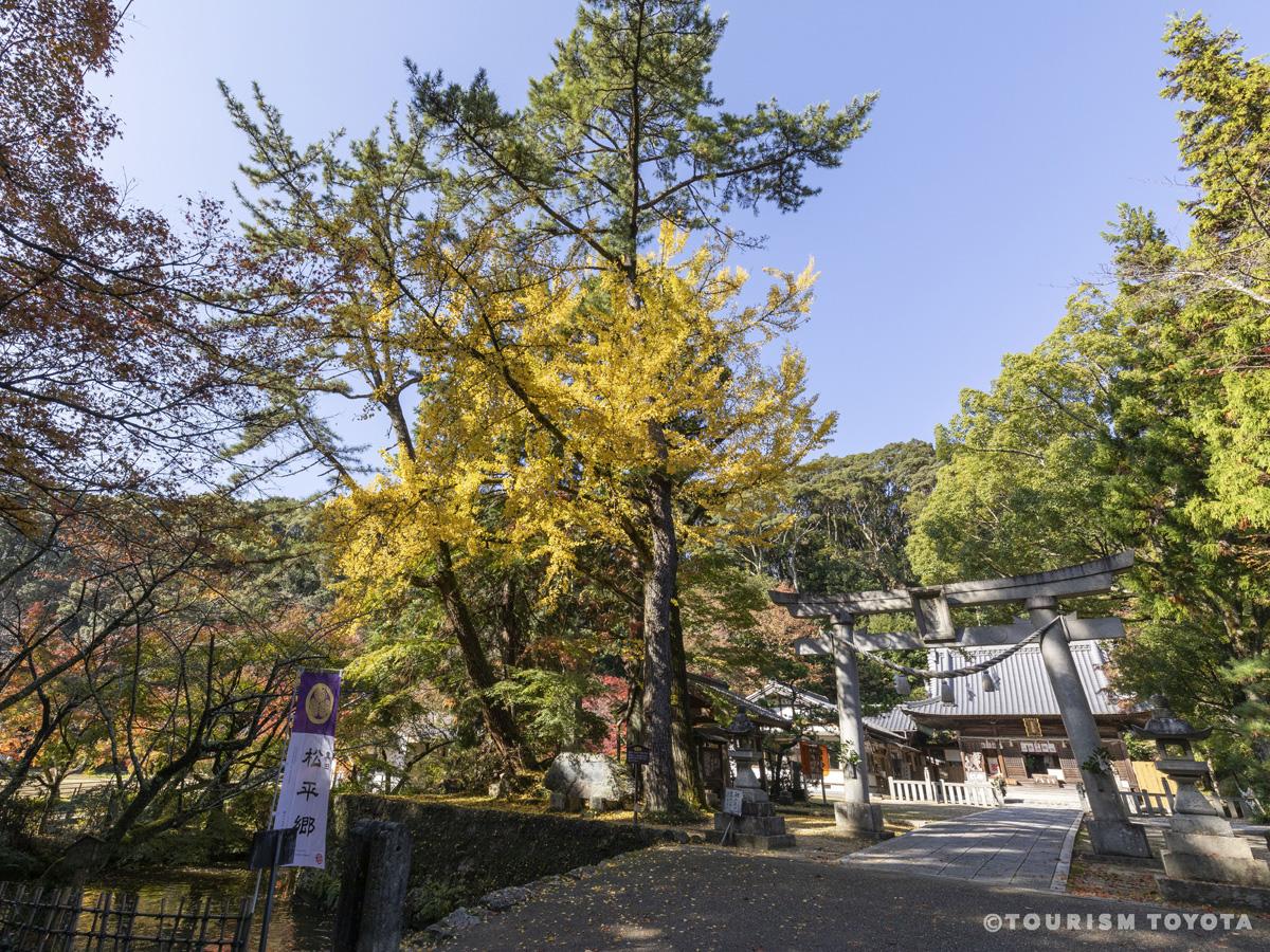
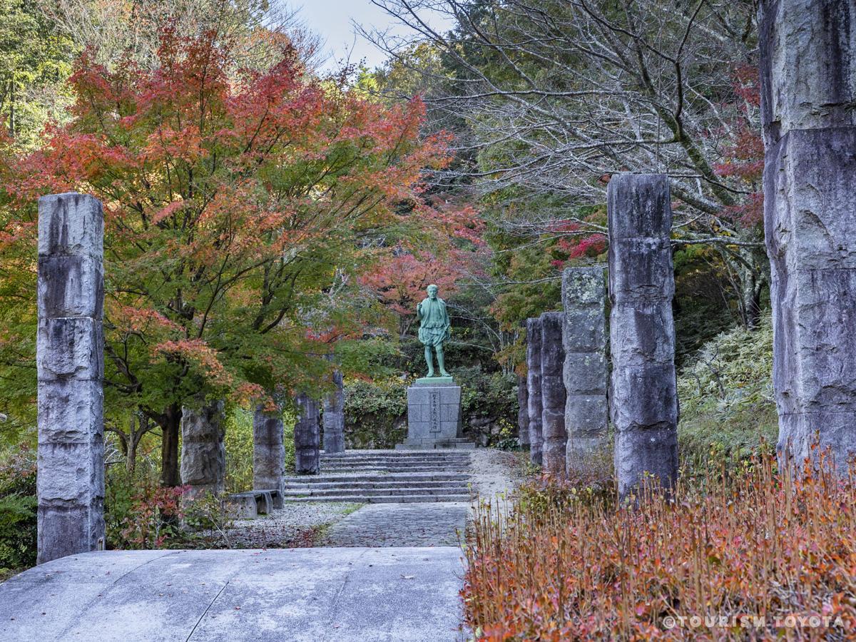
Mt. Sanage on the northern edge of the municipality of Toyota is both a popular hiking destination and a sacred peak that has been revered from prehistoric times to the present. The mountain’s rounded summit (629m) is visible from afar from nearly all directions, making it an important landmark, and is thought to have been an object of enduring awe and curiosity among the people who lived on the surrounding plains. It is not clear when organized worship of Mt. Sanageyama began, but there have been shrines on its slopes since at least the ninth century that were originally sites for syncretic Shinto-Buddhist practice. Those sites were the predecessors of modern-day Sanage Shrine, a large Shinto sanctuary that consists of the main shrine complex at the southern foot of the mountain and two smaller shrines, Higashinomiya and Nishinomiya, on its eastern and western slopes, respectively.
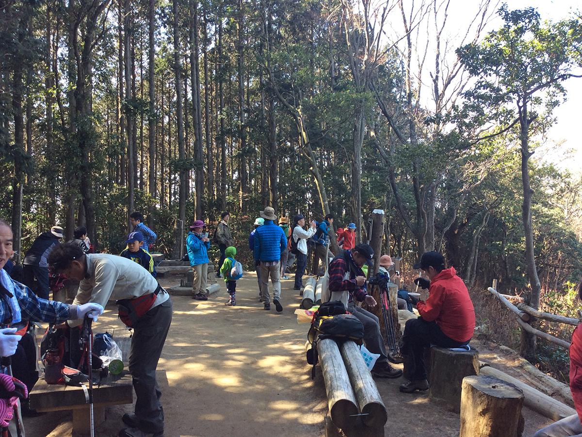
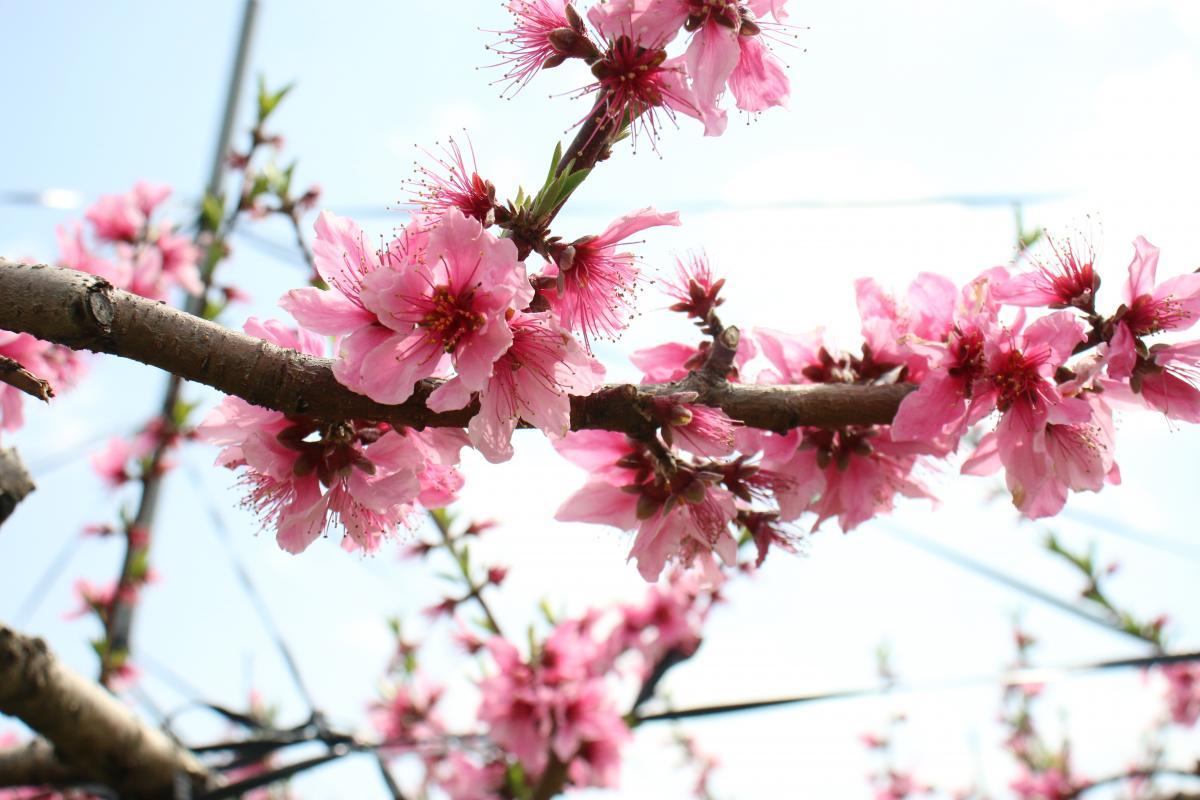
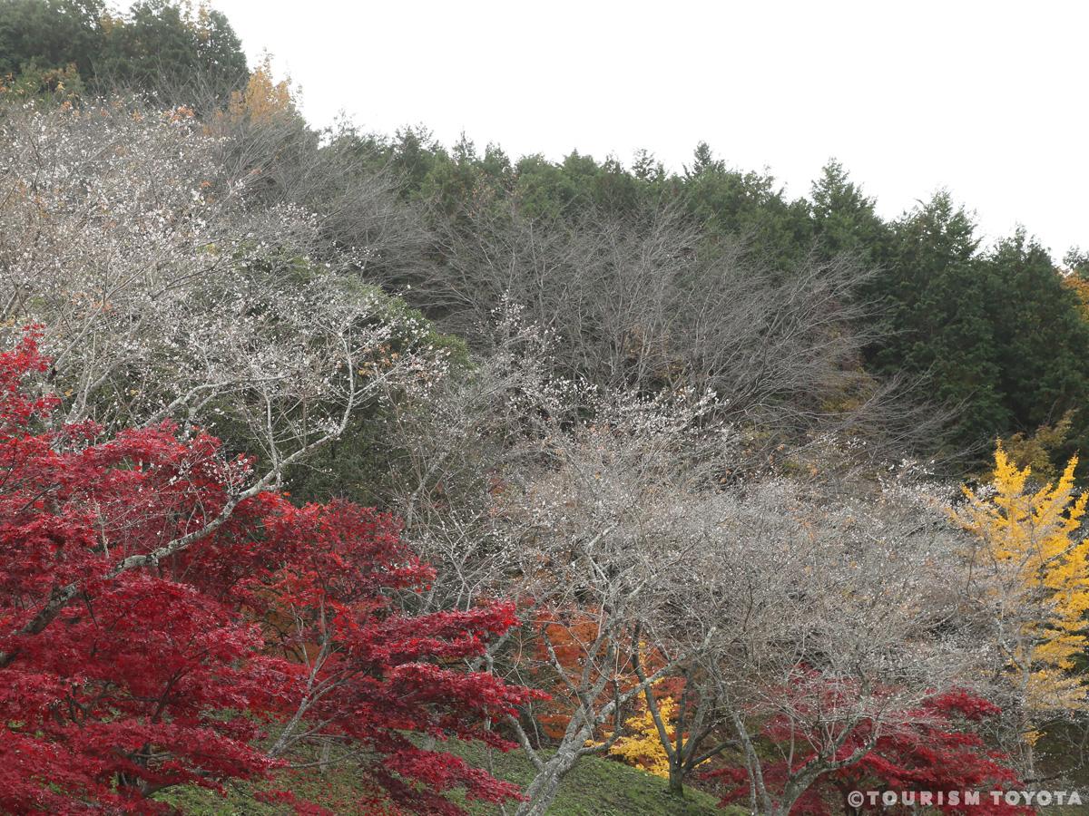
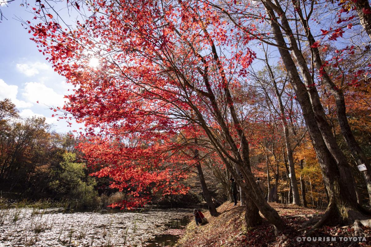
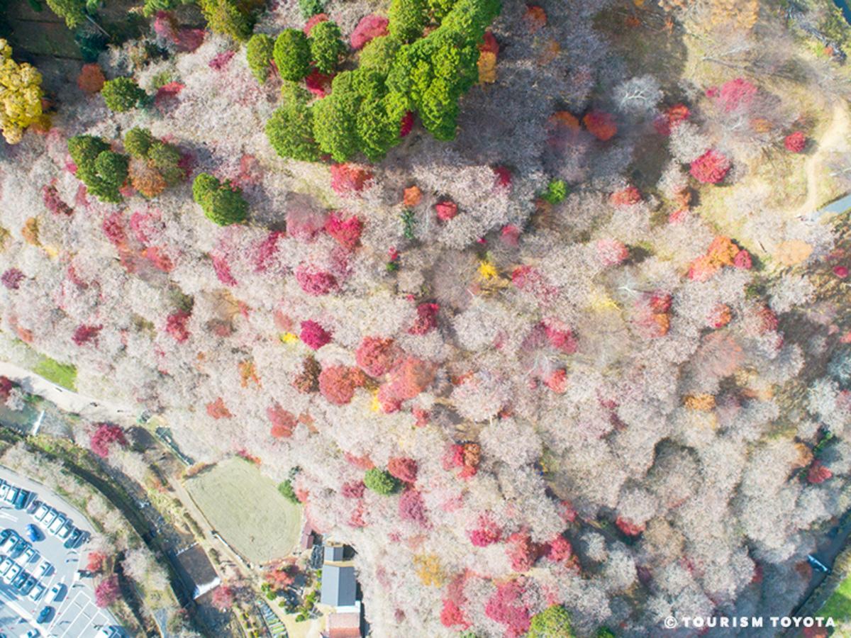
Many hikers visit the mountain on weekends, especially in spring when the peach trees around its slopes are in bloom, and in autumn to see the seasonal foliage. Japanese cedar and hinoki cypress trees grow throughout the slopes, interspersed with evergreen oaks (akagashi), camellias (yabutsubaki), chinquapins (tsuburajii), hemlocks (tsuga), and cherry birches (mizume).
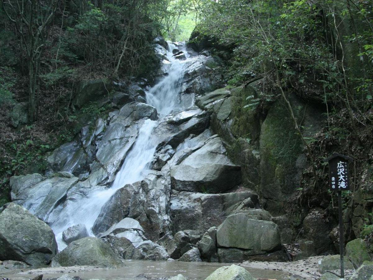
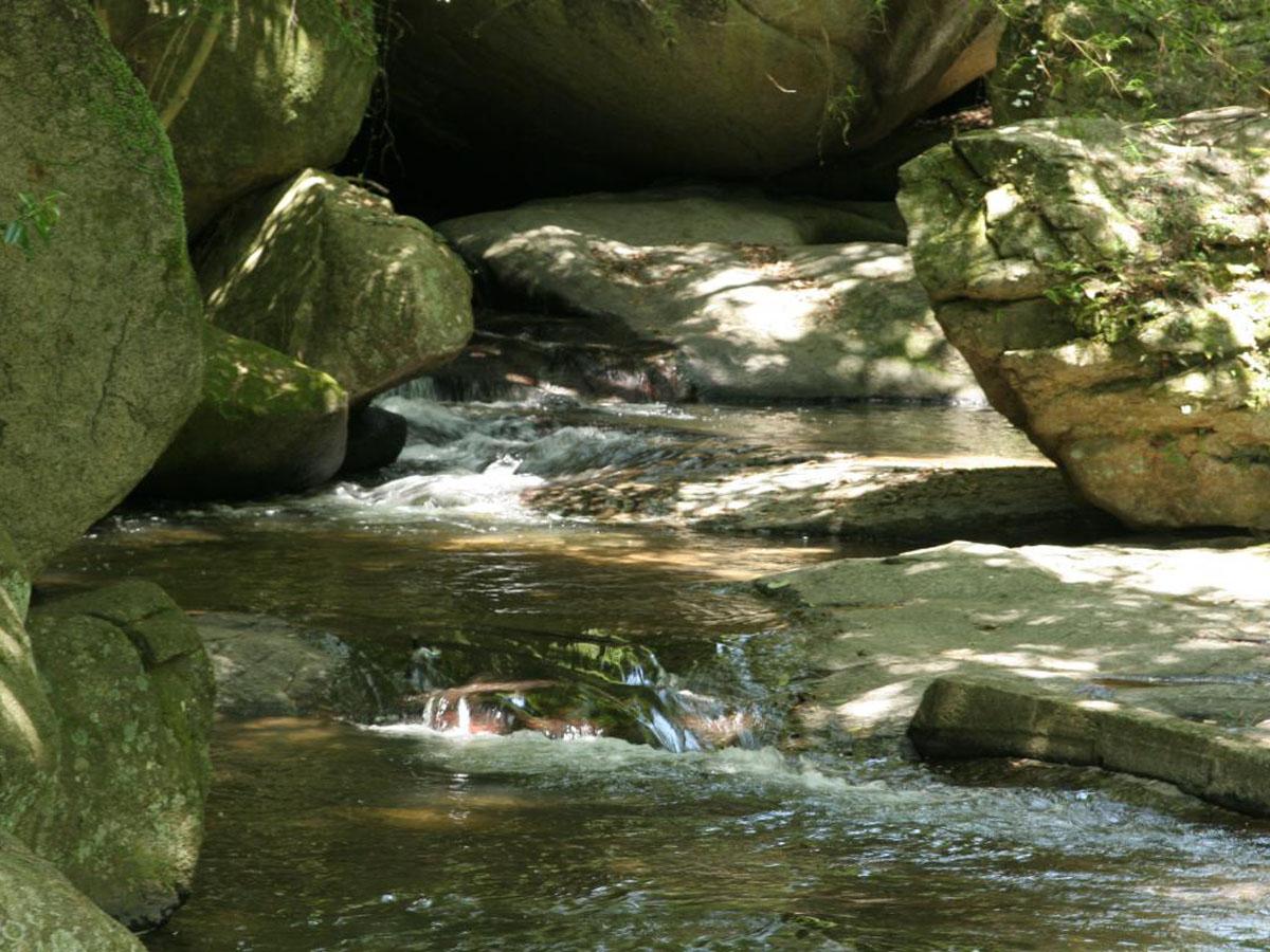
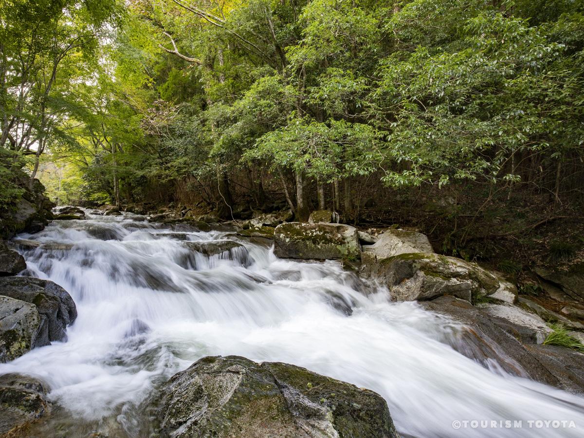
There are two trails to the summit, both starting from the main complex of Sanage Shrine. The western one follows the Hirosawa River and passes by a series of seven waterfalls on its way toward Nishinomiya Shrine and then on to the summit. The eastern trail goes past Higashinomiya Shrine and its grove of giant cedar trees before turning onto a ridge that offers views toward the Southern Alps along the way to the peak. Both trails are dotted with large boulders, one of which is shaped like a boat, and another is said to resemble a frog. Completing the entire 13.3-kilometer circuit takes about four and a half hours.
Visible from the summit toward the west and southwest are the city of Nagoya, the Chita Peninsula, Ise Bay, and Mikawa Bay. Just to the north is the 701-meter Mt. Mikuni (“three provinces”), named after its location on the border of the former Mino, Owari, and Mikawa Provinces. On clear days it is possible to see the peaks of Mt. Haku (2,702m) and Mt. Ontake (3,067m) as well as the Southern Alps.
Annual events
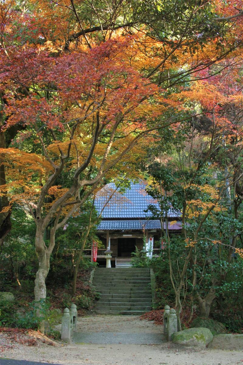
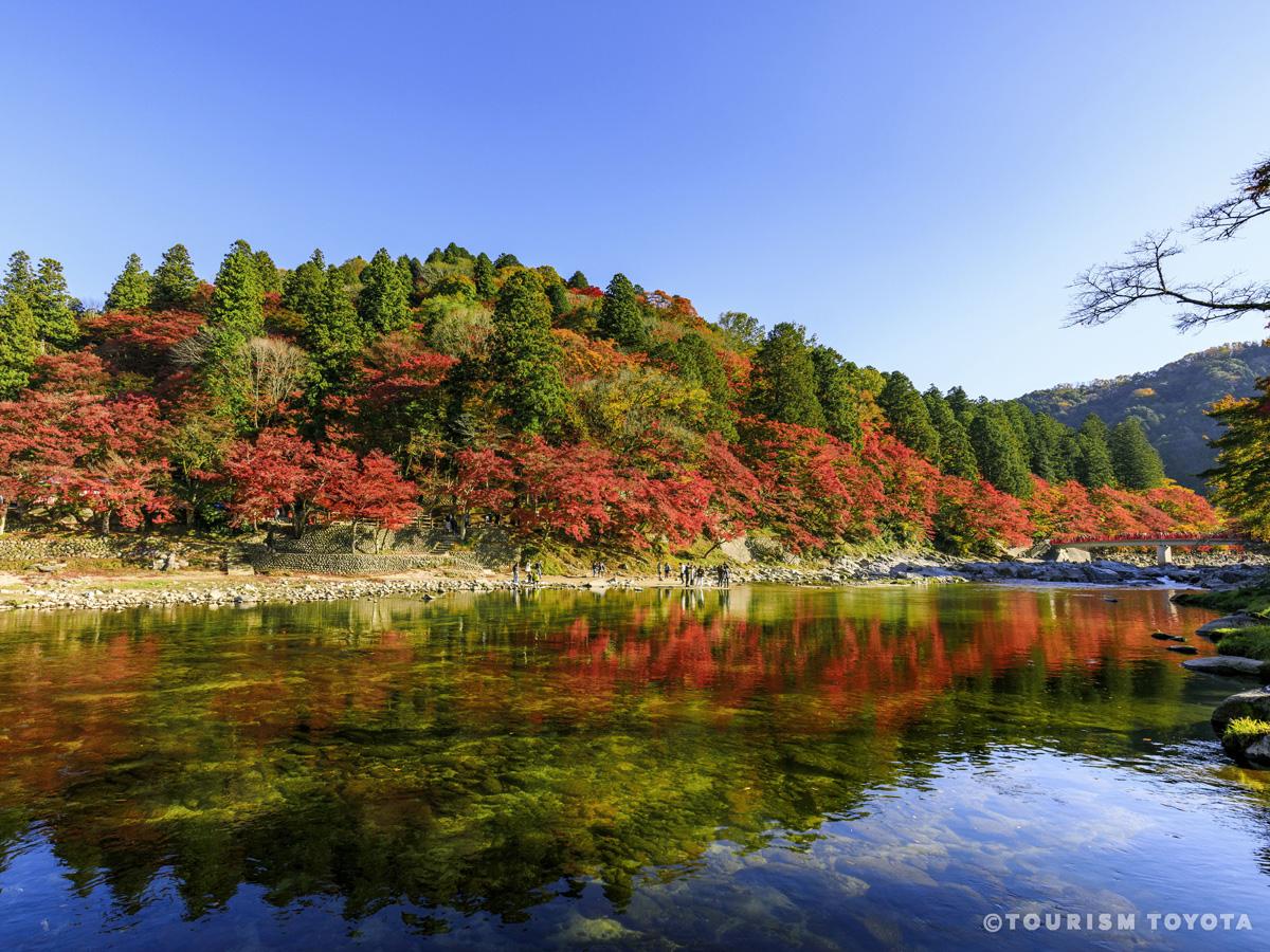
Sanage Jinja Shrine autumn foliage (mid- to late November)
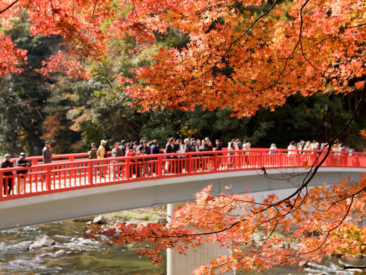
In autumn, the maple forest around Sanage Jinja Shrine in the foothills turns a deep crimson, to the delight of visitors. The maple tree in front of the Toshoji Temple Daihiden Hall is particularly famed for its beauty.
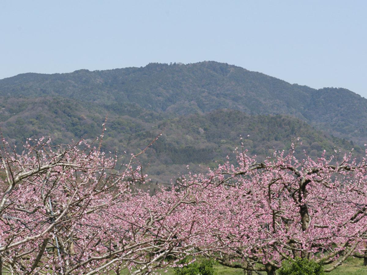
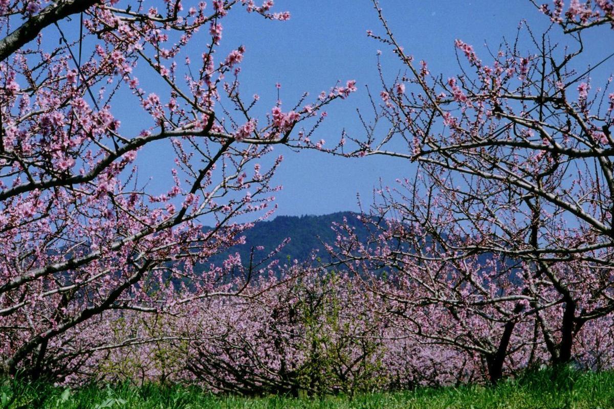
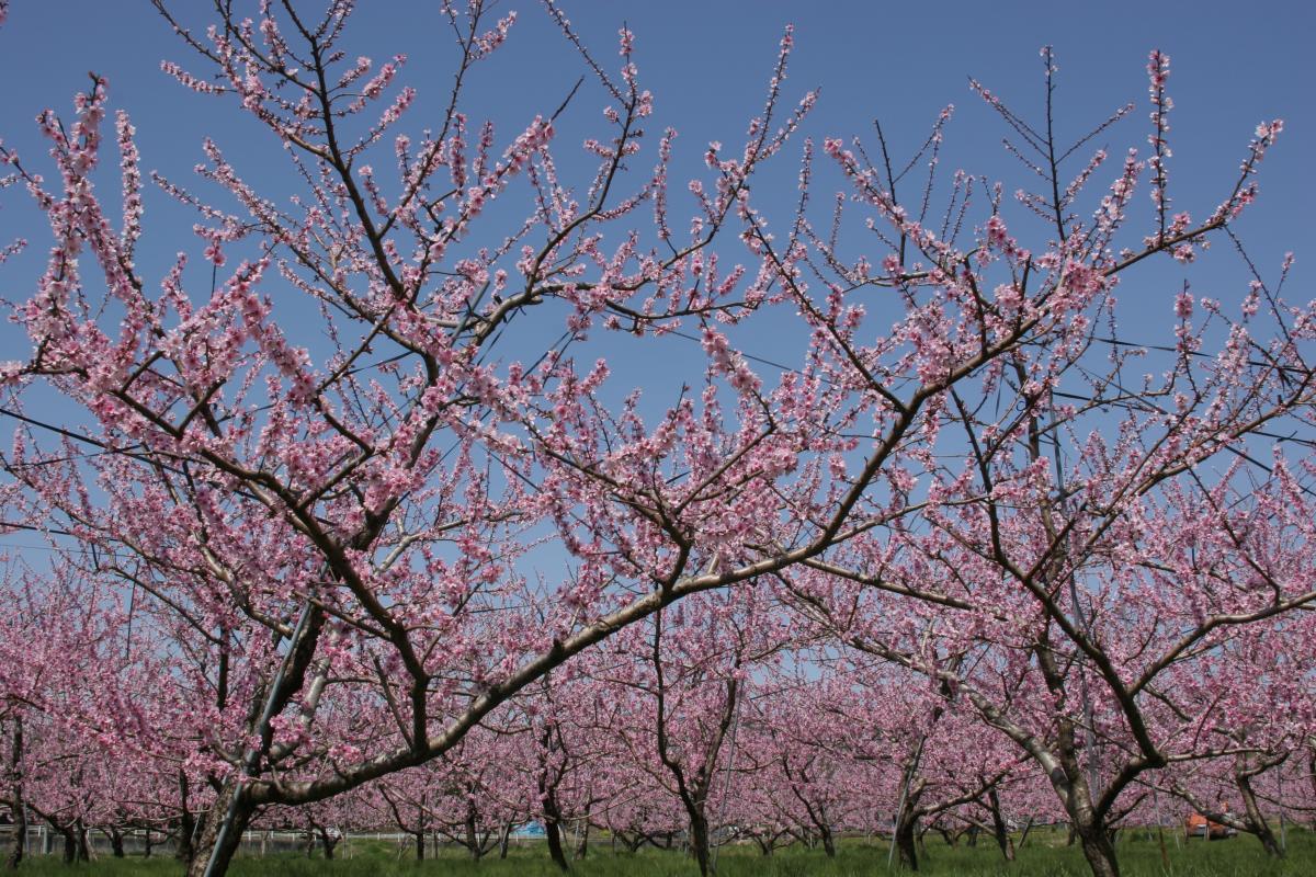
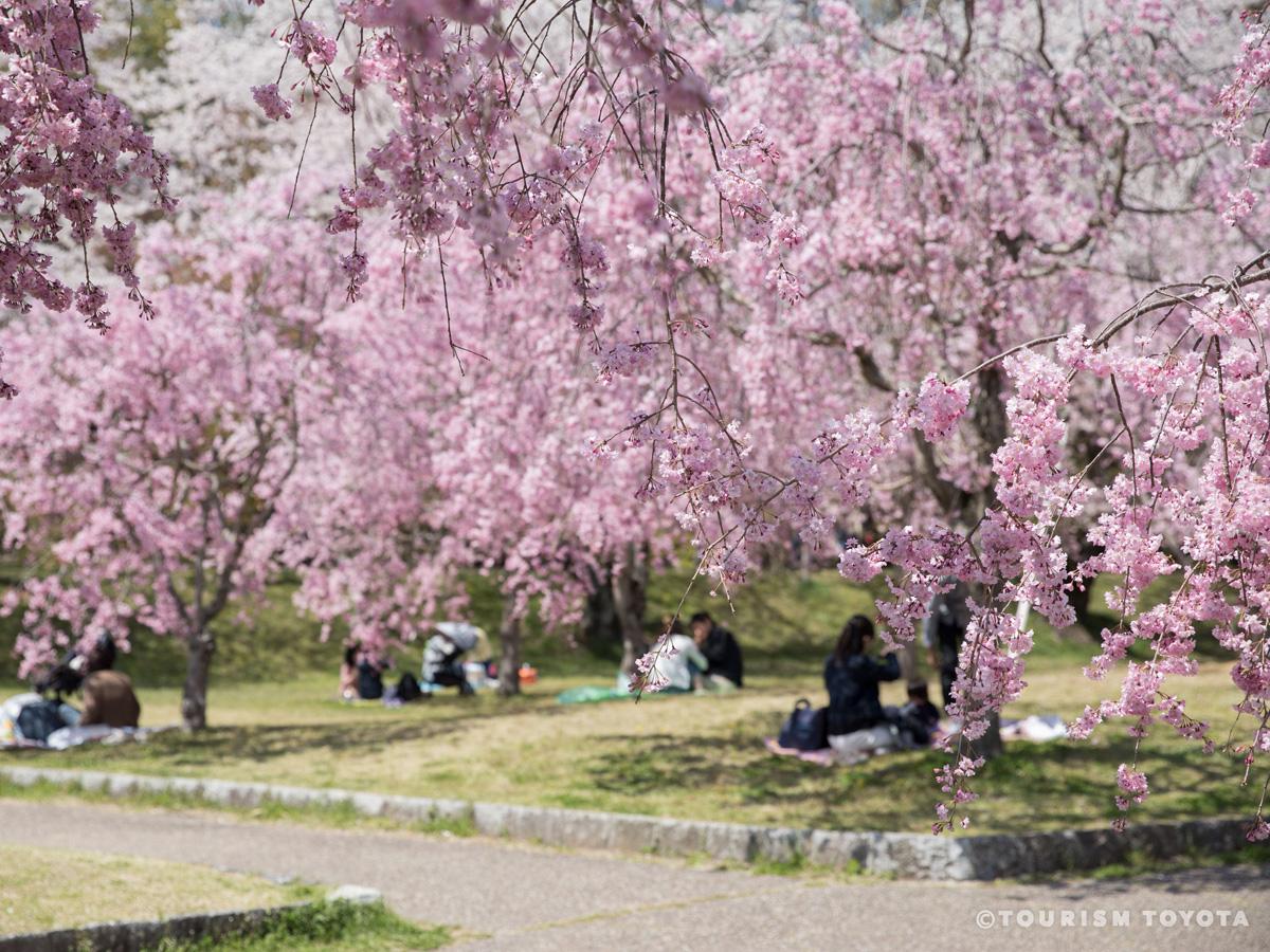
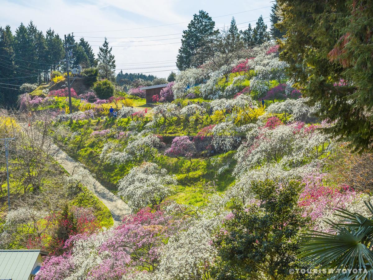
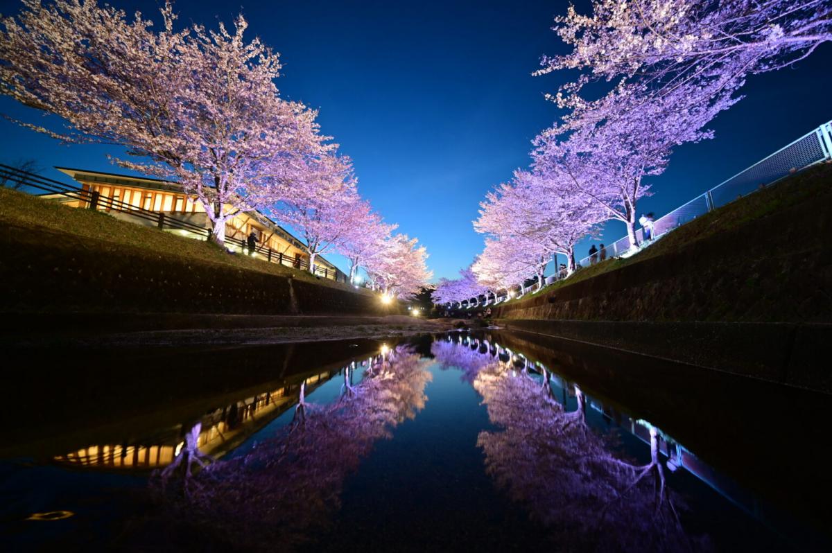
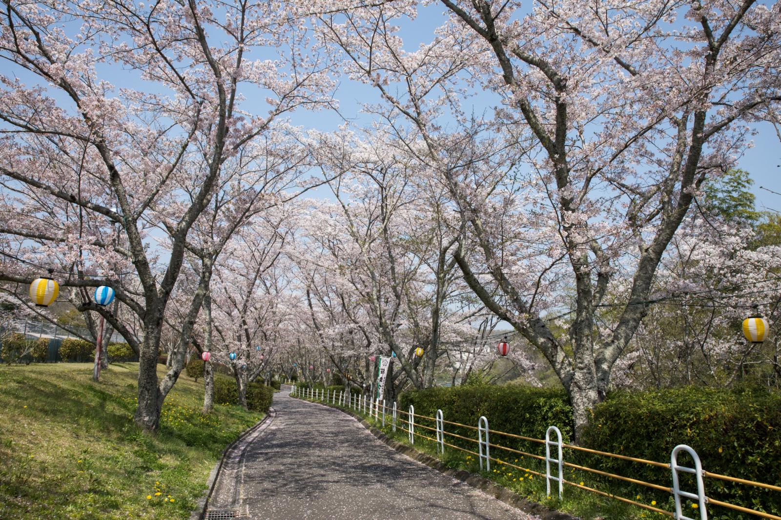
Mt. Sanage foothills peach blossoms (late March to mid-April)
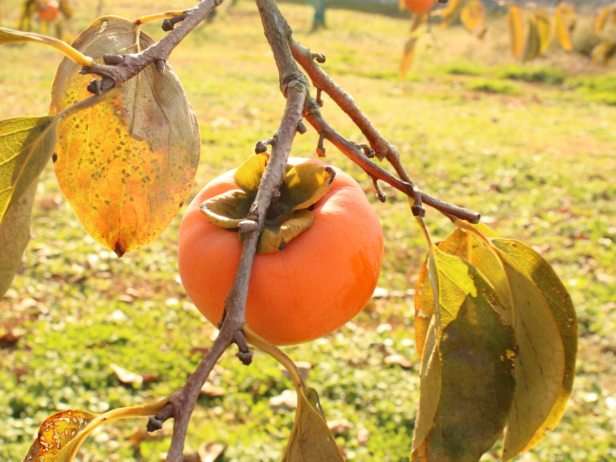
The Sanage area is called “Momo no Sato” (peach country), and boasts one of the largest peach harvests in the prefecture! In spring, the foothills are filled with blooming peach blossoms, like the world of the fable The Peach Blossom Land.
| Address | 〒470-0361 Washitori, Sanage-cho, Toyota-shi, Aichi |
|---|---|
| Cost | Free admission |
| Business hours | Open all day |
| Parking | Free parking for 50 vehicles. |
| Closed | None |
| Directions by car | 30 min. north on the Sanage Green Road Sanage Interchange |
Area Information
-

Sanage Onsen Resort
Toyota-Area
-
Daihiden Toshoji Temple
Toyota-Area
-
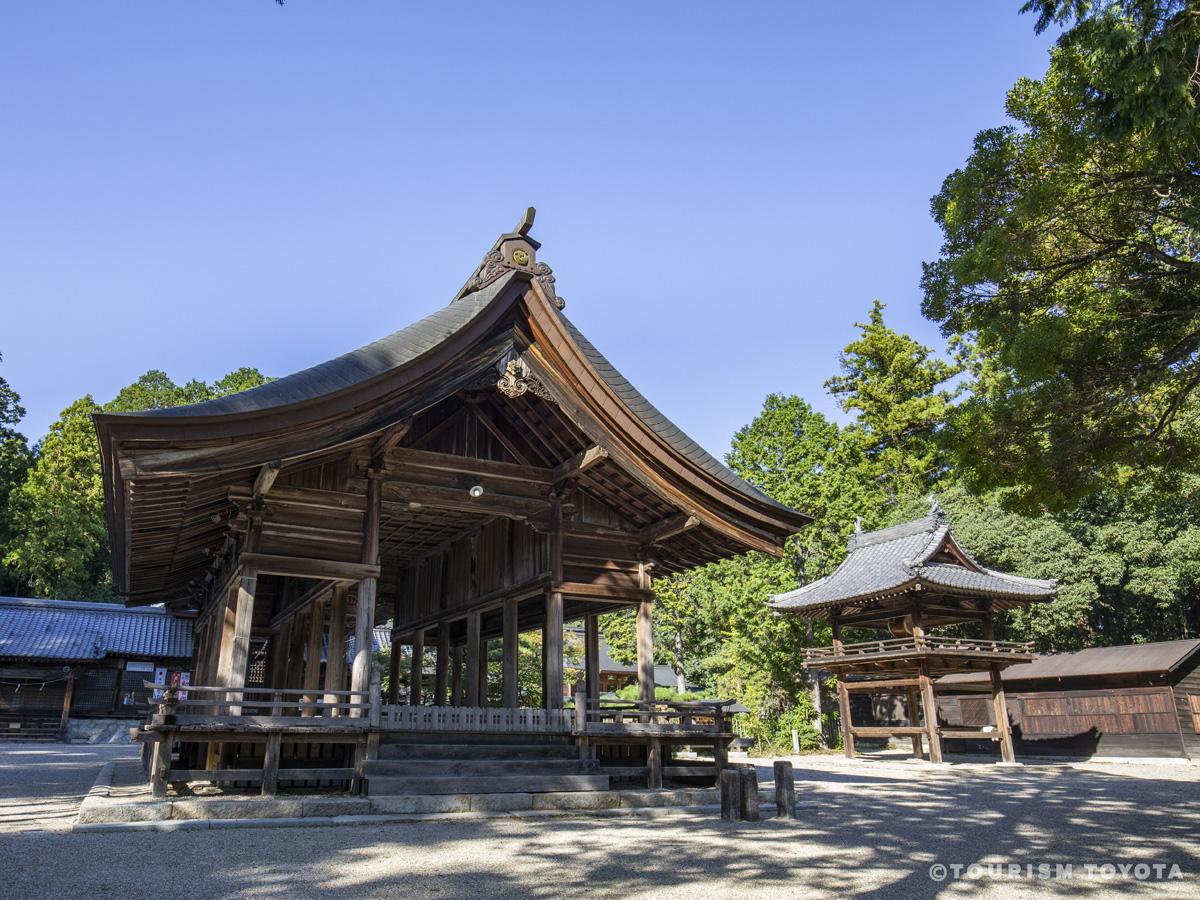
Sanage Shrine
Toyota-Area
-
Toyota Bo-no-Te Kaikan Museum
Toyota-Area
-
Aichi Prefectural Greenification Center
Fujioka-Area
-

Sakura Cherry and Yukiyanagi Thunberg's Meadowsweet Blossoms of Aichi Prefectural Greenification Center
Fujioka-Area
-

Umekou Peach, Pear, and Strawberry Farm
Toyota-Area
-

Fuji-no-Kairo Wisteria Alley
Fujioka-Area
-
Maruka Orchard
Toyota-Area
-
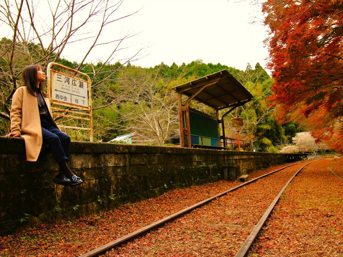
Abandoned stations along the Meitetsu Mikawa Line (Sanage Station–Nishi Nakagane Station)
Toyota-Area


Recommended Spots
-
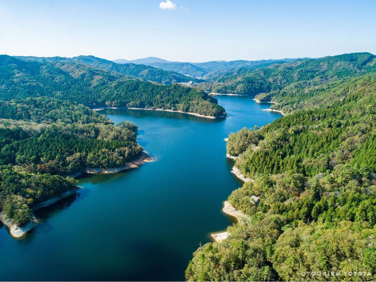
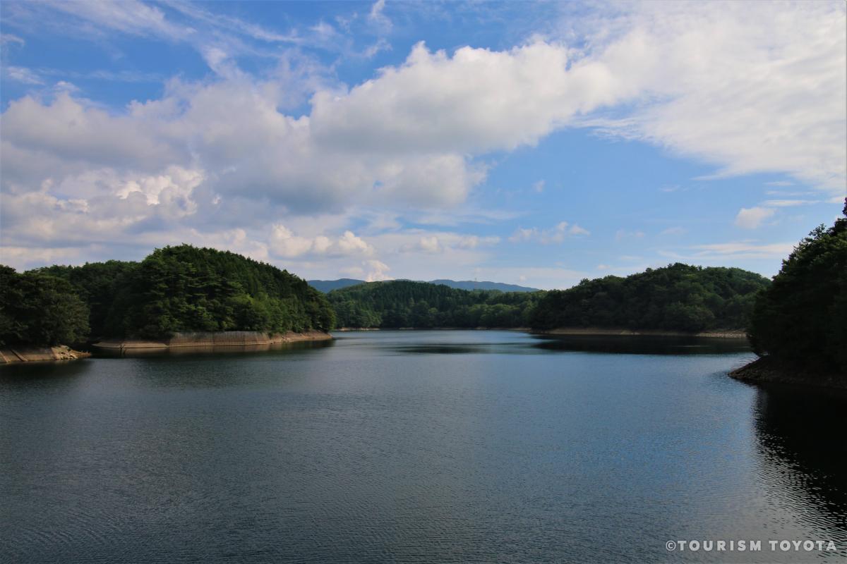
Lake Mikawa
Shimoyama-Area
Many people come to see the lake’s seasonal beauty. You can drive around the lake’s 16-km…
-
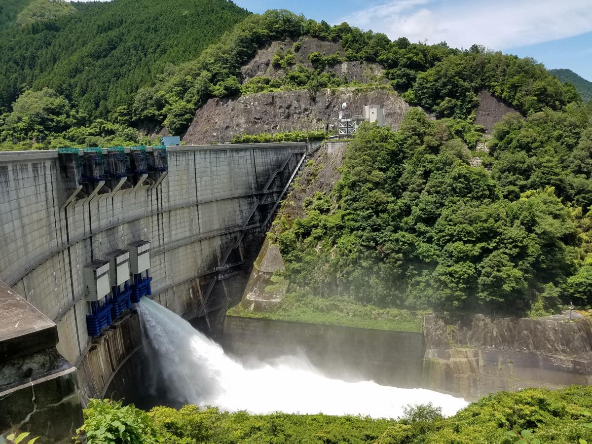
Yahagi Dam
Asahi-Area
Yahagi Dam is an arched concrete dam that embanks the Yahagi River, creating Oku Yagahi L…
-
Kuroda Dam
Inabu-Area
Kuroda Dam is a concrete gravitational power generation dam along the City of Toyota's Ku…
-
Mt. Sanage
Toyota-Area
-
Mikawa Plateau (Mikawakougen)
Shimoyama-Area
Mikawakougen is a gently sloping plateau with an altitude of 600 meters near the center o…
-
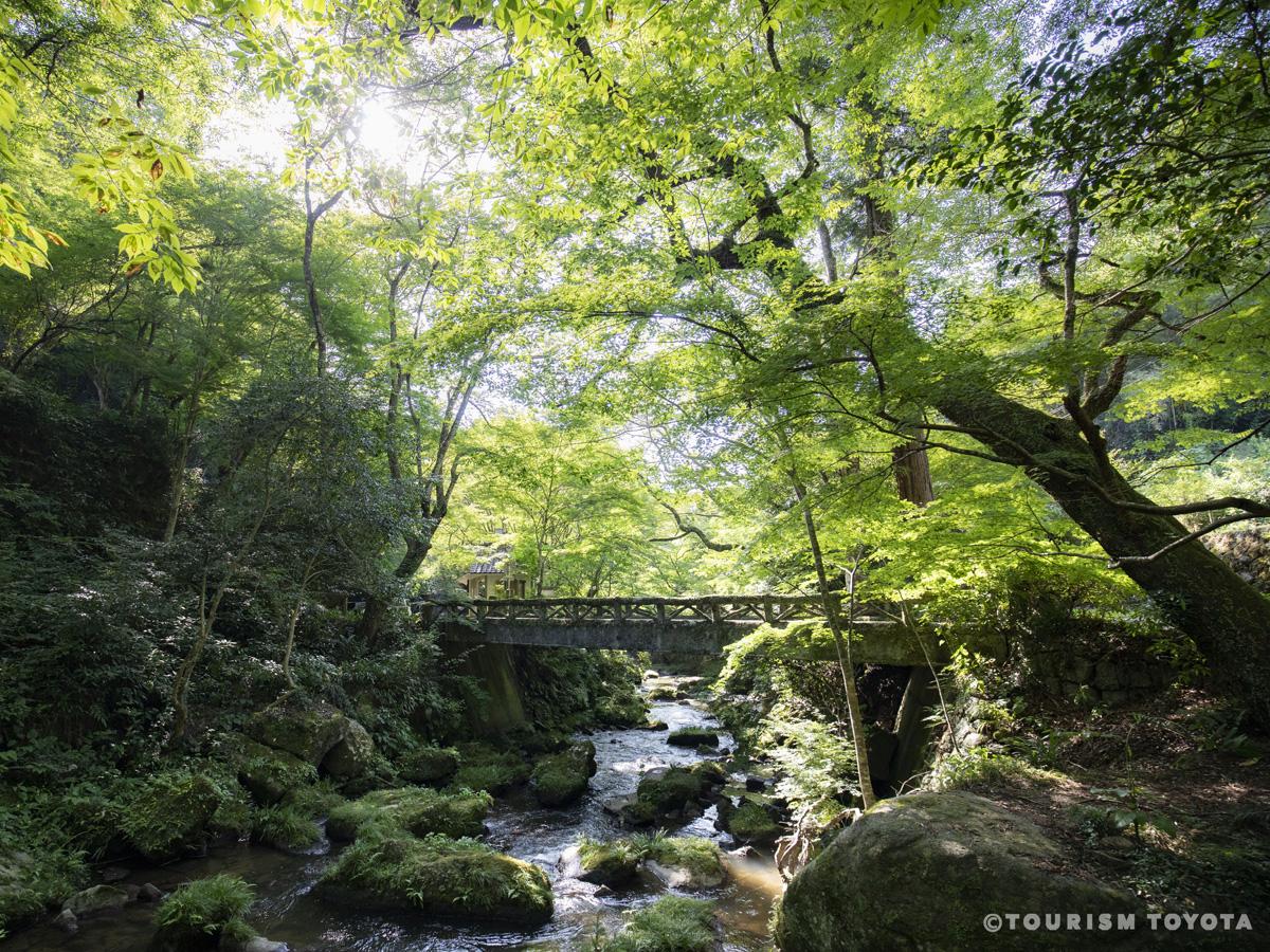
Otaki Gorge
Matsudaira-Area
-
Korankei Gorge
Asuke-Area
Korankei Gorge is famous as a location for fall foliage. The best time to see the foliage…
-
Hodo no Nanataki Waterfall
Shimoyama-Area
Hodo no Nakataki Waterfall is located on a tributary of the Nohara River. Stretching for …
-
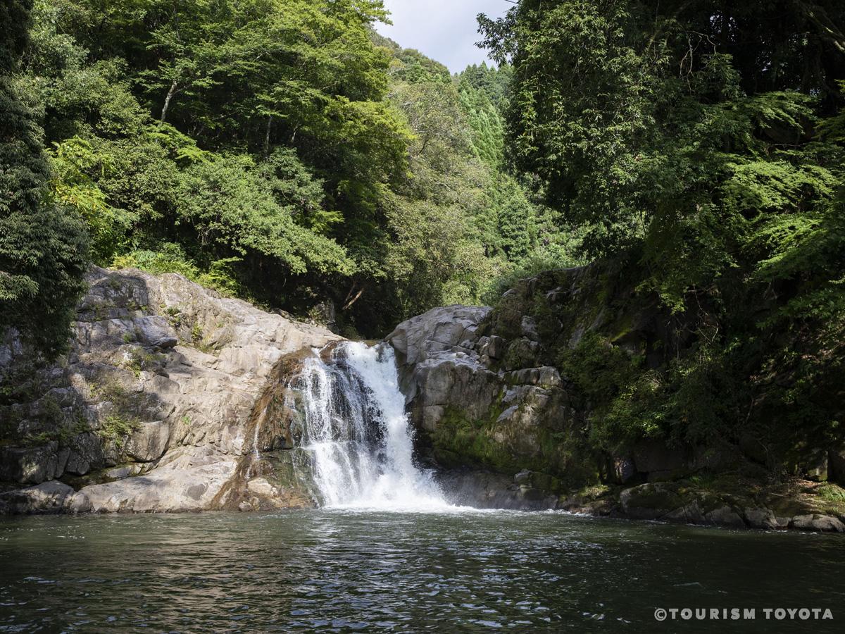
Oshikawa Waterfall
Inabu-Area
Oshikawa Waterfall is a calming spot where you can enjoy the rushing sound of water falli…
-
Kuragaike Park
Toyota-Area
-
Suigen Park
Toyota-Area
Stretching out along the Yahagi River, it is one of the city’s most famous spots for cher…
-
Aichi Prefectural Greenification Center
Fujioka-Area
A facility filled with a variety of gardens such as Japanese gardens and rock gardens whe…
-
Asahi Nature Highland (Asahi Kogen Genki-Mura)
Asahi-Area
A multipurpose leisure facility on a highland elevation of 650 m. Enjoy various activitie…
-
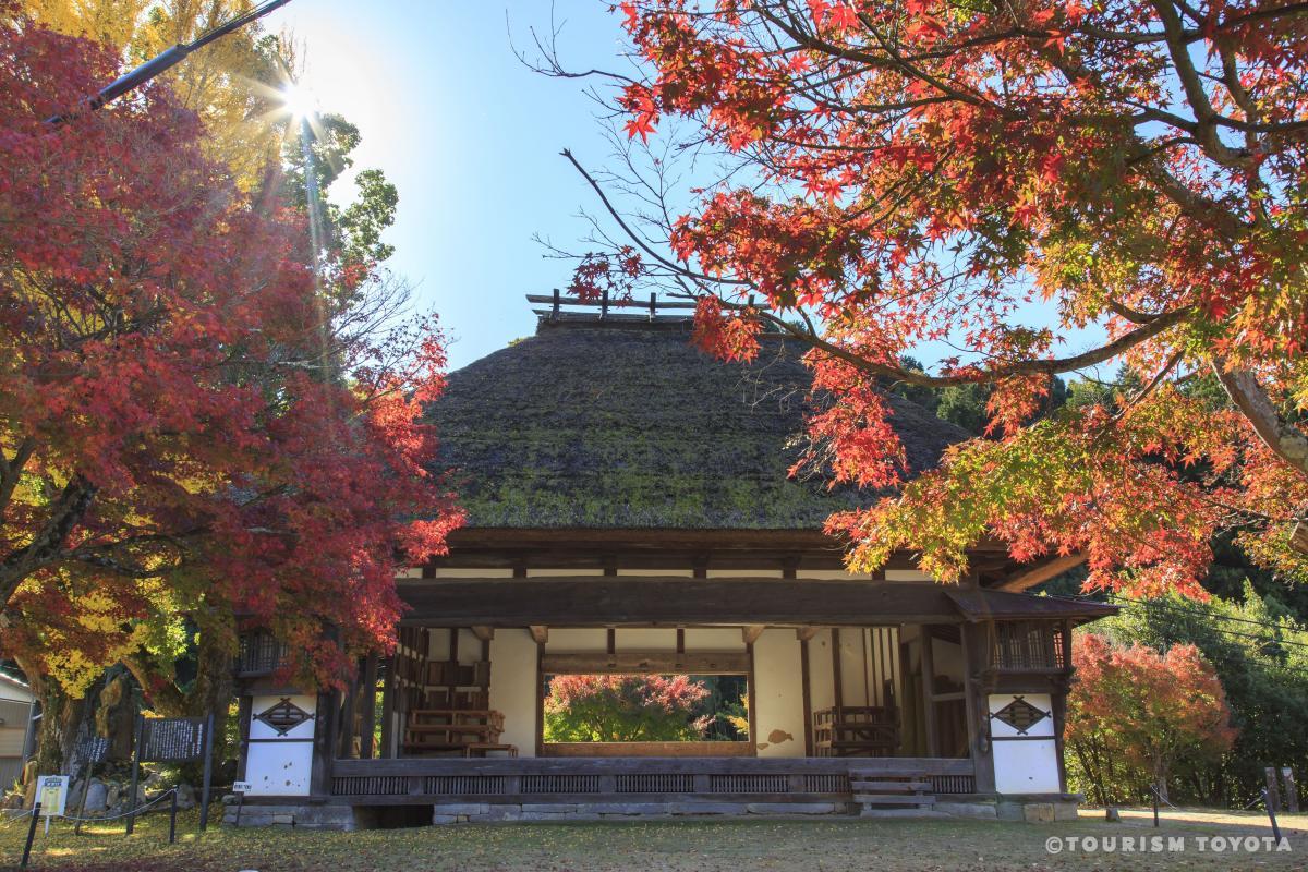
Daihiden Toshoji Temple
Toyota-Area
Daihiden Toshoji is a Soto Zen temple located approximately 300 meters northeast of the m…
-
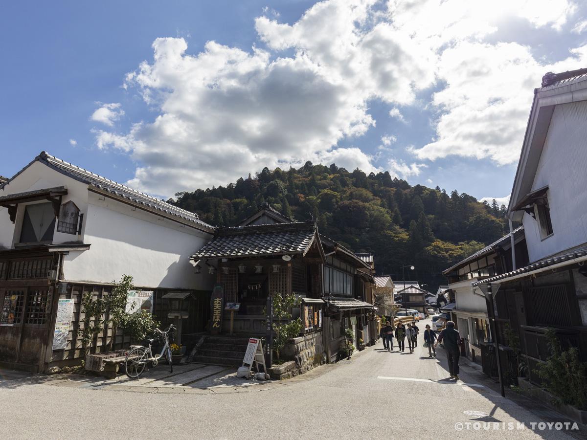
Asuke Townscape (Important Preservation District of Historic Buildings)
Asuke-Area
The basic pattern of the Asuke Townscape (Important Preservation District of Historic Bui…
-
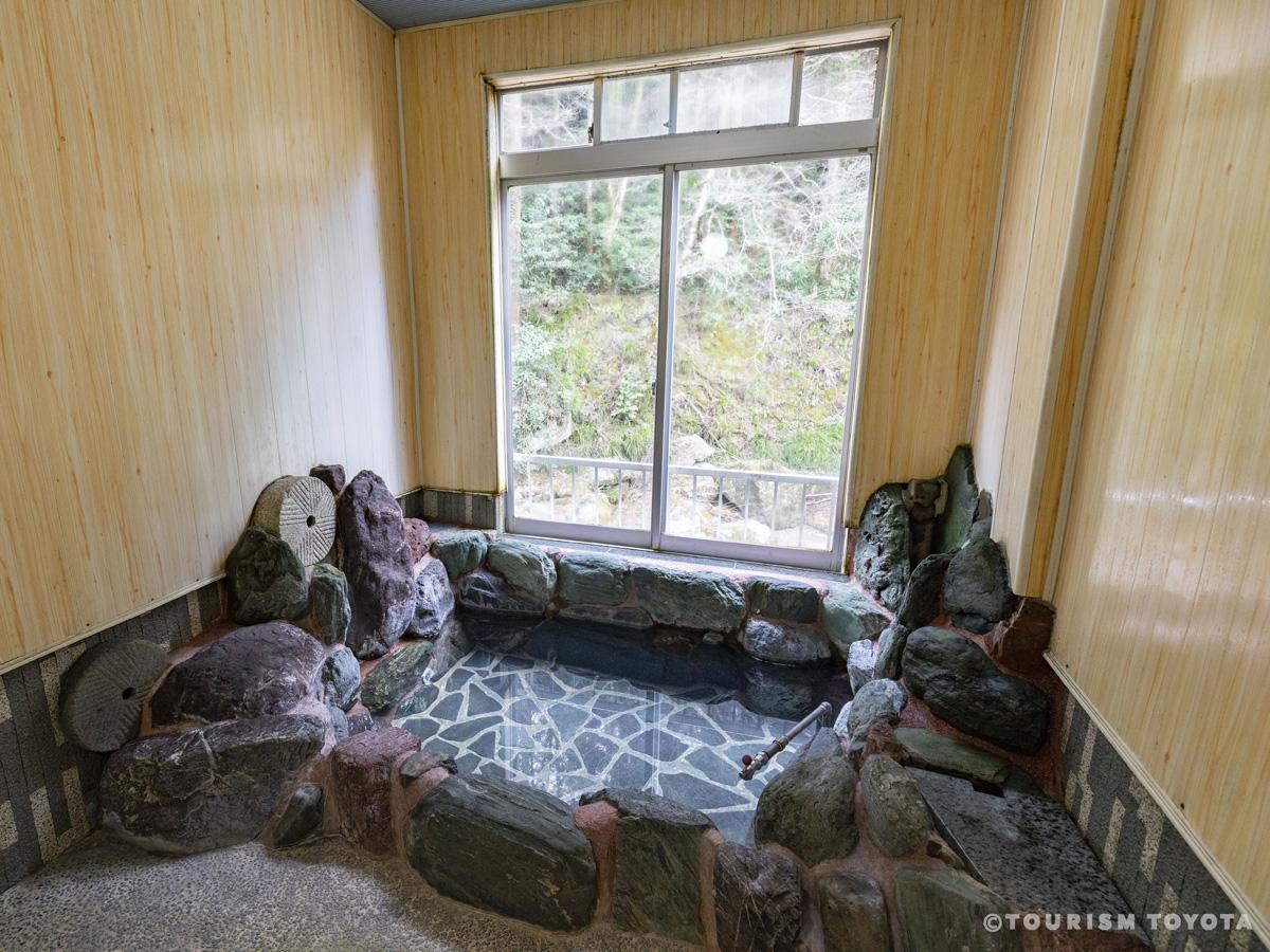
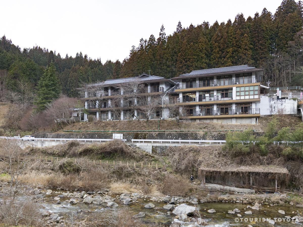
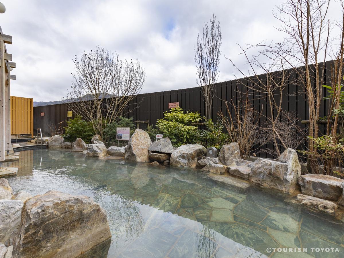
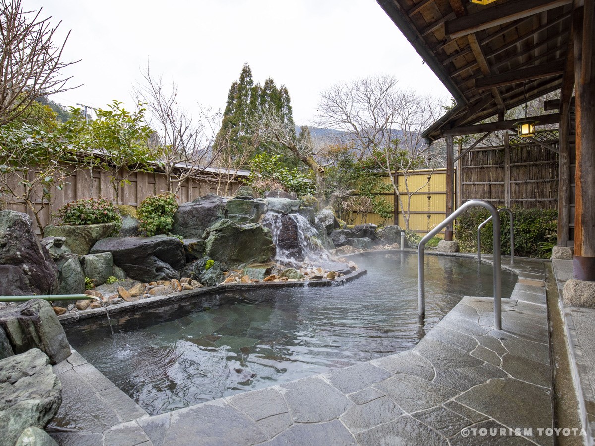
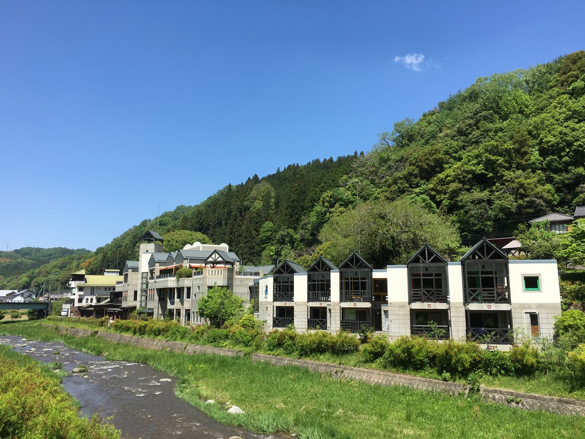
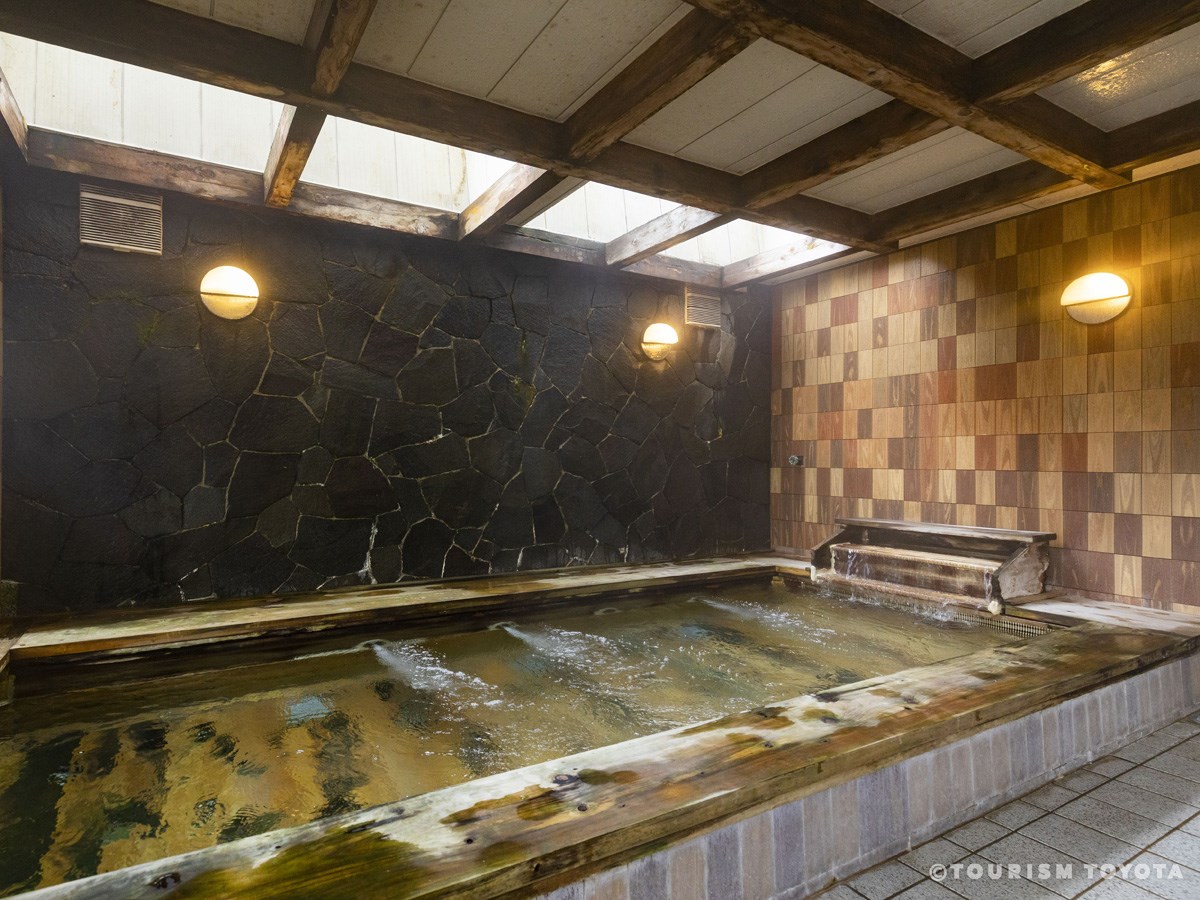
Sanage Onsen Resort
Toyota-Area
Sanage Onsen is Aichi Prefecture's largest natural radon hot spring. The hot spring water…
-
Odo Onsen Resort
Asahi-Area
Odo Onsen Hot Spring's main attraction is the radon bath. It can help ease rheumatism, ne…
-
Sakakino Onsen Resort
Asahi-Area
Along with Odo Onsen Hot Spring and Sasado Onsen Hot Spring, Sakakino Onsen Hot Spring is…
-
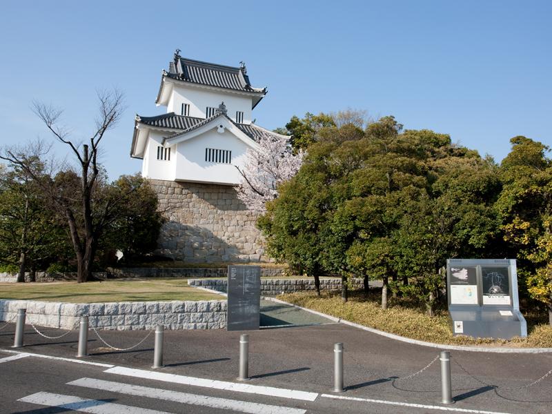
Shichishu Castle Site
Toyota-Area
-
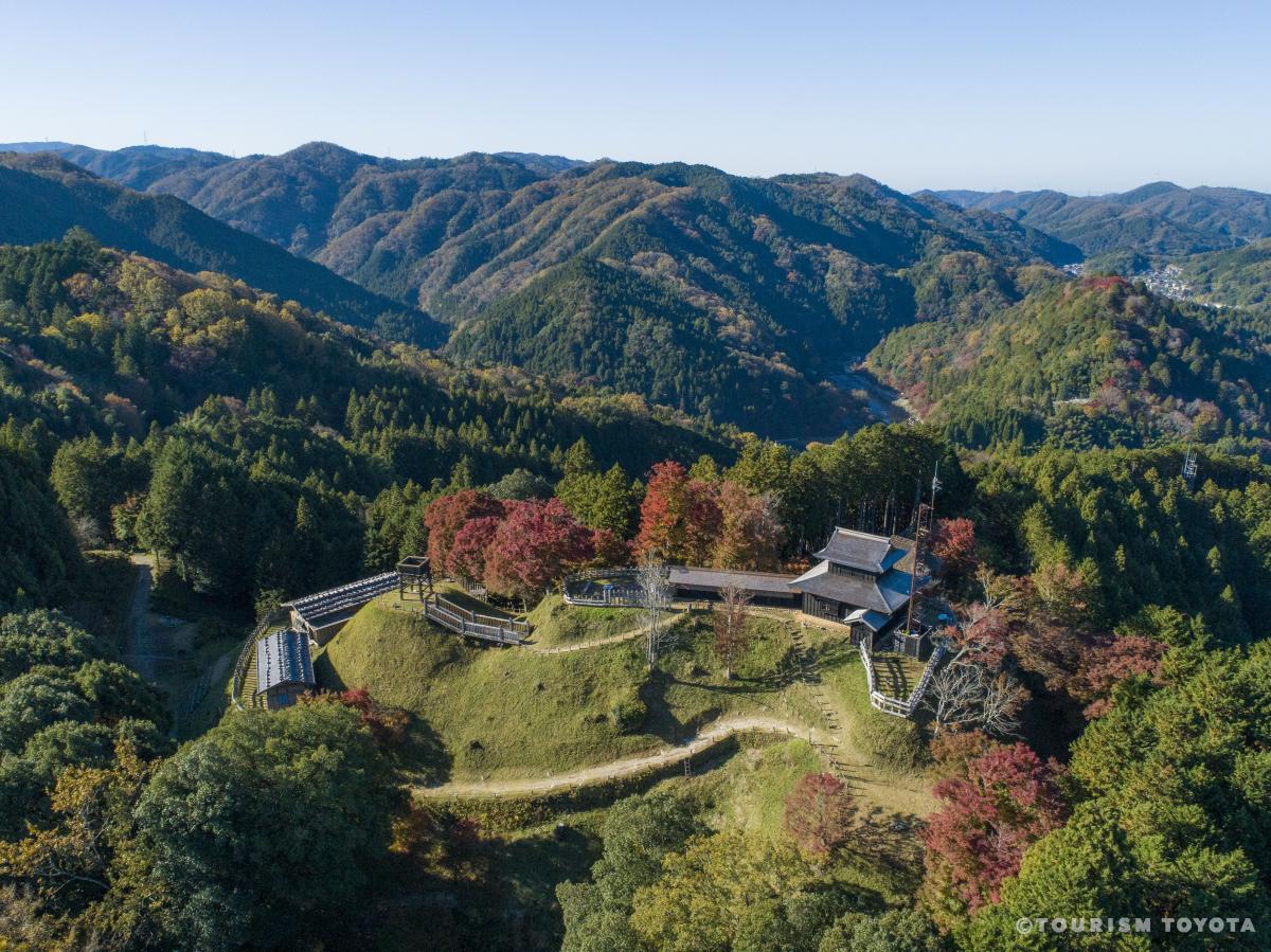
Asuke Castle
Asuke-Area
Located atop Mt. Mayumi-yama and at 301m above sea level, Asuke Castle offers a breathtak…
-
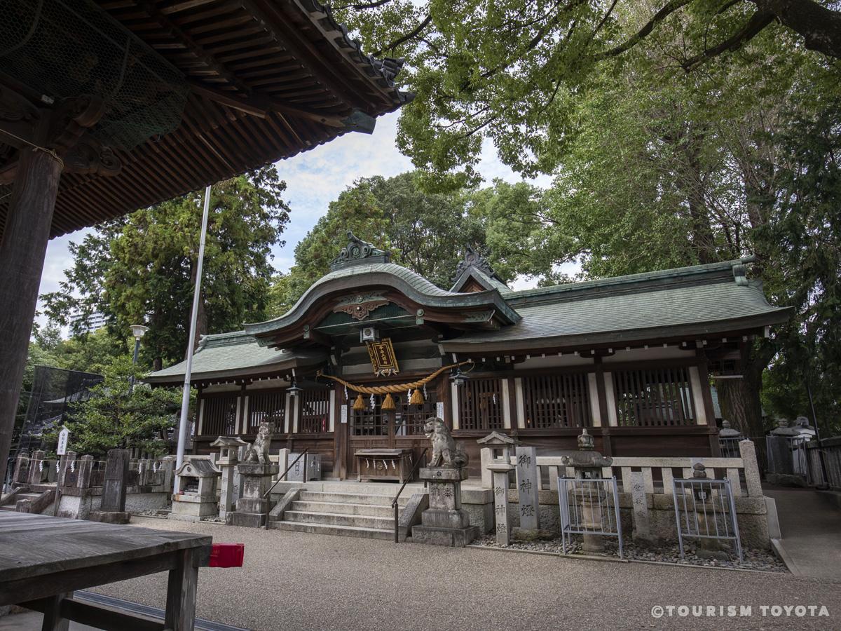
Koromo-jinja Shrine
Toyota-Area
-
Matsudaira Toshogu Shrine
Matsudaira-Area
-
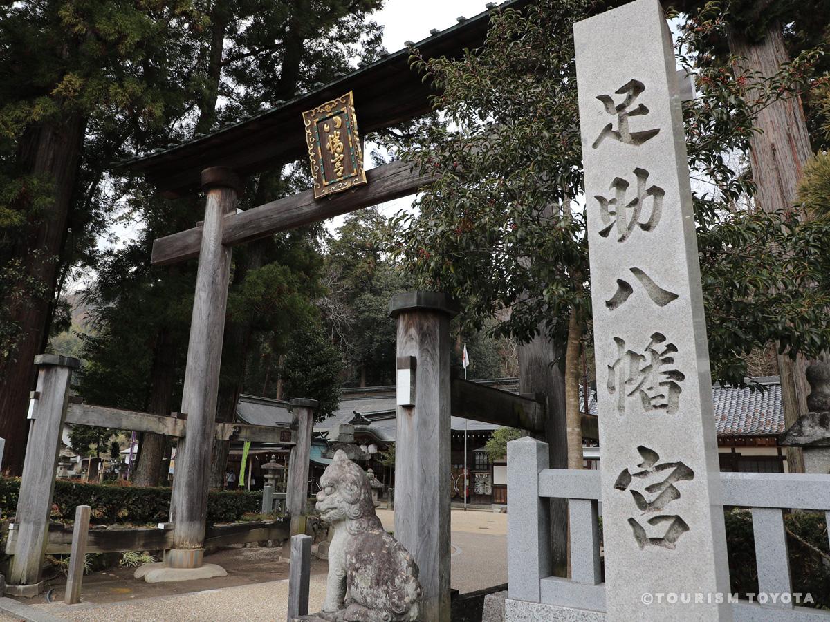
Asuke Hachimangu Shrine
Asuke-Area
It is said that the Asuke Hachimangu Shrine answers the prayers of people for healthier f…
-

Kogetsuin Temple
Matsudaira-Area
-
Toyota Kuragaike Commemorative Hall
Toyota-Area
-
Toyota Bo-no-Te Kaikan Museum
Toyota-Area
An intangible folk cultural property designated by the prefecture, the bonote is a martia…
-
Toyota City Folk Craft Museum
Toyota-Area
Toyota City Folk Craft Museum is a facility that commemorates Shizuo Honda, a scholar of …
-
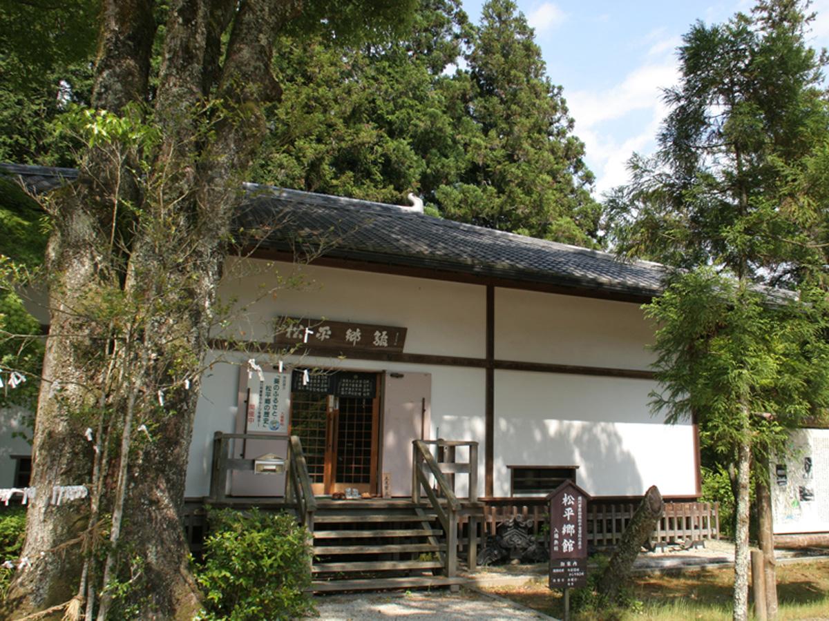
Matsudaira-go Museum of History and the Matsudaira Tarozaemon Family
Matsudaira-Area
-
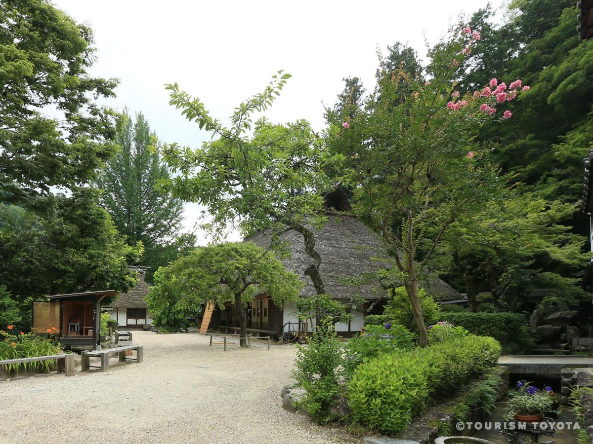
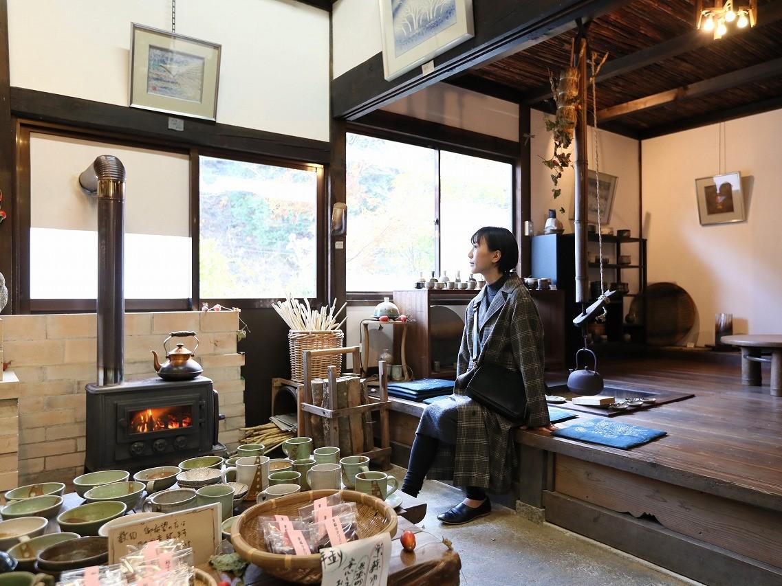
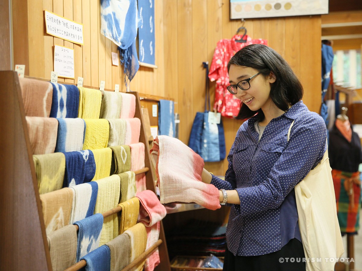
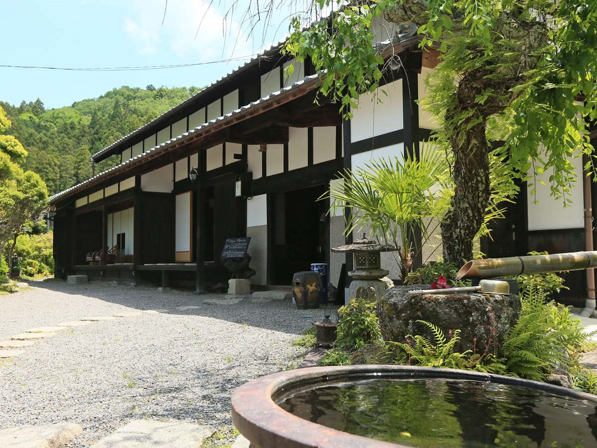
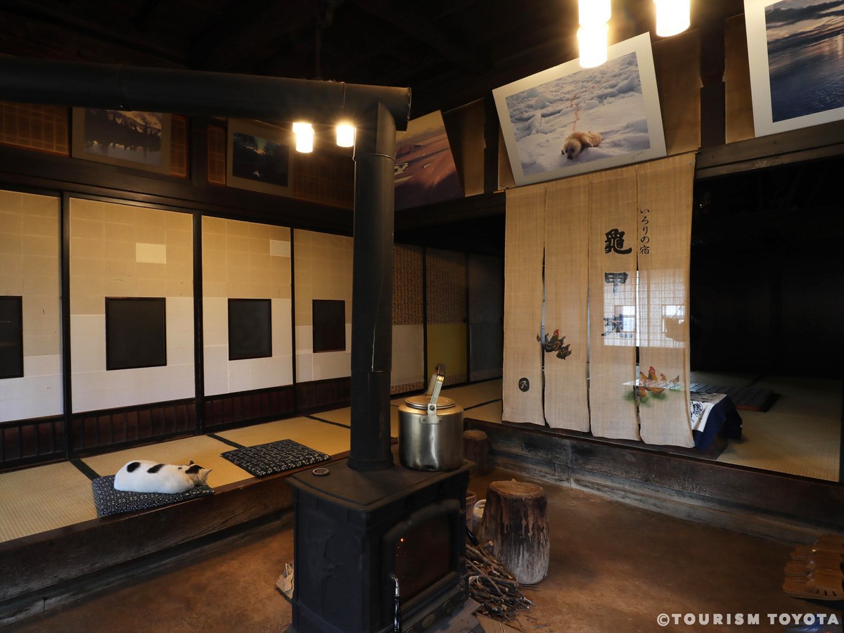
Sanshu Asuke Yashiki Museum
Asuke-Area
This living folk culture museum opened in 1980. The former villa of a wealthy farming fam…
-

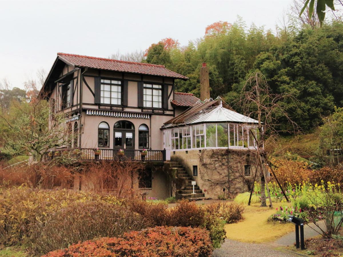
Karen no Yakata
Shimoyama-Area
On a path along the Tomoe River flowing from Lake Mikawa lies a picturesque building that…
-
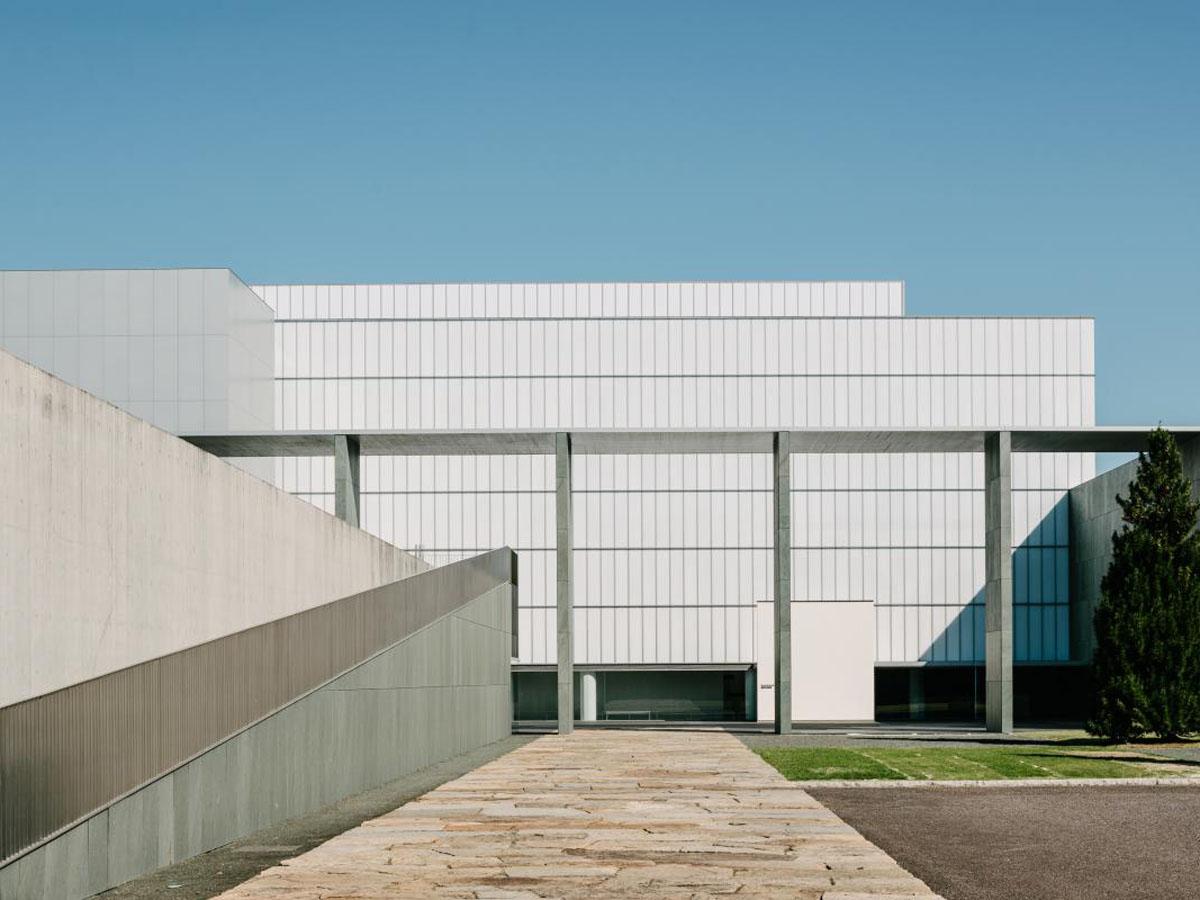
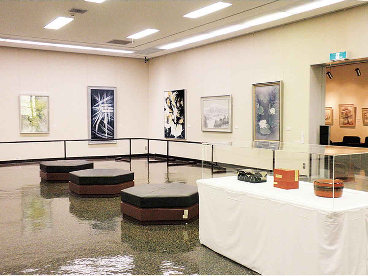
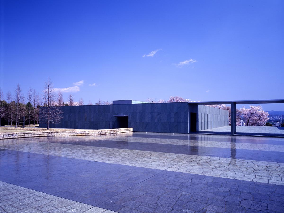
Toyota Municipal Museum of Art
Toyota-Area
-
Natsuyake Onsen Resort
Inabu-Area
Nagura River runs through the center of the hot spring town. The river scenery is beautif…
-
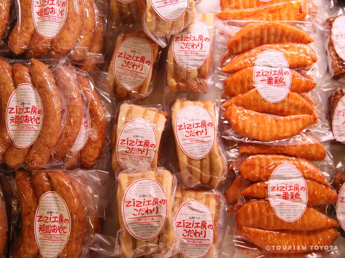
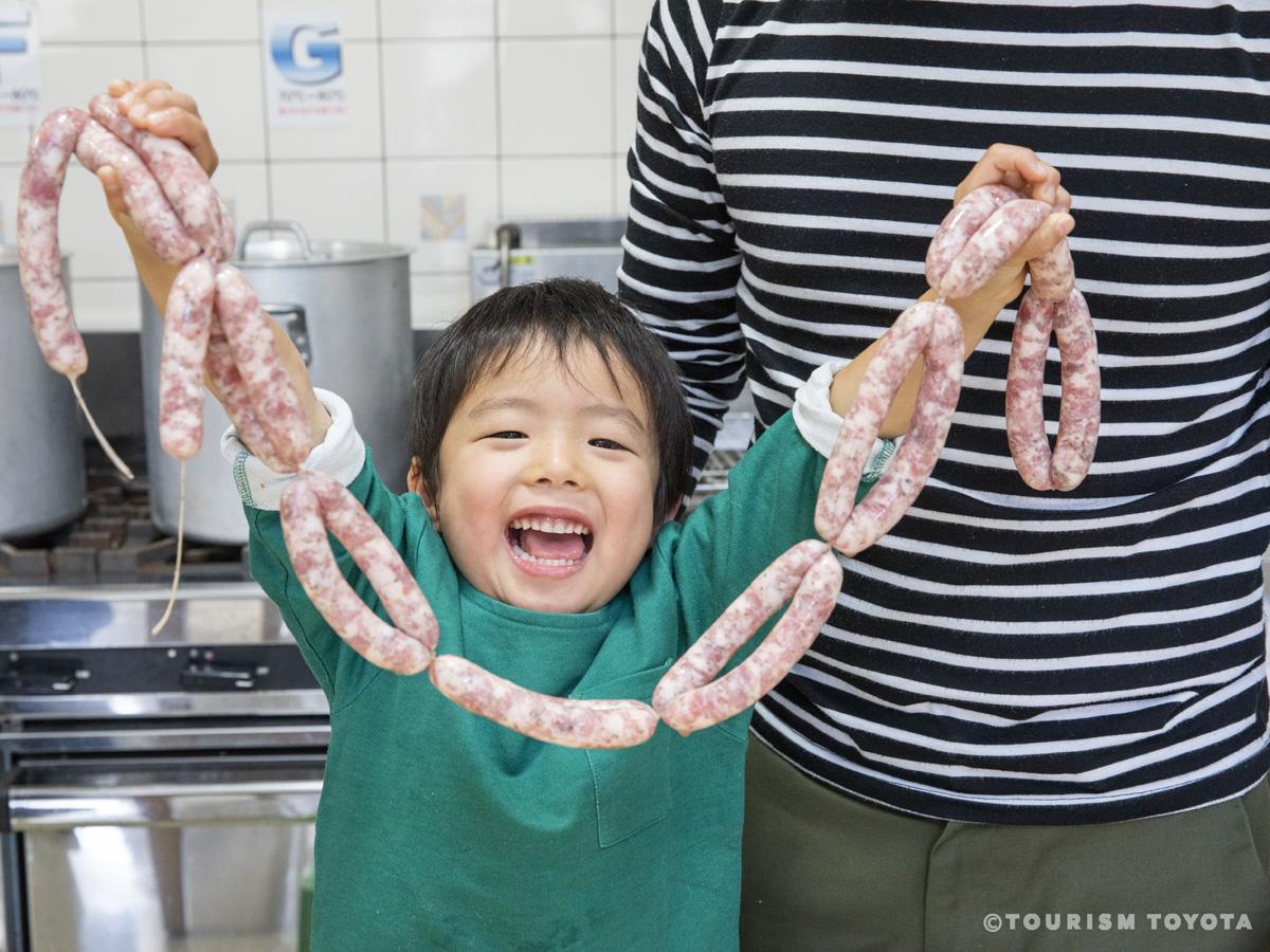
Asuke Ham ZiZi Studio
Asuke-Area
Enjoy handmade ham and sausages made with only the best ingredients by spry old senior ci…
-
Koshikake Mountain Cottage
Shimoyama-Area
-

Art and Craft Center at Obara Paper Art Museum
Obara-Area
-
Fuji-no-Kairo Wisteria Alley
Fujioka-Area
Approximately 370 meters of walking paths lined by wisteria flowers, offering entrancing …
-
Inabu Onsen Donguri no Yu Hot Spring
Inabu-Area
Enjoy a variety of baths such as the outdoor bath surrounded by seasonal flowers and a wo…
-
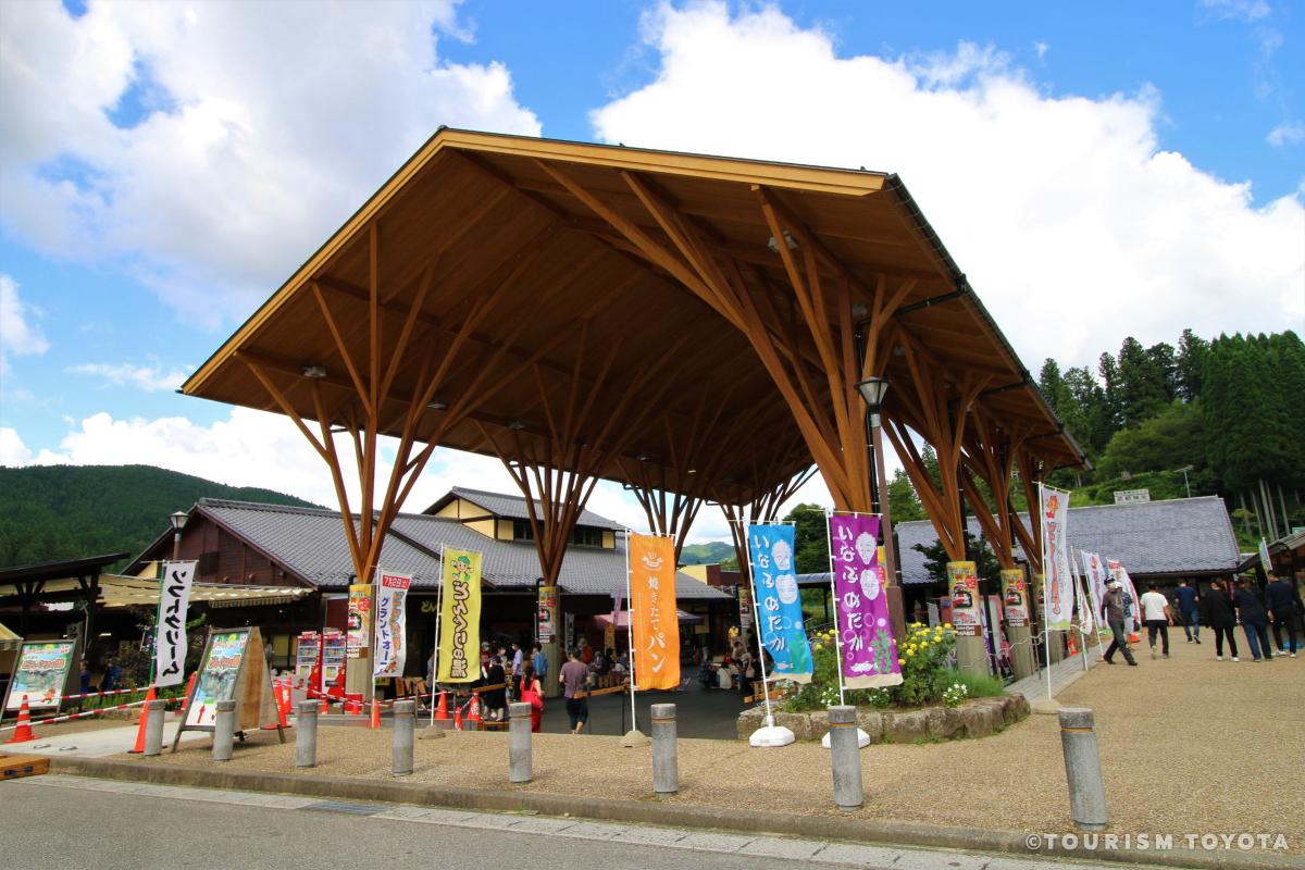
Donguri no Sato Inabu Roadside Station
Inabu-Area
Donguri no Sato Inabu Roadside Station is a shopping hub located in the Inabu Area of Toy…
-
Yamayuri Handmade Workshop
Shimoyama-Area
Located in the Shimoyama region, an area abundant with nature, is Yamayuri Handmade Works…
-
Masuzuka Miso of Noda Miso Co.
Toyota-Area
At this manufacturer of naturally fermented soybean miso, we protect the traditional meth…
-
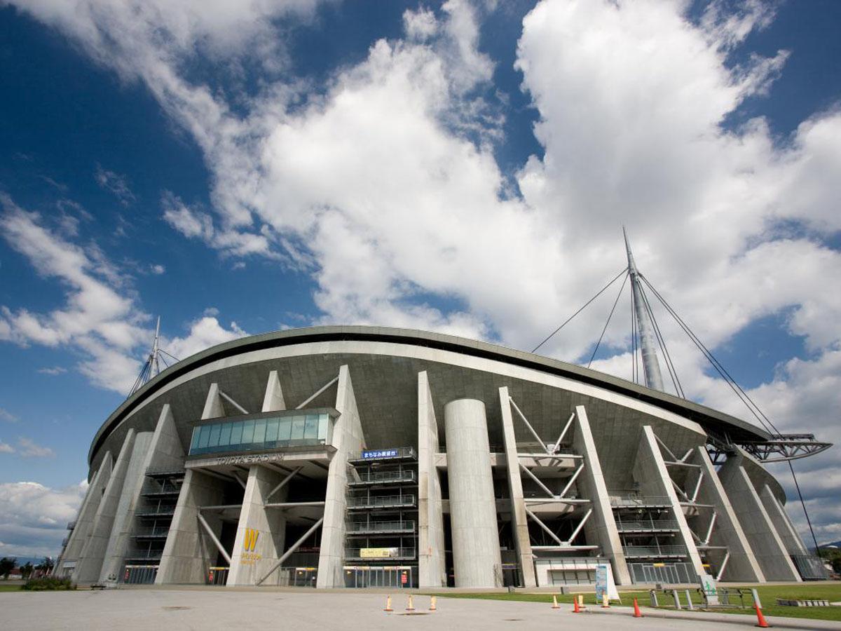
Toyota Stadium
Toyota-Area
-
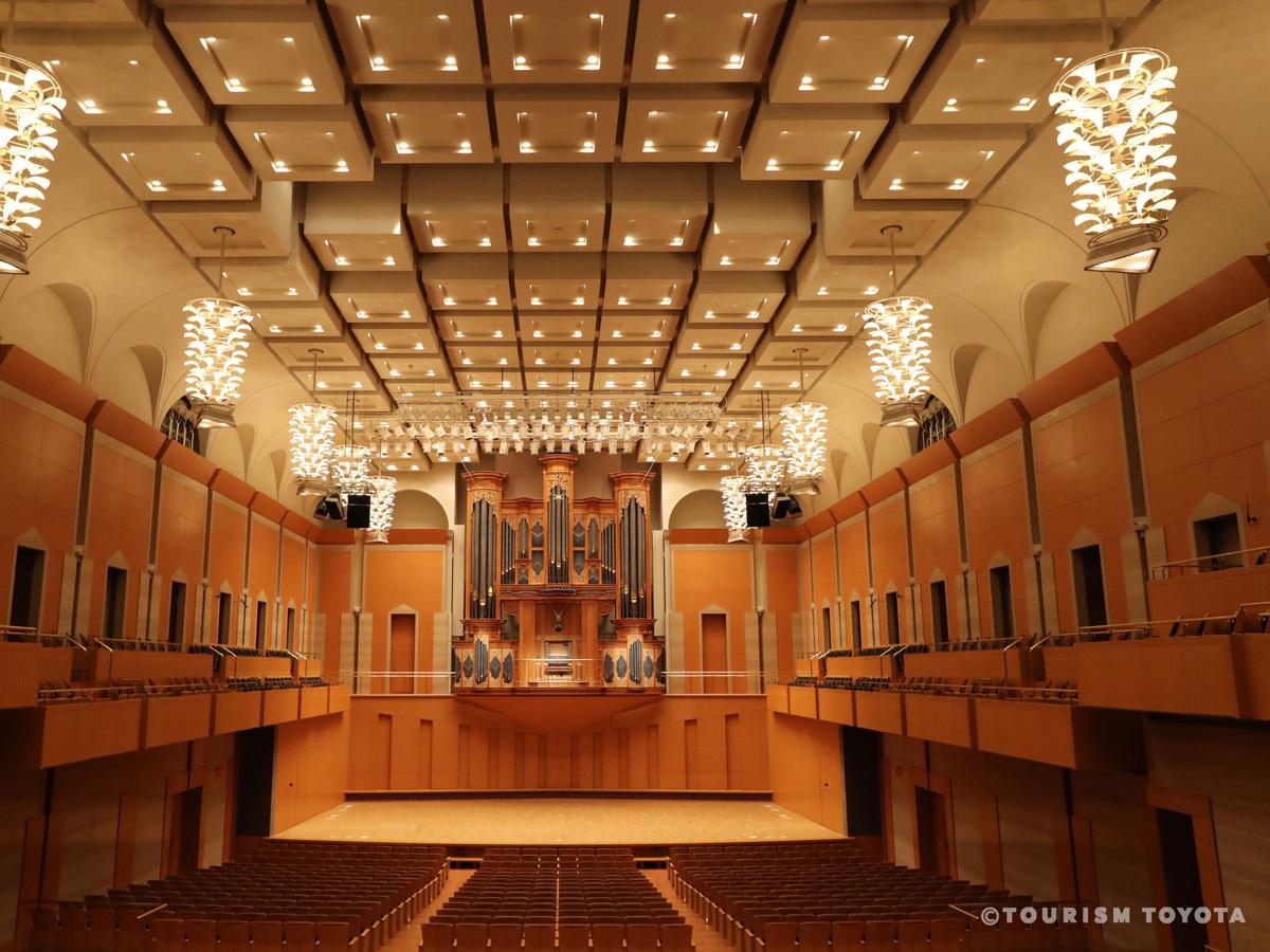
Toyota City Concert Hall
Toyota-Area
This concert hall is located in the Toyota Sangohkan, part of an urban redevelopment proj…
-
Kaminaka Weeping Peach Blossoms
Asahi-Area
-
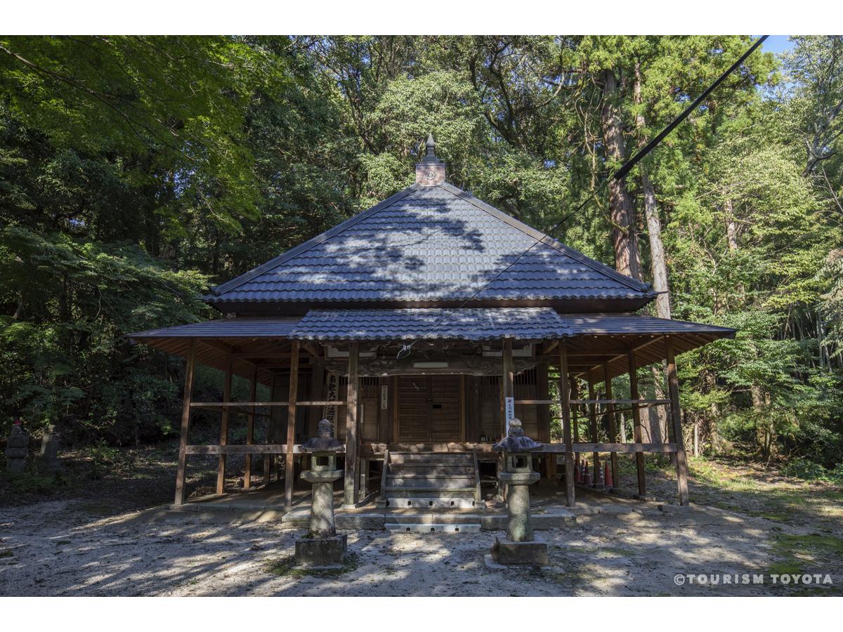
Sanage Shrine
Toyota-Area
-
Obara Paper Art Museum Washi-no-Furusato - Washi Artwork Gallery
Obara-Area
Culture is spread through information, information is spread through communication, commu…
-
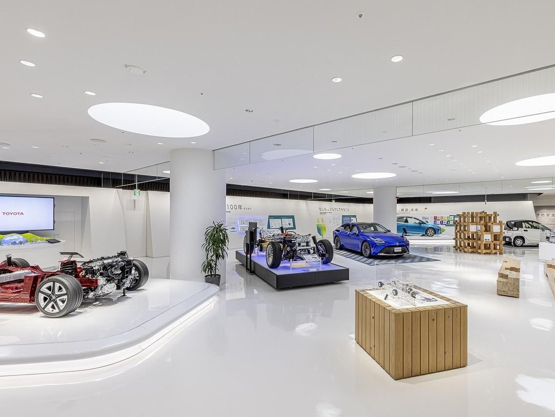
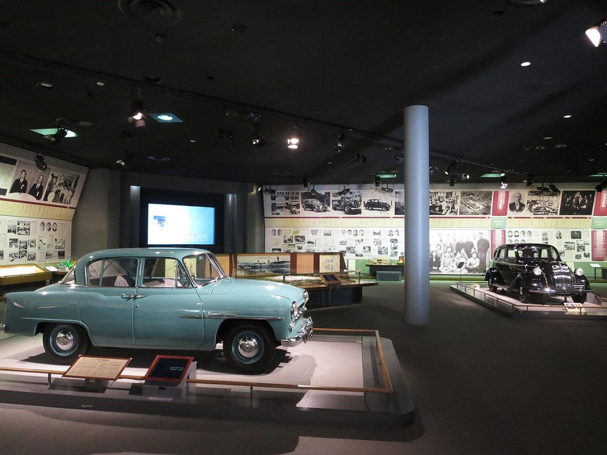
Toyota Kaikan Museum
Toyota-Area
The Toyota Kaikan Museum at the head office of Toyota Motor Corporation is one of the com…
-
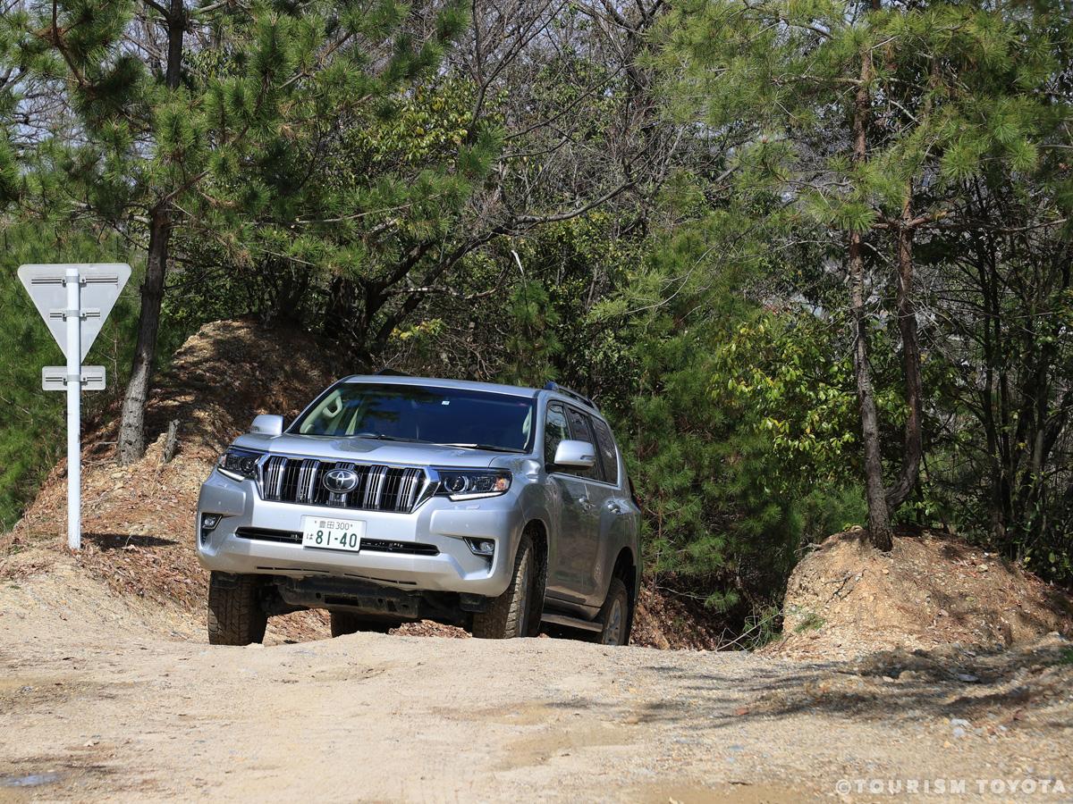
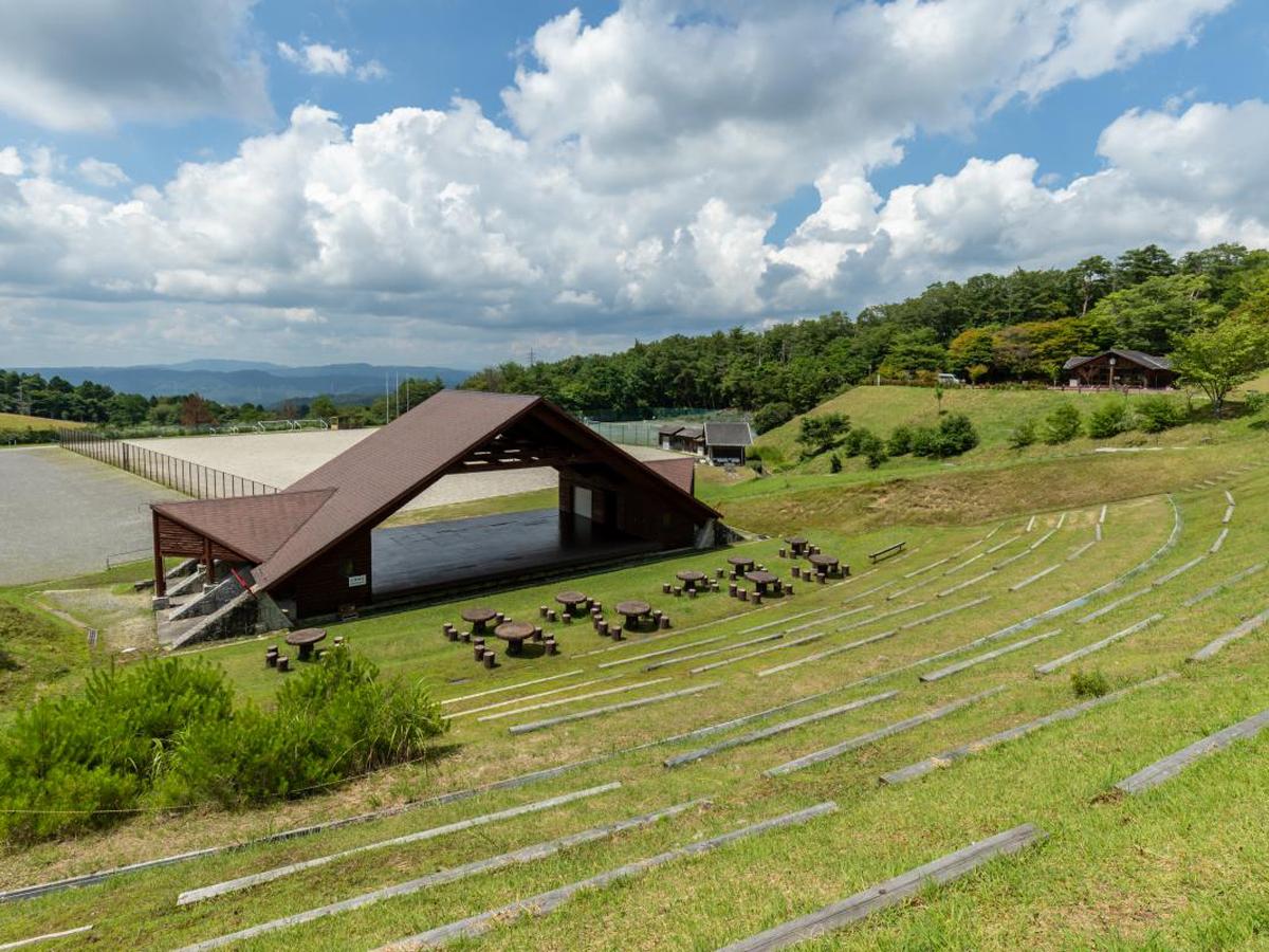
Sanage Adventure Field
Toyota-Area
Multipurpose outdoor attraction with off-road runs for four-wheel drive vehicles, barbecu…
-

Matsudaira-go Gongen Matsuri (Matsudaira Spring Festival)
Matsudaira-Area
-

Katakuri Asian Fawnlily Colony of Asuke
Asuke-Area
The Asian Fawnlilies of Asuke are located on slopes of Mt. Iimori facing northwestwards a…
-
Umekou Peach, Pear, and Strawberry Farm
Toyota-Area
Umekou Peach, Pear, and Strawberry Farm is a highly popular and delightful strawberry pic…
-
Sakura Cherry and Yukiyanagi Thunberg's Meadowsweet Blossoms of Aichi Prefectural Greenification Center
Fujioka-Area
Cherry blossoms and Thunberg's meadowsweets bloom along a 130-meter-long promenade in a J…
-

Hina Dolls of Chuma in Asuke
Asuke-Area
The homes and shops lining the old streets of Asuke decorate their foyers and interiors w…
-
Matsudaira-Go
Matsudaira-Area
-
Shikizakura Four-Season Cherry Blossoms of Obara Fureai Park
Obara-Area
The Obara Fureai Park acts as a place of recreation and respite for local residents. The …
-
Kura-no-Naka Gallery Manrin Bookshop & Café
Asuke-Area
Along the Old Road of Asuke, a once busy Shio-no-Michi route - as vital backbone trading …
-
Takadoya Wetland
Inabu-Area
The Takadoya Wetland area offers visitors a level walking course equipped with boardwalks…
-

Daianji Temple
Inabu-Area
Daianji Temple belongs to the Soto school of Zen Buddhism and was established in the year…
-

Sekiya Brewery - Horaisen Ginjo Workshop
Inabu-Area
This is the workshop of Sekiya Brewery, producer of fine Japanese sake. Horaisen is a loc…
-

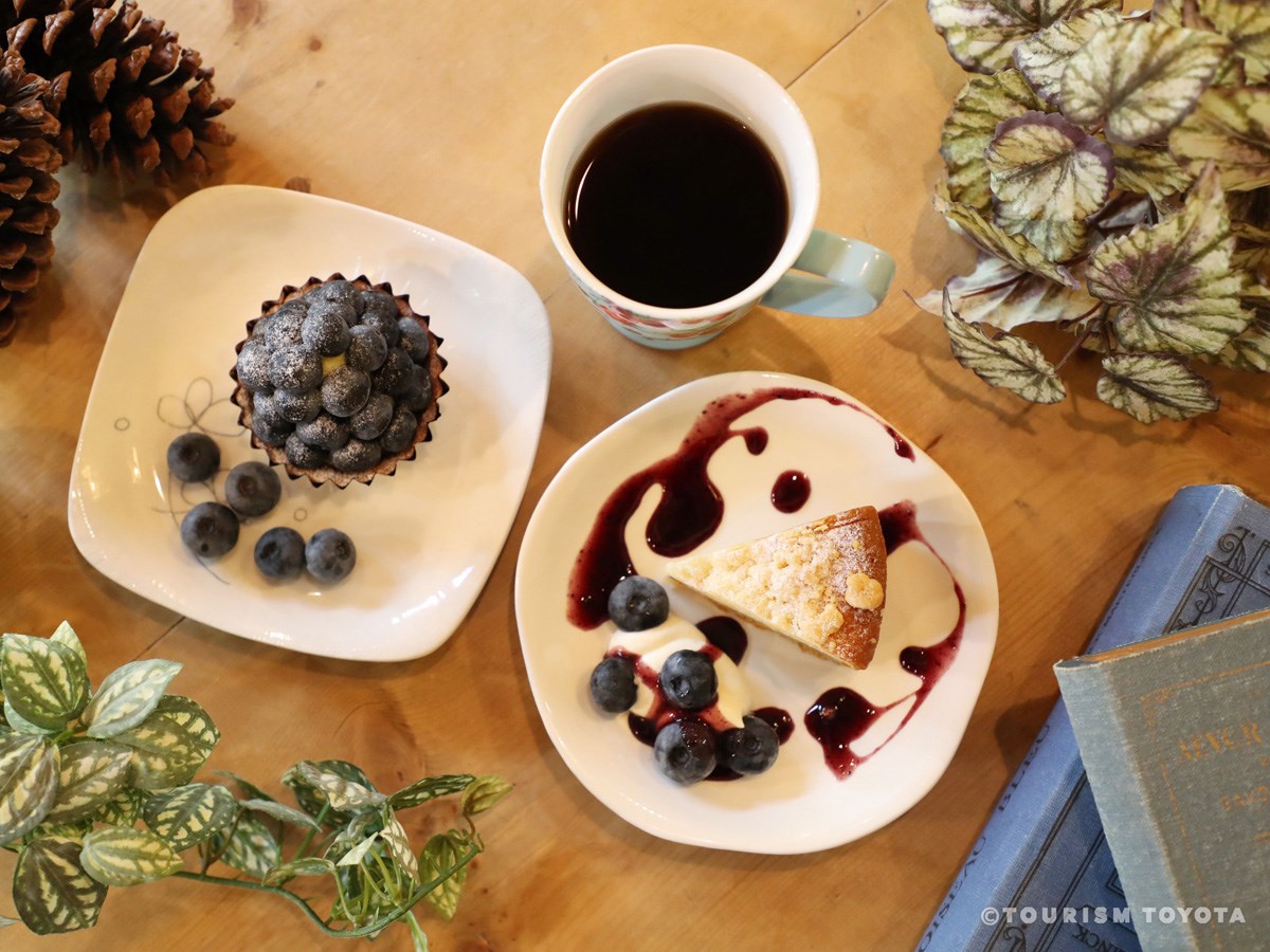
Blueberry-no-Komichi
Inabu-Area
Blueberry-no-Komichi has been in operation in the Inabu region since July 2008. Spend a l…
-
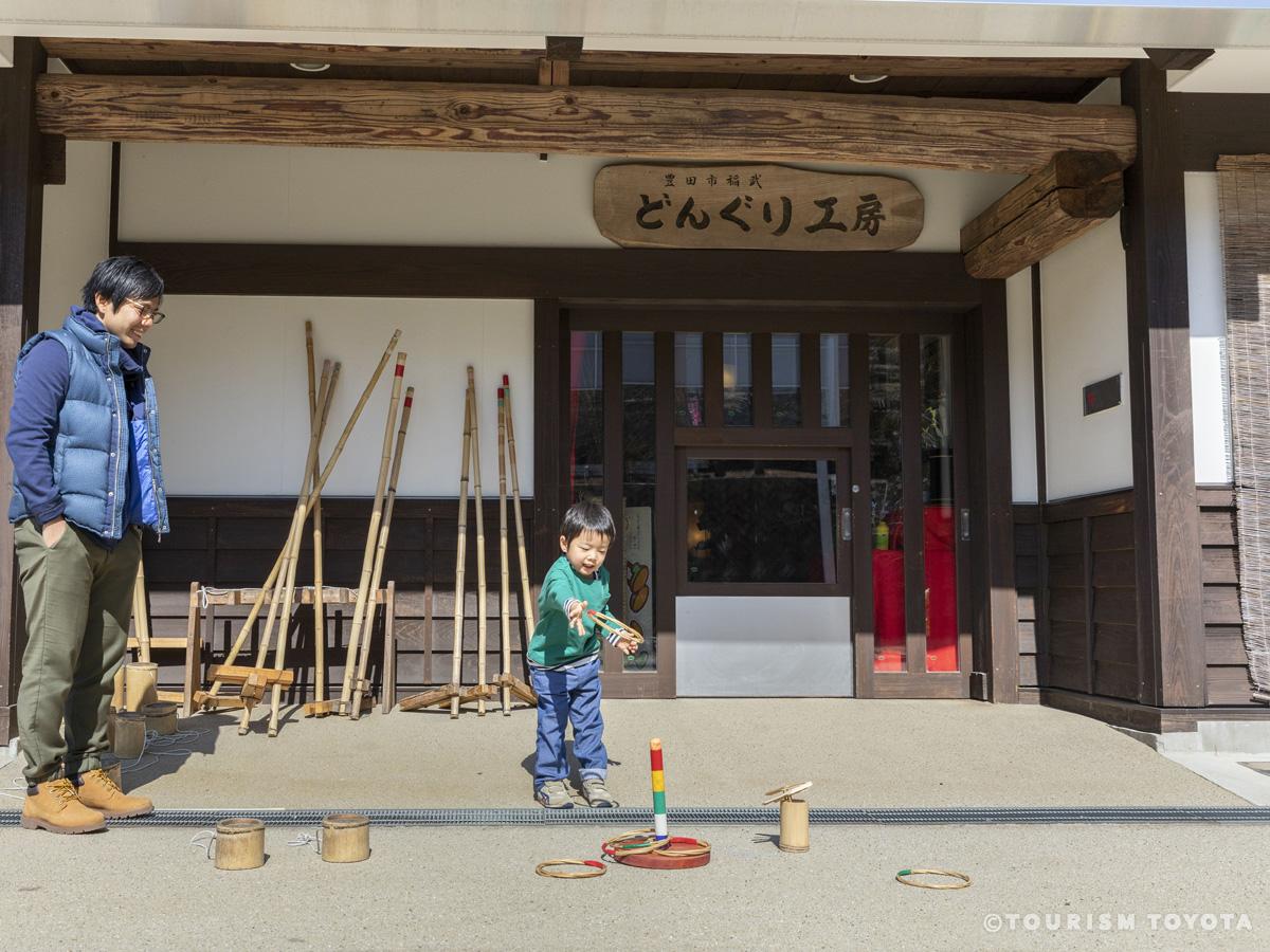
Donguri Workshop
Inabu-Area
Donguri Workshop is a facility set within a natural area in the mountains with a rich his…
-
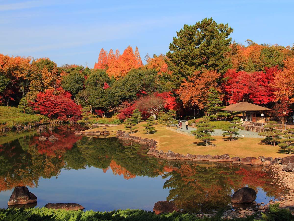
Senmi Shikizakura no Sato Park
Obara-Area
Take in a breathtaking view of 1,200 shikizakura cherry trees as their flowers contrast w…
-
Obara Kama (Pottery Workshop)
Obara-Area
You can try your hand at pottery in the workshop. The shop also exhibits and sells a rang…
-
Noharagawa Tourism Center
Shimoyama-Area
Enjoy nature to the fullest from season to season with refreshing breezes along the clear…
-
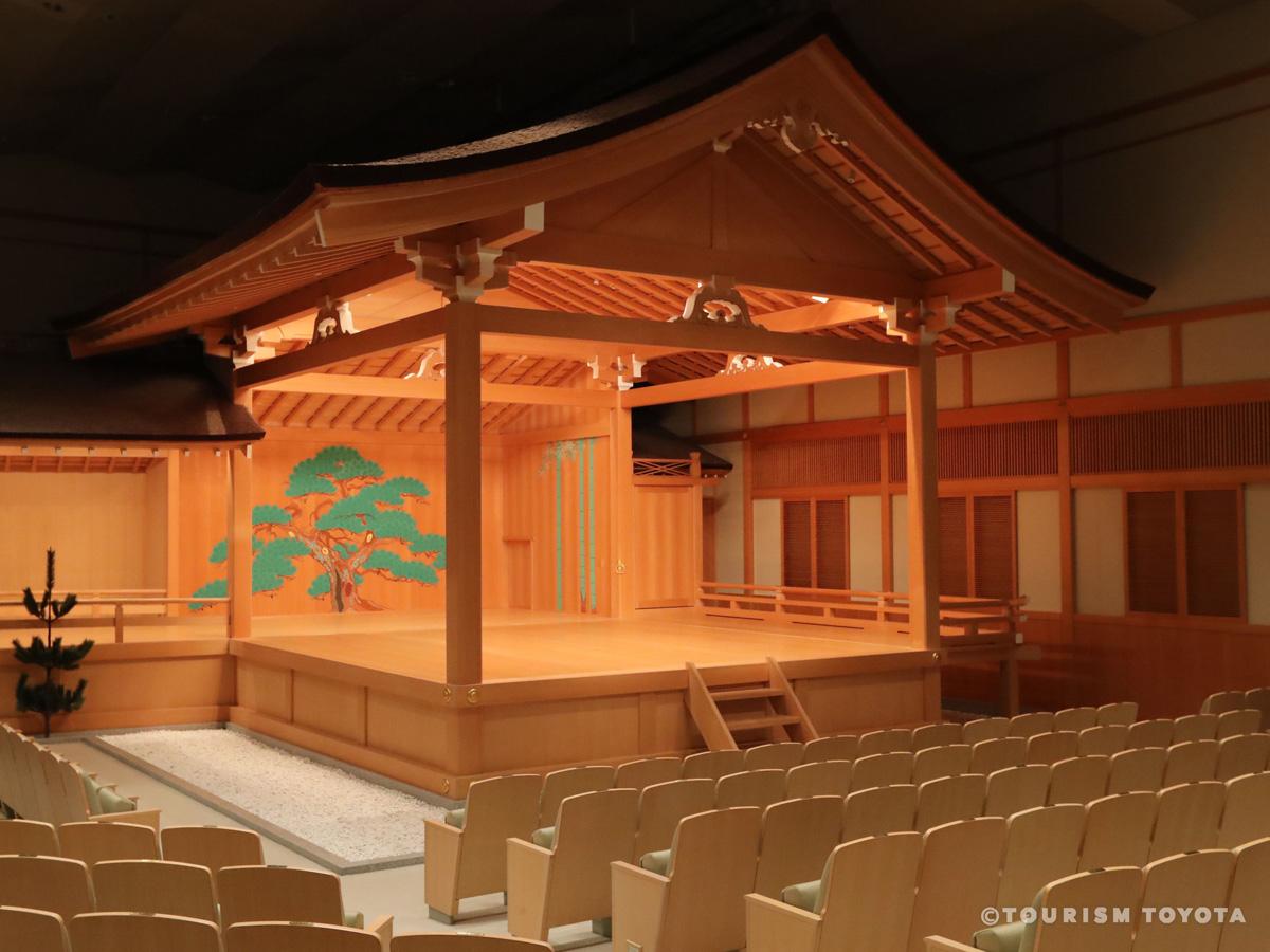
Toyota City Concert Hall - Nohgakudo
Toyota-Area
A Noh theater in the Toyota Sangohkan urban redevelopment building. Featuring a Kirizuma-…
-

Inabu Lunar Calendar’s Hina Festival
Inabu-Area
Meet various kinds of hina dolls and look forward to seeing what theme the hina dolls wil…
-

Kitsune no Kamisori Orange Spider Lilies
Inabu-Area
Keyaki forest on Mt. Natsuyake Jogayama is covered with wild Orange Spider Lilies, known …
-
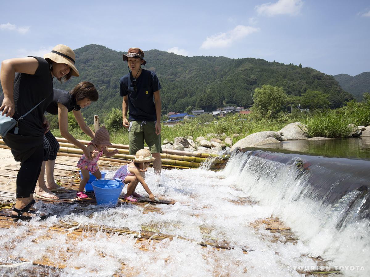
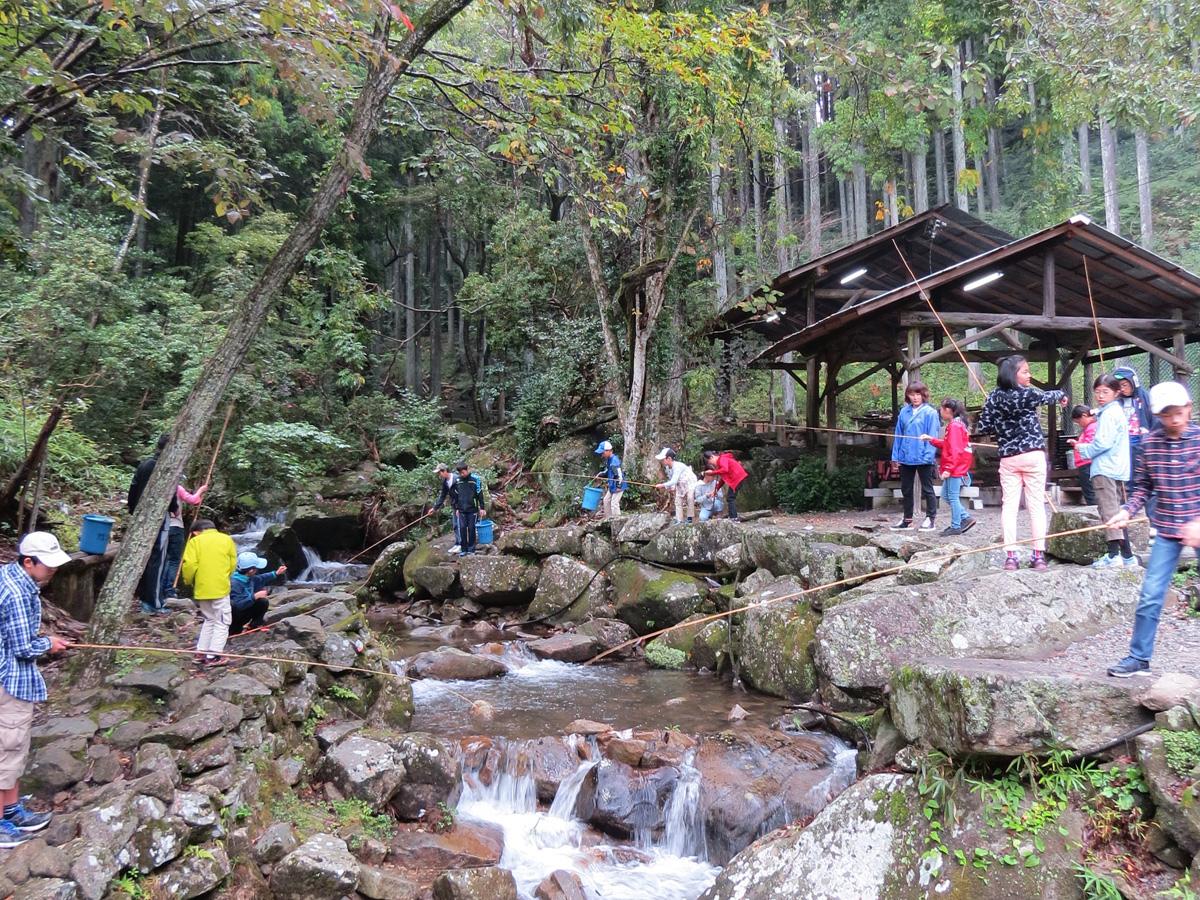
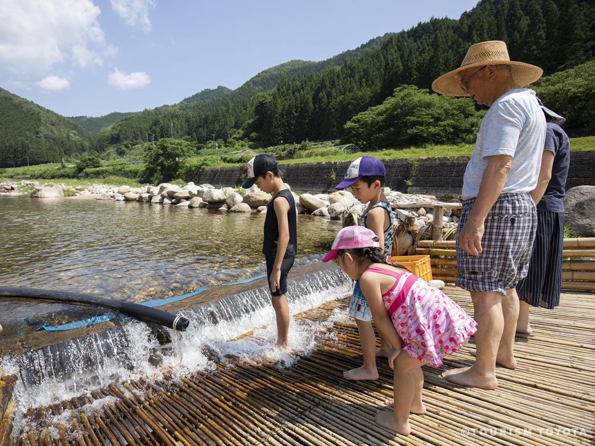
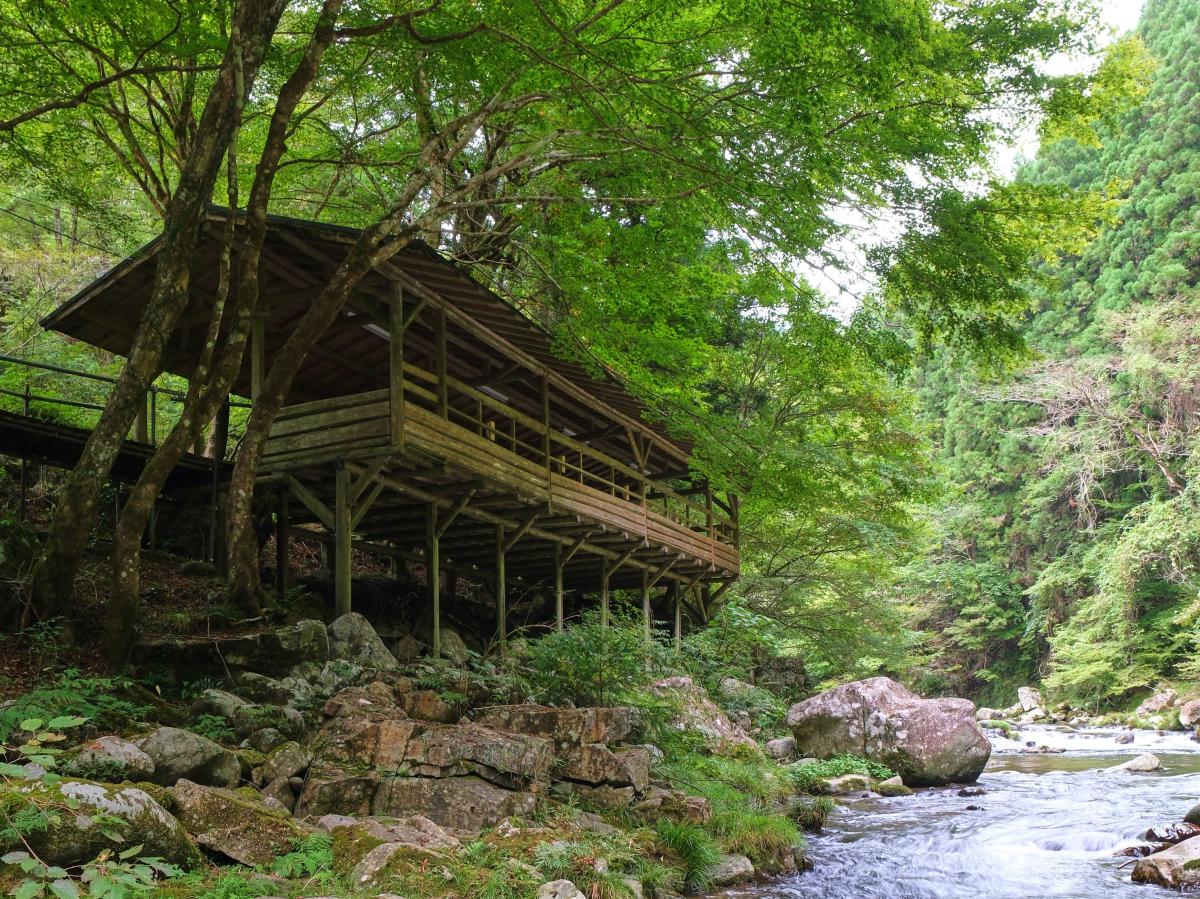
Odo Kanko Yana Fishing Weir
Asahi-Area
Here you can catch sweetfish and enjoy sweetfish cuisine. In summer, the place is bustlin…
-

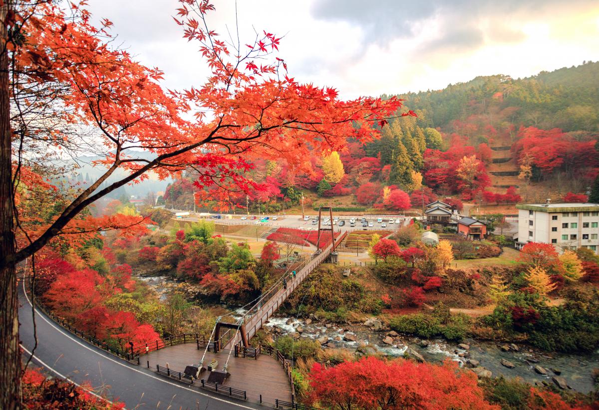
Takadoya Maple Leaves Festival
Inabu-Area
Located near the interesting Kuroda Dam in the eastern region of Toyota City, this spot i…
-

Toyota City Industry Festa 2022
Toyota-Area
A great fair featuring Industrial Booths Street with exhibitions and sales of companies f…
-

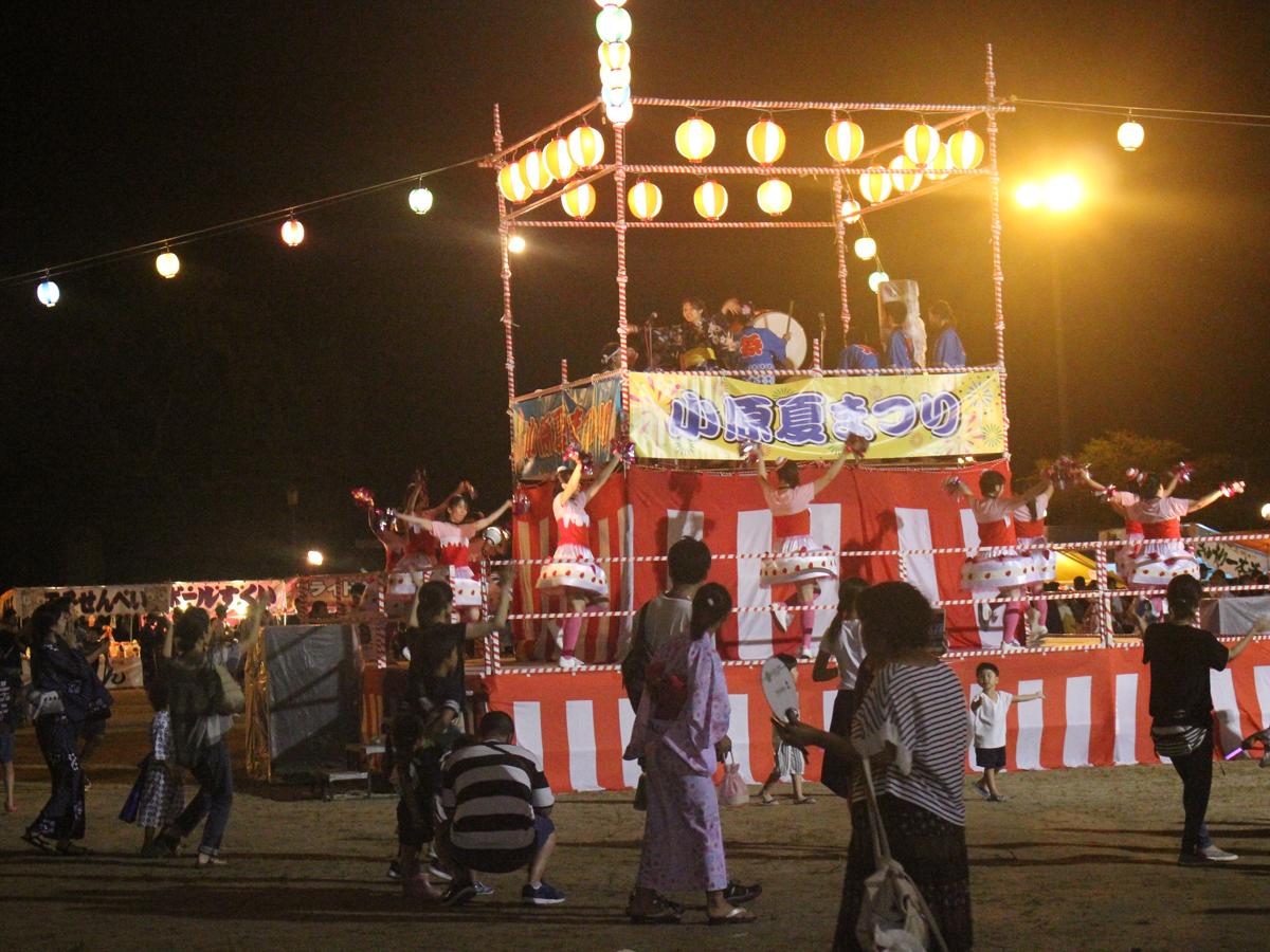
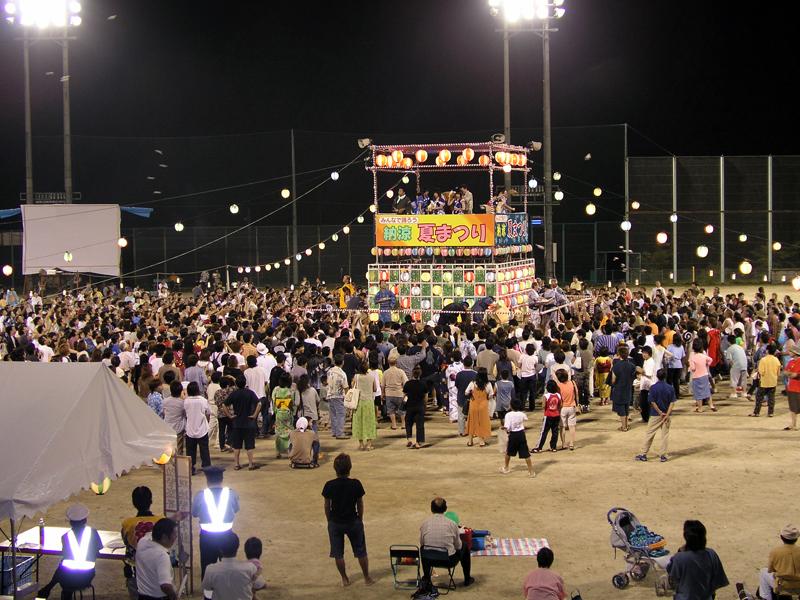
Fujioka Oiden Summer Festival & Fireworks
Fujioka-Area
Part of the larger My Town Oiden of Toyota City, this event is held at the Fujioka Distri…
-

Fujioka Wisteria Festival 2025
Fujioka-Area
-

Inabu Lavender Fair - Donguri Workshop Lavender Gathering
Inabu-Area
Large fields of lavender grow close to National Route 153 each summer. Lavender gatheri…
-
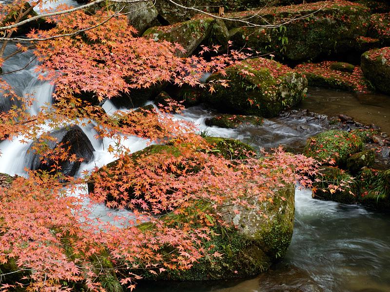
Otaki Gorge Maple Festival
Matsudaira-Area
Otaki Gorge is located along Niogawa River, the tributary of Tomoegawa River, in the city…
-

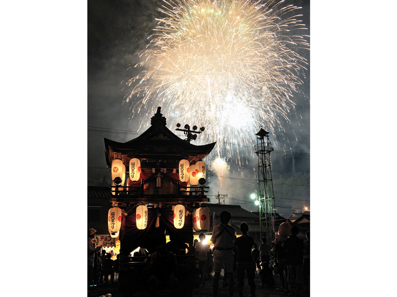
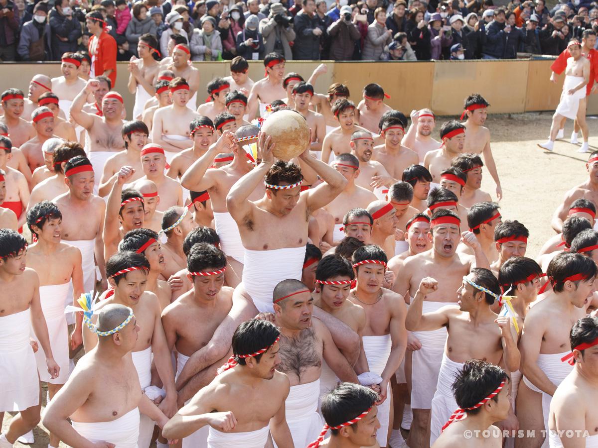
Koromo Festival
Toyota-Area
Each year, the main festival is held on the third Sunday of October, with the rehearsal f…
-
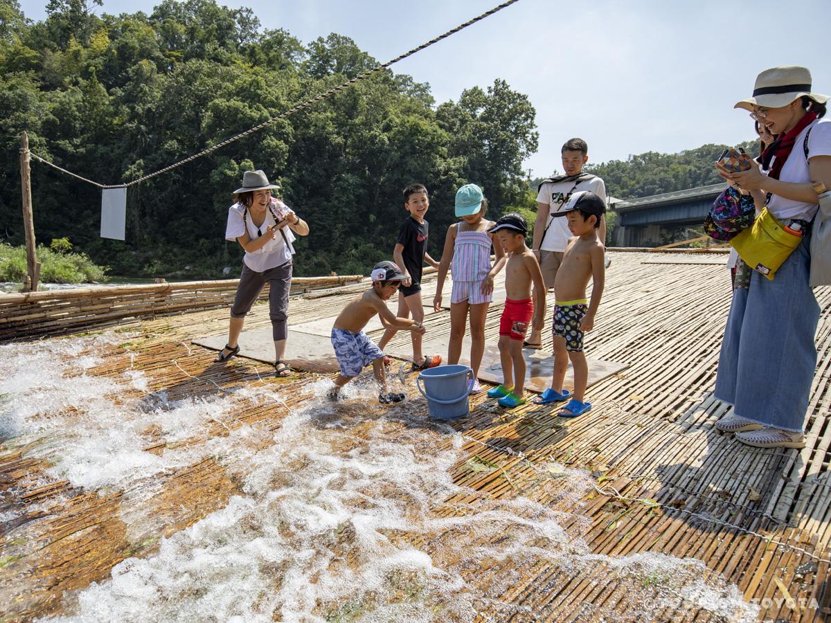
Hirose Yana Fishing Weir
Toyota-Area
A famous sightseeing place in Toyota, the fishing platform at Hirose Yana Fishing Weir is…
-

Sasado Autumn Festival
Asahi-Area
This festival is for enjoying the red maple leaves at Sasado Park while eating natural ya…
-

Obara Cultural Festival Obara Kabuki
Obara-Area
Obara kabuki started in the mid-Edo Period when villagers performed the play as an offeri…
-
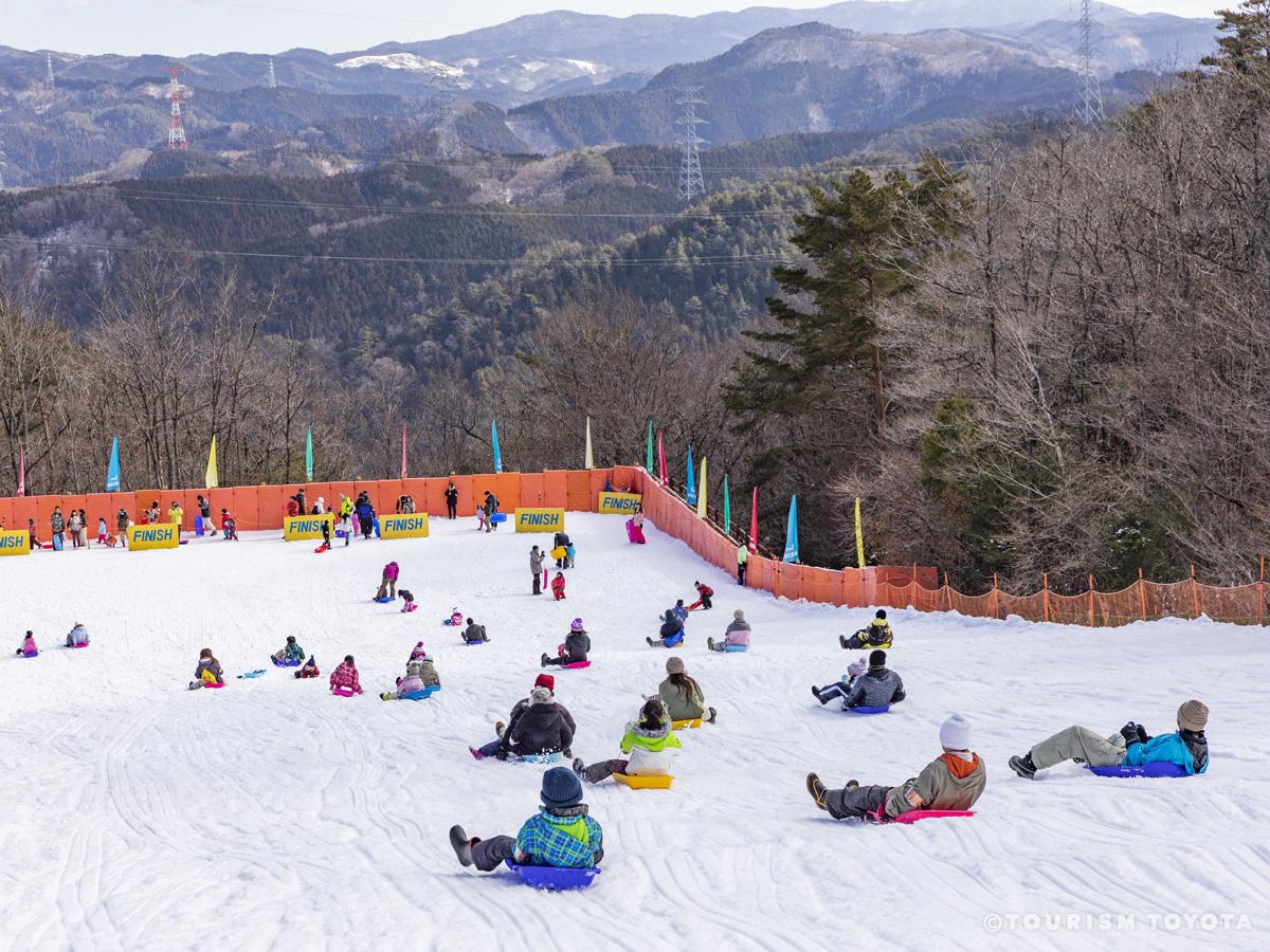
Asahi Nature Highland - Snow Sled Gelände Slope
Asahi-Area
Asahi Nature Highland (Asahi Kogen Genki-Mura) has a nice snow-covered slope, with snow m…
-
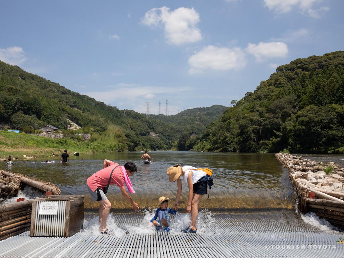
Kawaguchi Yana Fishing Weir
Fujioka-Area
Kawaguchi Yana Fishing Weir is built along the clean Yahagi River. Enjoy fresh sweetfish …
-

Hyobaku Ice Cascade of Yusui Hiroba in Inabu
Inabu-Area
Starting in December of each year, columns are set up in a waterfall near Oidaira Park (R…
-

Toyota Oiden Festival
Toyota-Area
-

Illumination Story in Toyota 2025
Toyota-Area
An illumination event centered around Toyotashi Station on the Meitetsu Mikawa Line, Illu…
-
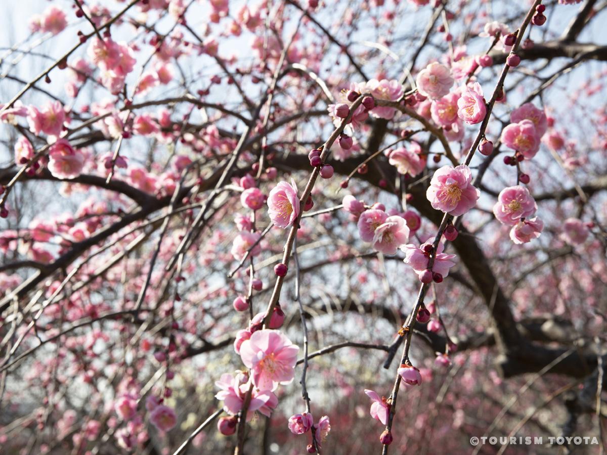
Hirashiba Park Plum Blossom Festival
Toyota-Area
Hirashiba Park is host to some of the best plum blossoms in Toyota with approximately 530…
-
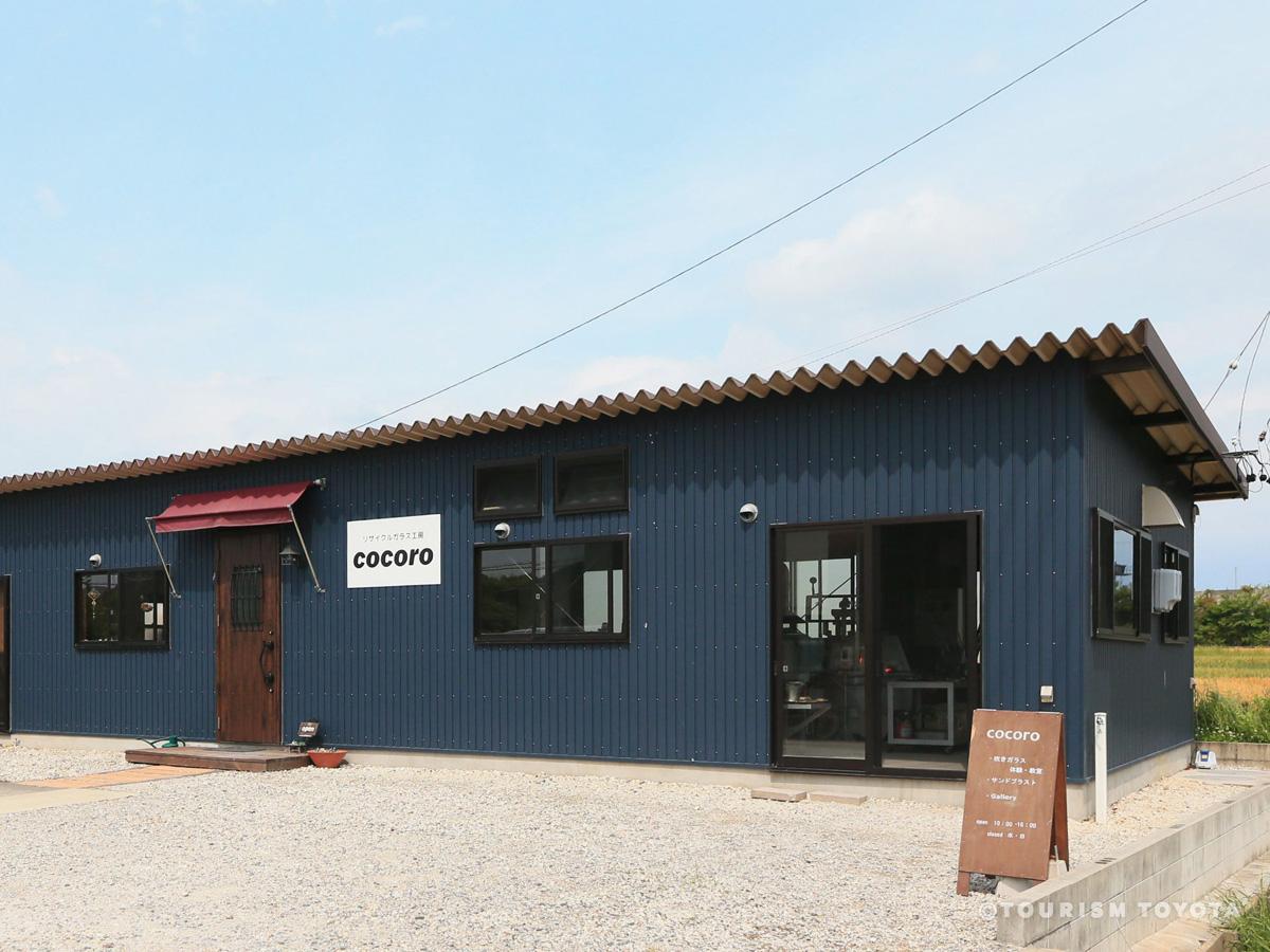
Recycled Glass Workshop Cocoro
Toyota-Area
The glass at Cocoro is made entirely from recycled glass bottles. See the fiery colors an…
-
Matsudaira-go Enchi Park
Matsudaira-Area
Matsudaira-go Enchi Park is a five-acre expanse of greenery next to the main road in the …
-
Matsudaira Castle Site
Matsudaira-Area
On a now heavily forested hill overlooking the road into the village of Matsudaira is the…
-
Matsudaira-go Lookout Terrace
Matsudaira-Area
-

Inabu Ice Cascade
Inabu-Area
Starting in December of each year, columns are set up in a waterfall near Oidaira Park (R…
-
Mennoki Soft Rime Virgin Forest
Inabu-Area
The virgin forest of Mennoki, filled with beech trees over 300 years old, is designated a…
-
Oiden Yana Fishing Weir
Inabu-Area
Catch sweetfish or play in the river. In the tent area, you can enjoy sweetfish cuisine s…
-

Bo-no-Te Keigo "Sentinel" Festival
Toyota-Area
Held at the Shigo-Yabashira Shrine, this festival features demonstrations of the Aichi Pr…
-
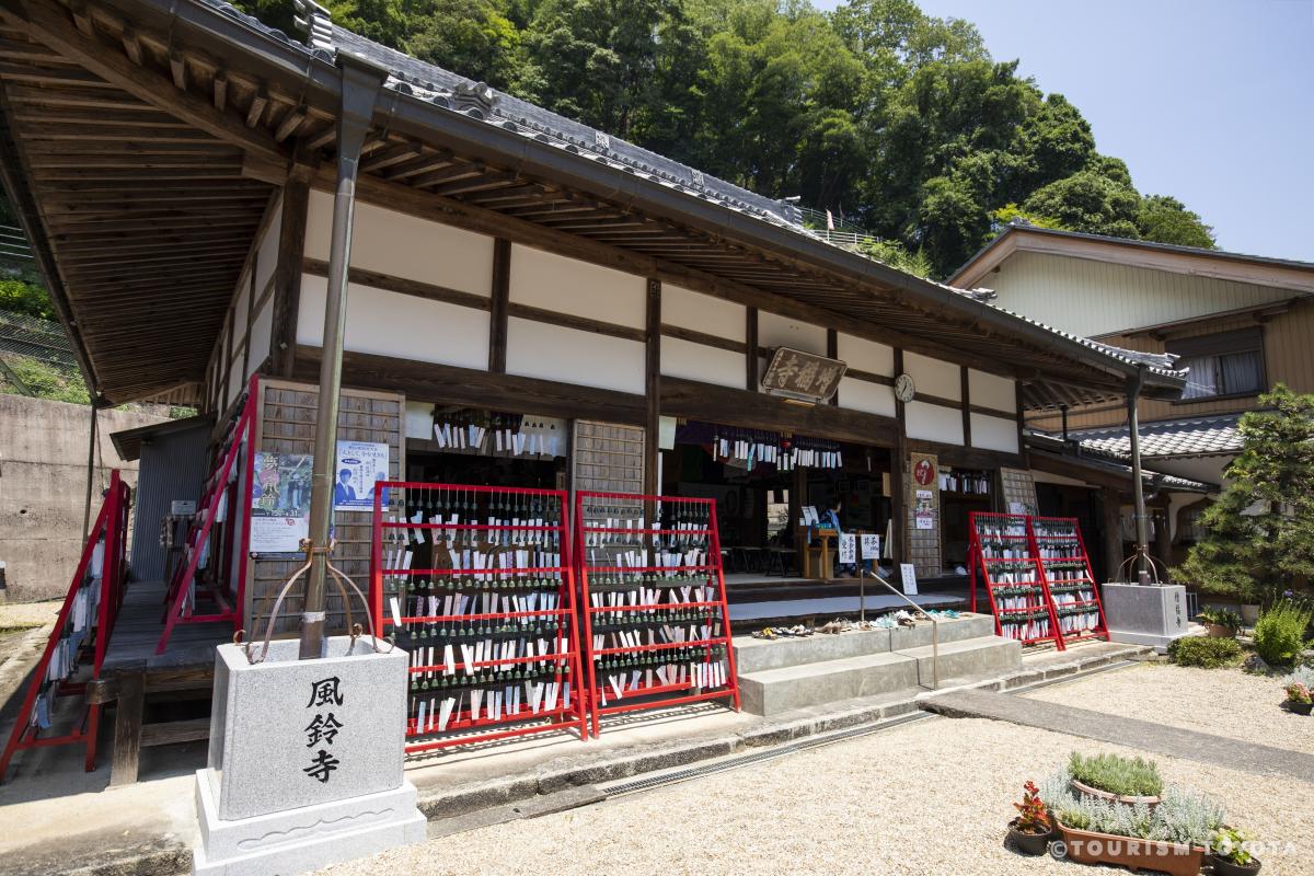
Zofukuji Temple (Furindera Temple)
Asahi-Area
Zofukuji Temple—otherwise known as “Furindera Temple”, meaning the “Wind Chime Temple”—is…
-
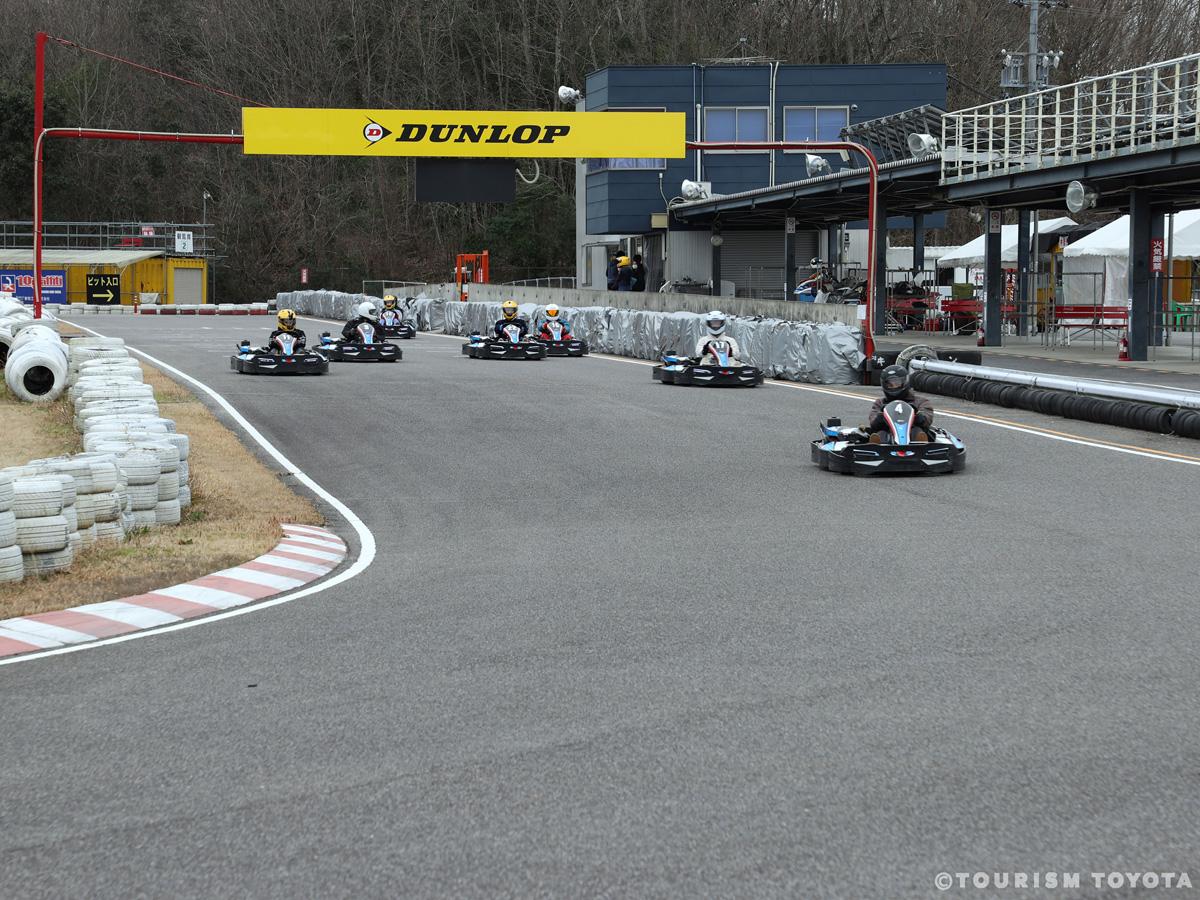
Ishino Circuit
Toyota-Area
From the rental go-kart to the helmet and gloves, everything you need for racing can be r…
-
ORBIT
Toyota-Area
ORBIT is a surf school and surfing goods retailer that rent out surfboards and wet suits.…
-
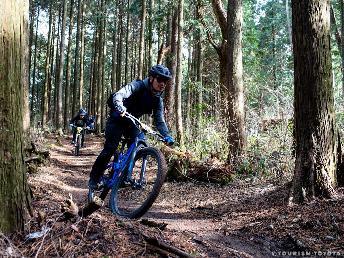
26ism Asagiri Trail
Shimoyama-Area
Experience mountain cycling at Mikawakougen Camp Village! Intended for beginner through i…
-
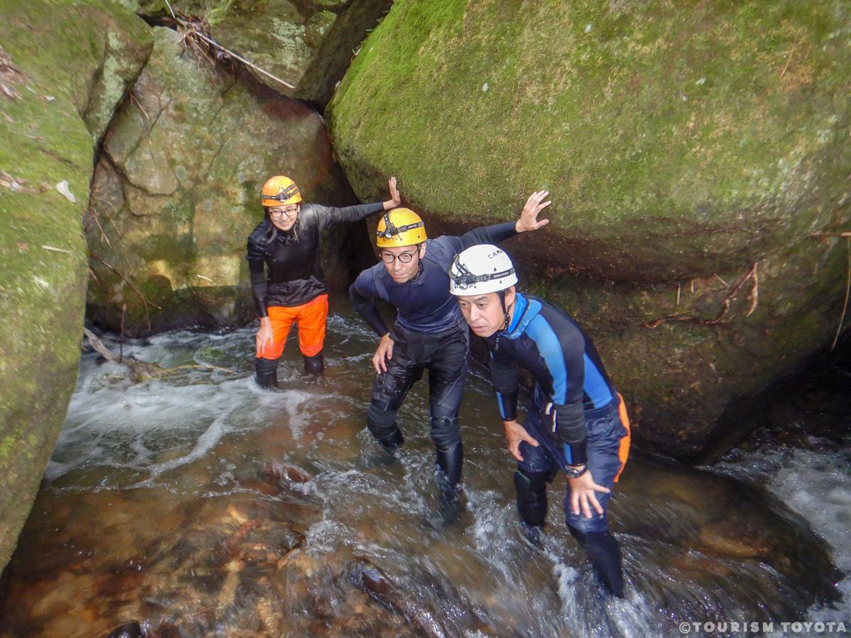
Black Water Shower Caving (TRIPPER)
Matsudaira-Area
This newest type of outdoor activity combines shower climbing, where you climb up an invi…
-

STREET & PARK MARKET
Toyota-Area
STREET & PARK MARKET is held on the first and third Saturdays of every month. The carefu…
-
Gardening Museum Kayutei
Toyota-Area
Stroll through 28 different themed gardens, including a natural garden, a Japanese garden…
-
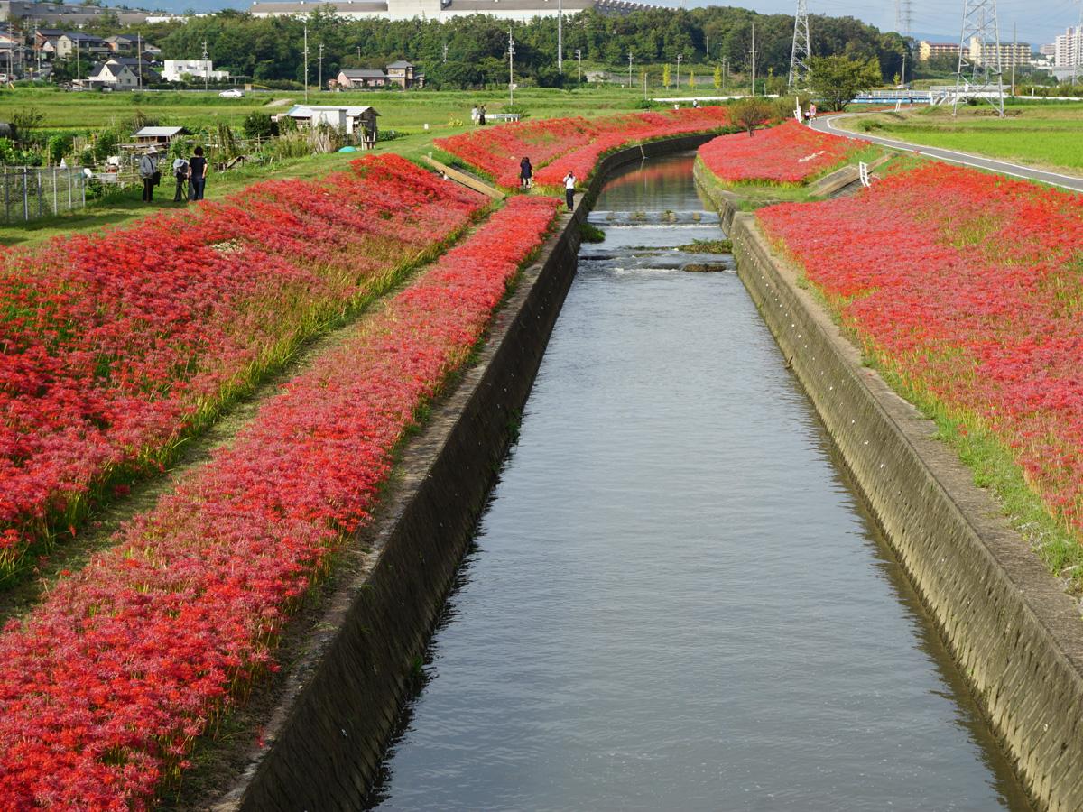
Red Spider Lilies of the Aizumame River
Toyota-Area
Approximately 450 meters of red spider lilies bloom on both banks of the Aizumame River i…
-
Kirakutei
Toyota-Area
Located inside the grounds of the Toyota Sangyo Bunka Center, Kirakutei is a modern Japan…
-
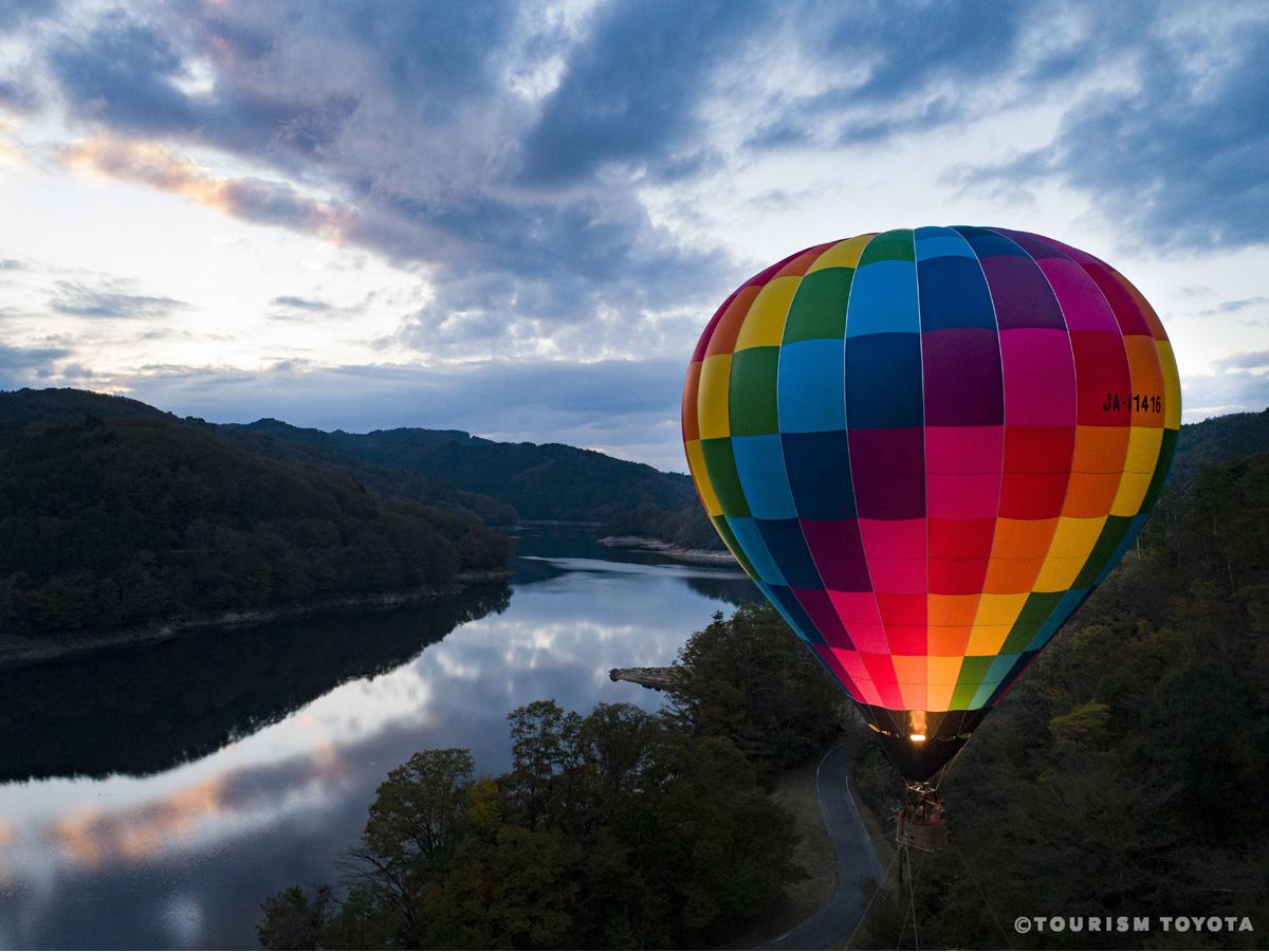
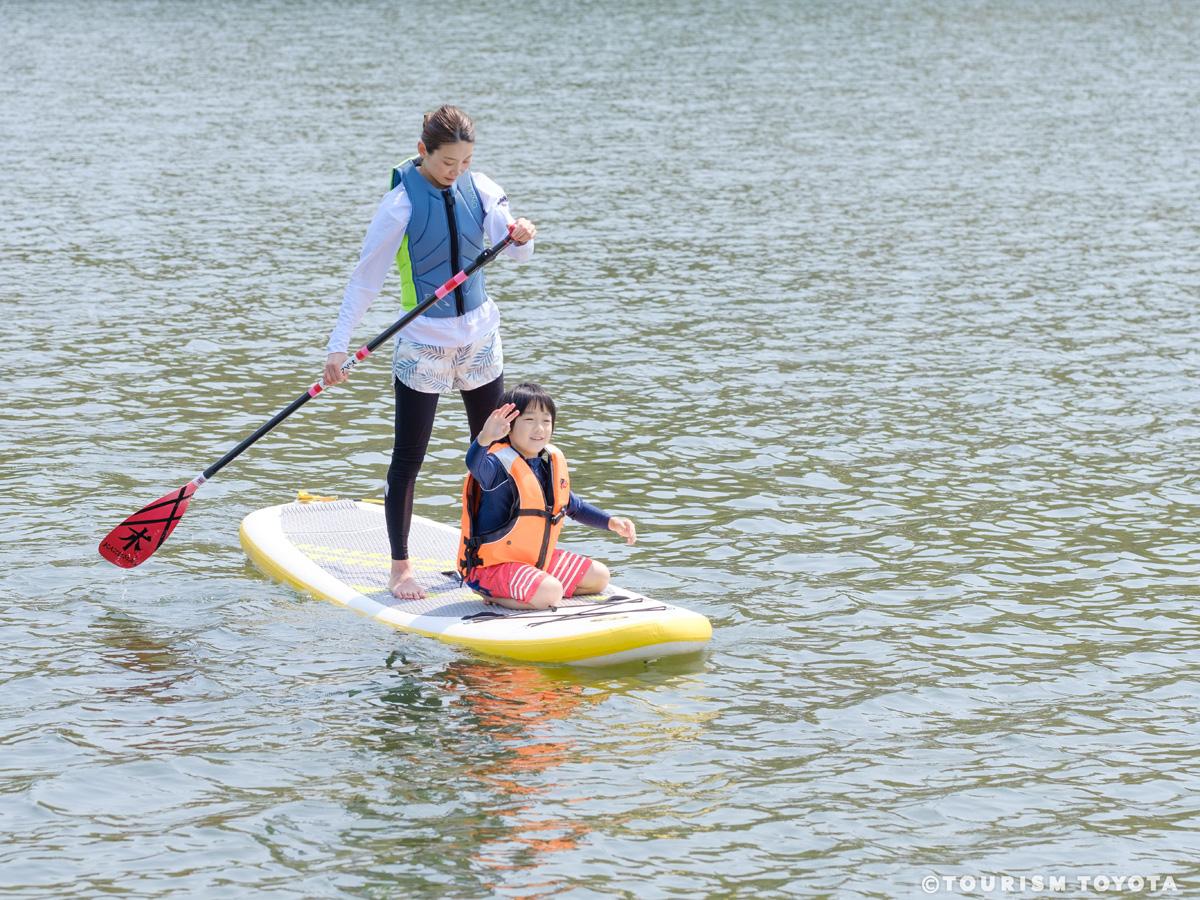
Toyota Mikawa Highlands Adventure
Shimoyama-Area
Enjoy experiential outdoor activities such as boarding a hot air balloon, camping, fishin…
-
Matsuzakaya Toyota
Toyota-Area
Only a one-minute walk from Meitetsu Toyotashi Station, the Matsuzakaya Toyota department…
-
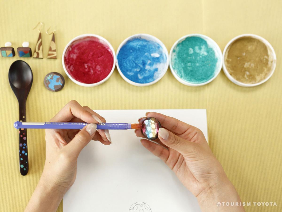
Sasahira Workshop
Obara-Area
Sasahira Workshop holds classes on making artistic handicrafts with lacquer or Japanese w…
-
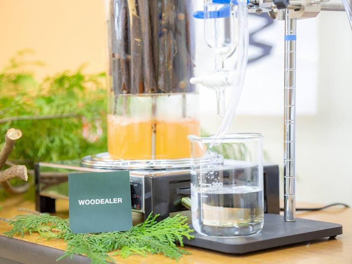
WOODEALER Toyota
Toyota-Area
At WOODEALER Toyota, Japanese cypress, Japanese cedar, and spicebush foliage from woods i…
-
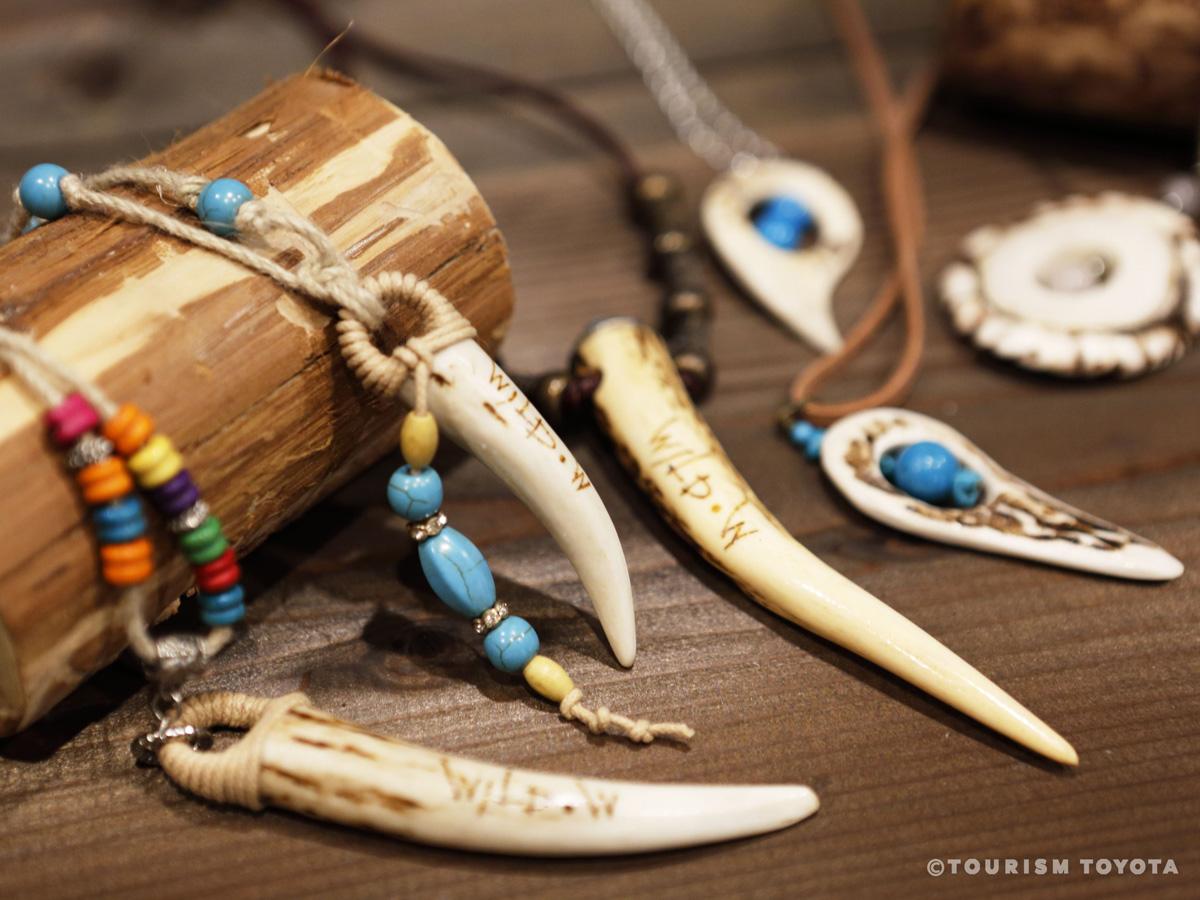
Sanshu Shishi Mori Shachu
Asuke-Area
Sanshu Shishi Mori Shachu is a workshop and gallery offering a range of accessory and cra…
-
Rokusho Shrine
Matsudaira-Area
Rokusho Shrine is a Shinto sanctuary that traces its history back to Matsudaira Chikauji …
-
Toyota Municipal Museum of Art: Takahashi Setsuro Gallery
Toyota-Area
-
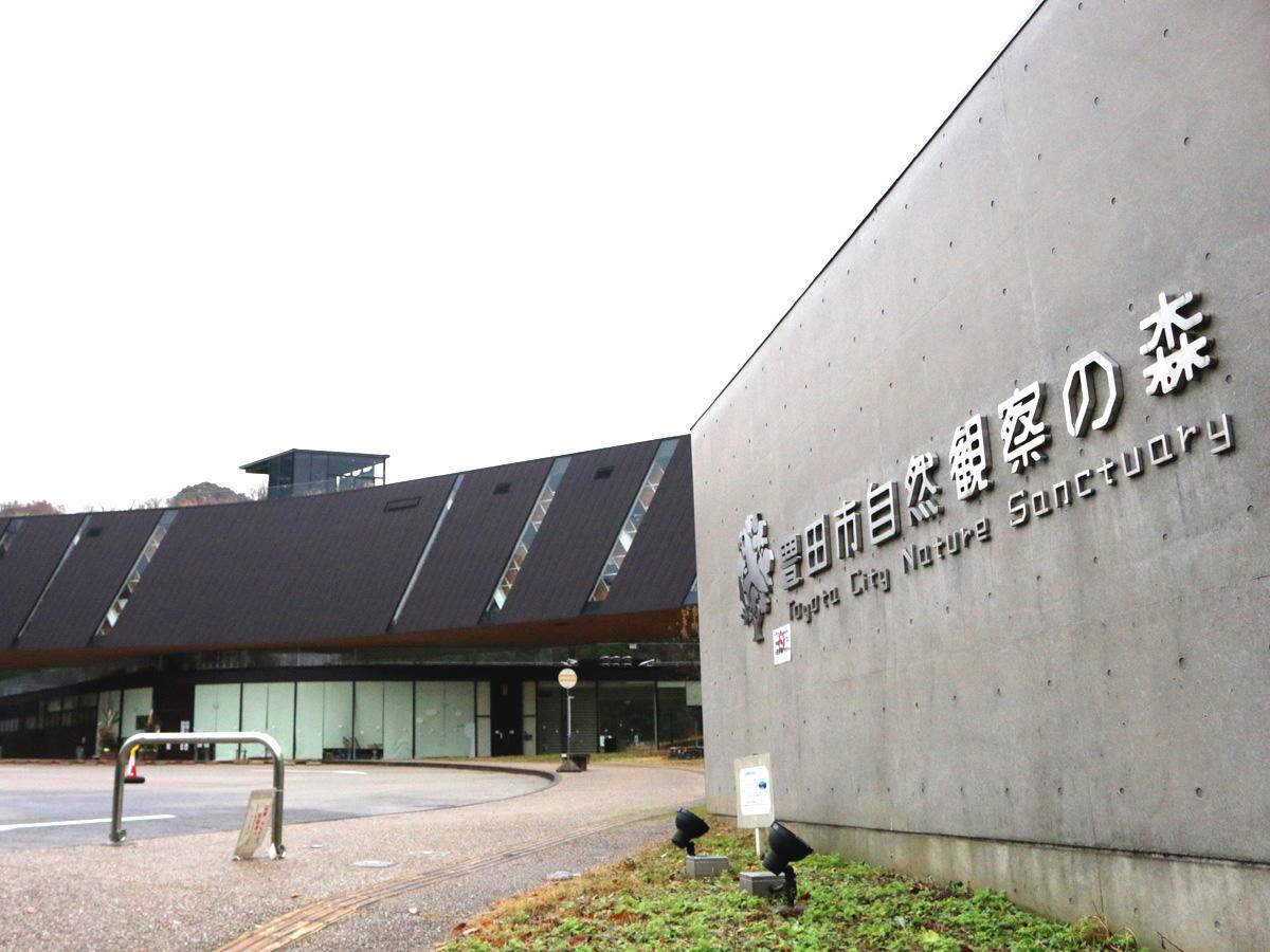
Toyota City Nature Sanctuary
Toyota-Area
At Toyota Nature Sanctuary you can get close to nature, learn about the natural world, an…
-
Toyota City Aizuma Exchange Center
Toyota-Area
Aizuma Exchange Center moved to a new building in March 2010 designed by architect Kazuyo…
-
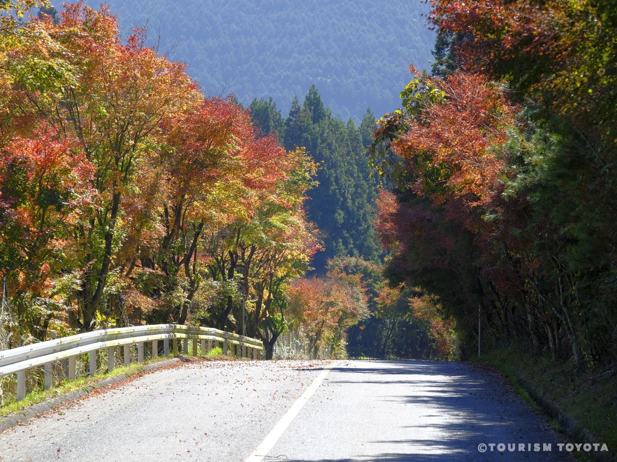
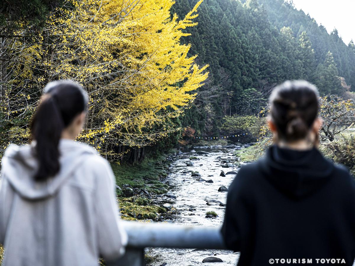
Maple Leaves Road (Momiji Kaido)
Shimoyama-Area
Located in the Shimoyama area of Toyota City, Maple Leaves Road (Momiji Kaido), is a stre…
-
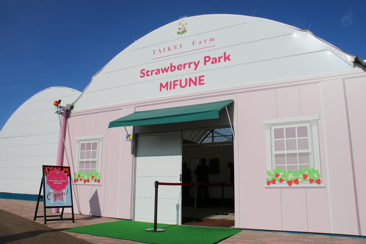
Strawberry Park MIFUNE
Toyota-Area
Strawberry Park MIFUNE offers simple strawberry picking from elevated beds on concrete fl…
-
Umekou Peach, Pear, and Strawberry Farm (Strawberry Picking)
Toyota-Area
Umekou Peach, Pear, and Strawberry Farm is a highly popular and delightful strawberry pic…
-
Myoshoji Temple
Matsudaira-Area
Myoshoji is a small Soto Zen temple with deep ties to the Matsudaira samurai family that …
-
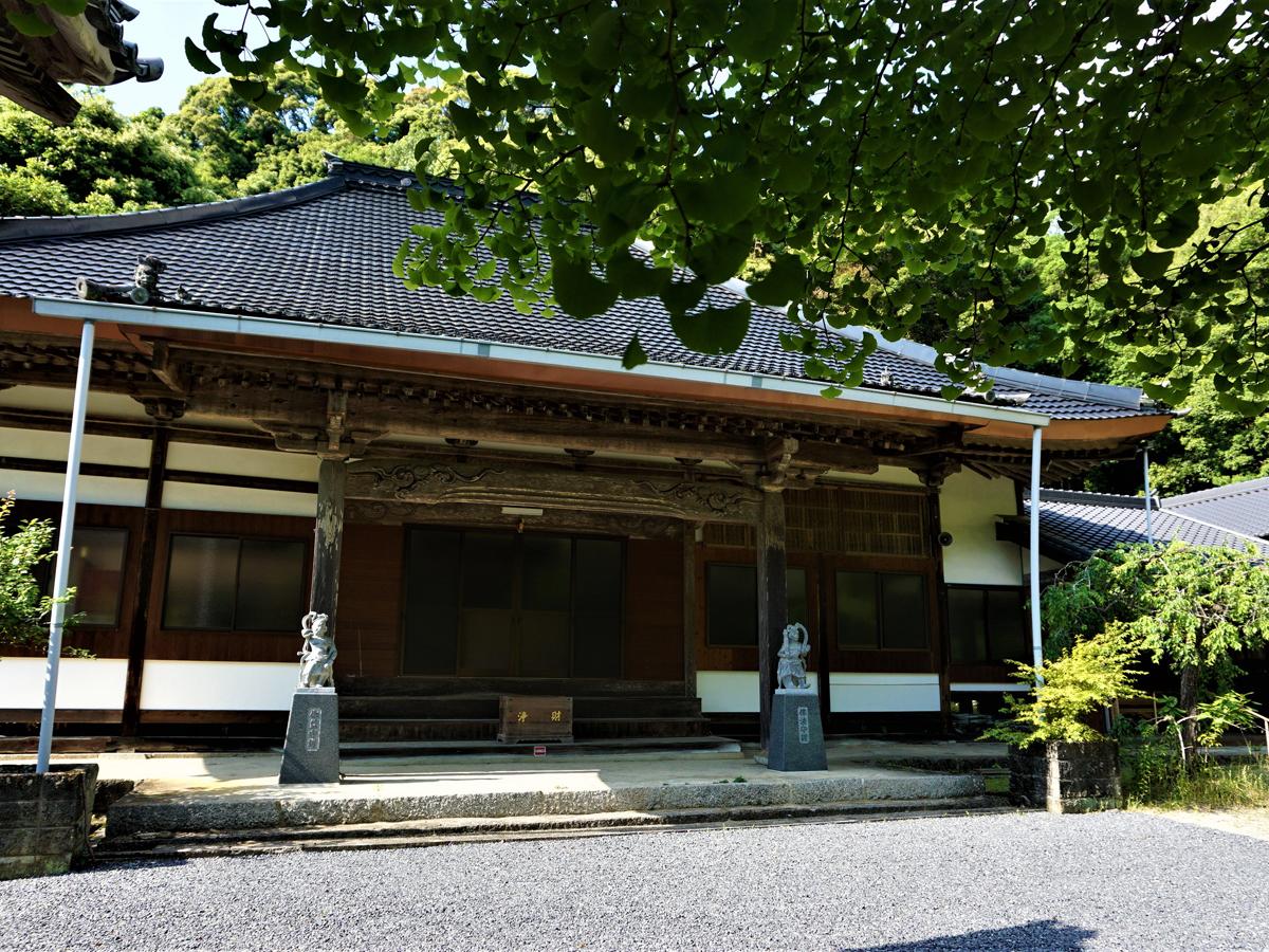
Yamanaka Kannondo Hall
Toyota-Area
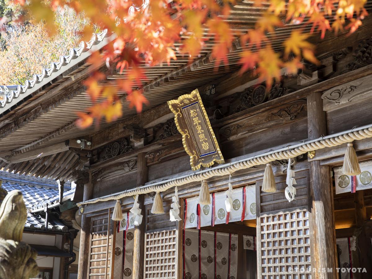
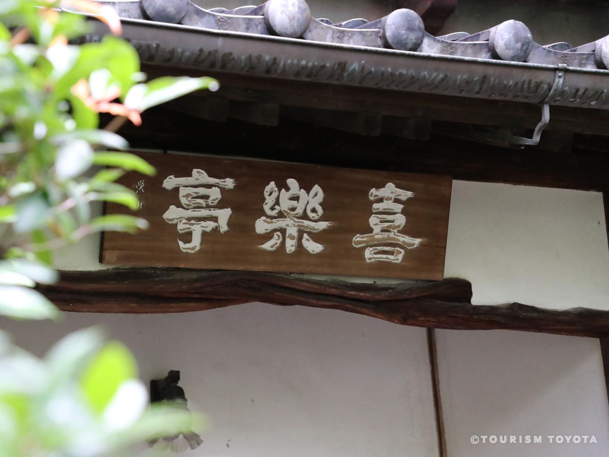
Yamanaka Kannondo Hall at Sanage Shrine serves as a quiet reminder of how Shinto and Budd…
-
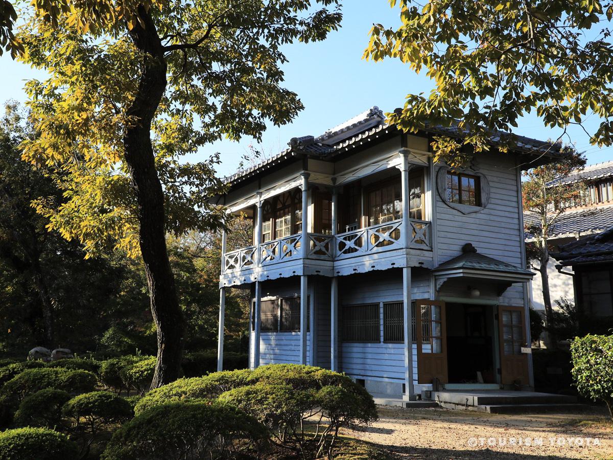
Toyoda Kiichiro’s Former Residence
Toyota-Area
-

Forest Adventure TOYOTA KURAGAIKE
Toyota-Area
This adventure park allows you to walk among the forest canopy of Kuragaike Park through …
-
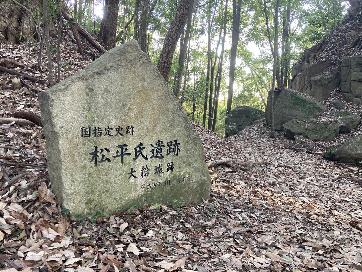
Ogyu Castle Site
Toyota-Area
Ogyu Castle was a large mountain fortress that played a significant role in local armed c…
-
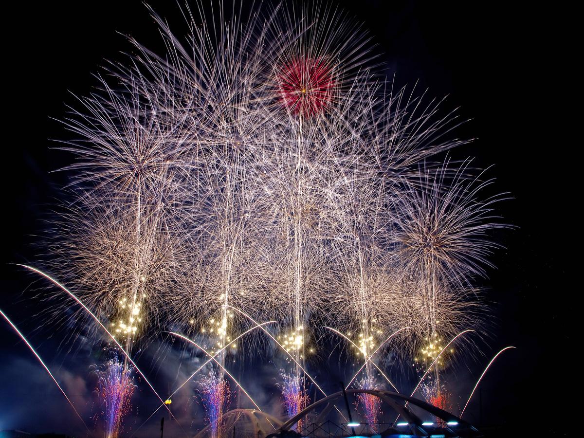
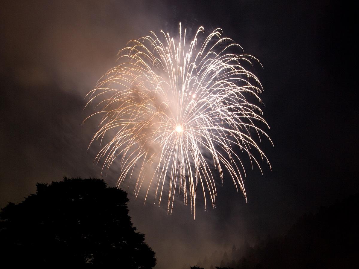
Toyota Oiden Festival Fireworks
Toyota-Area
Toyota Oiden Festival is Toyota City's largest event and, to conclude it with a big splas…
-

Tomoe River Fireworks Display
Matsudaira-Area
Tomoe River Fireworks Display is held annually and features an impressive display of fire…
-

Asahi Yamabiko Fireworks
Asahi-Area
From the spectator seats, the Asahi Yamabiko Fireworks look much closer than normal firew…
-
Obara Summer Festival & Fireworks
Obara-Area
The summer festivities of Obara area. The fireworks show in the end features approx. 200 …
-

Tankororin Lantern Nights
Asuke-Area
-
Inabu Festival
Inabu-Area
The Inabu Festival is an event everyone can participate in by taking part in the dance an…
-
Shimoyama Summer Festival
Shimoyama-Area
Not many fireworks are launched at this simple but cute festival, but guests get to see t…
-
2025 Asuke Summer Festival
Asuke-Area
-
Abandoned stations along the Meitetsu Mikawa Line (Sanage Station–Nishi Nakagane Station)
Toyota-Area
Old train stations lie along the old Mikawa Line (Sanage Station–Nishi Nakagane Station) …
-

Asuke Festival
Asuke-Area
The Asuke Festival is held by Asuke Hachimangu Shrine. The main hall was rebuilt in 1466 …
-
70th Korankei Gorge Maple Festival
Asuke-Area
-

Obara Shikizakura Four-Season Cherry Blossom Festival
Obara-Area
Japan is famous for its cherry blossom in spring and autumn leaves in fall, and that make…
-

Sanage Festival
Toyota-Area
-
Inabu Maple Leaves Festival
Inabu-Area
The Oidaira Park is a widely known autumn leaves spot of the district of Inabu, eastern T…
-
Fujioka Maple Festival (Tree illumination)
Fujioka-Area
Aichi Prefectural Greenification Center and its vivid fall colors act as the main venue f…
-
Tenka Festival
Matsudaira-Area
-

Yukimi Kaido Inabu
Inabu-Area
Yukimi Kaido Inabu is an annual winter event in the Inabu area of Toyota City. When the …
-

Toyota City Museum
Toyota-Area
-
Iino River Cherry Blossom Lane Light Display 2026
Fujioka-Area
-
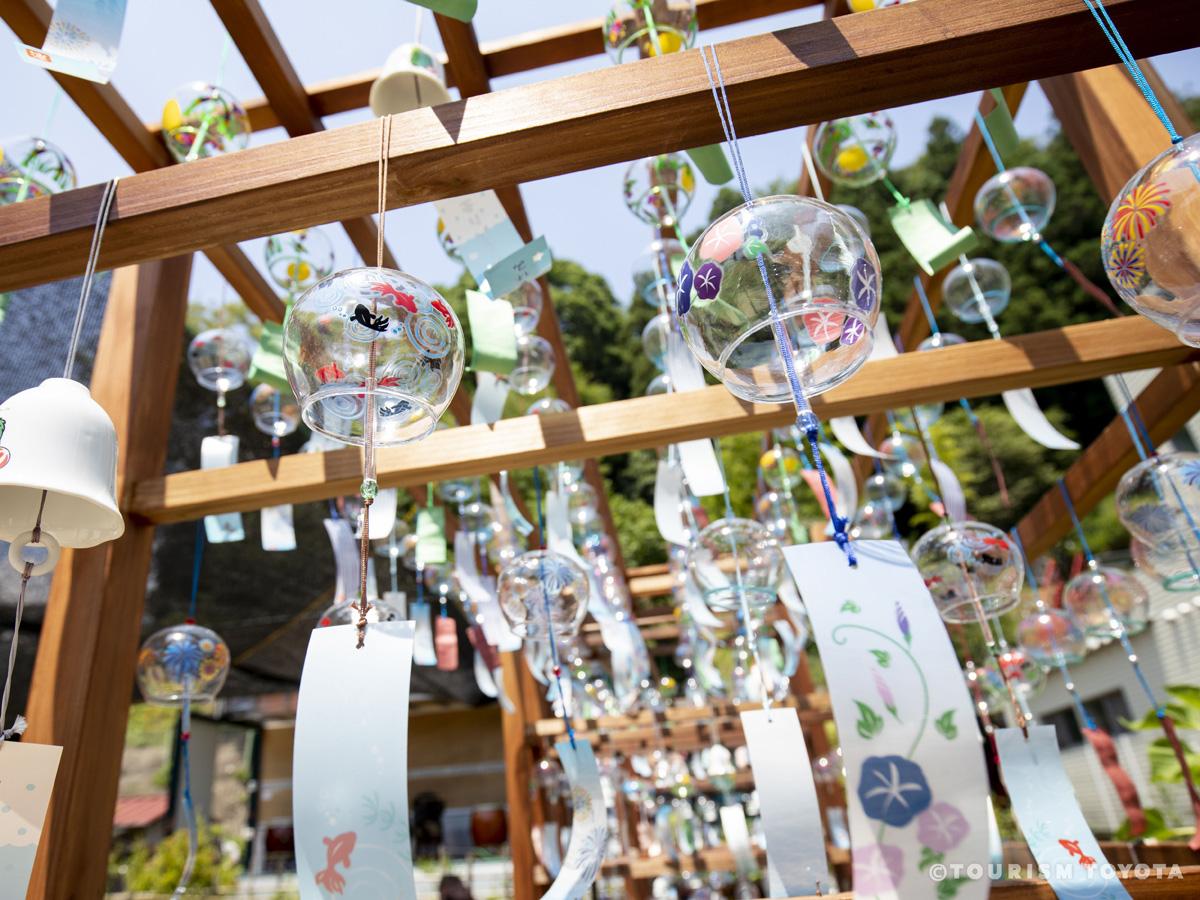
Odo Yumekake Wind Chime Festival
Asahi-Area
An event begun in 2003. In the middle of July, wind chimes join the sounds of the river t…
-
Maruka Orchard
Toyota-Area
-
Hiratobashi Park
Toyota-Area
Hiratobashi Park, located in the northern part of Toyota City along the Yahagi River, is …
-
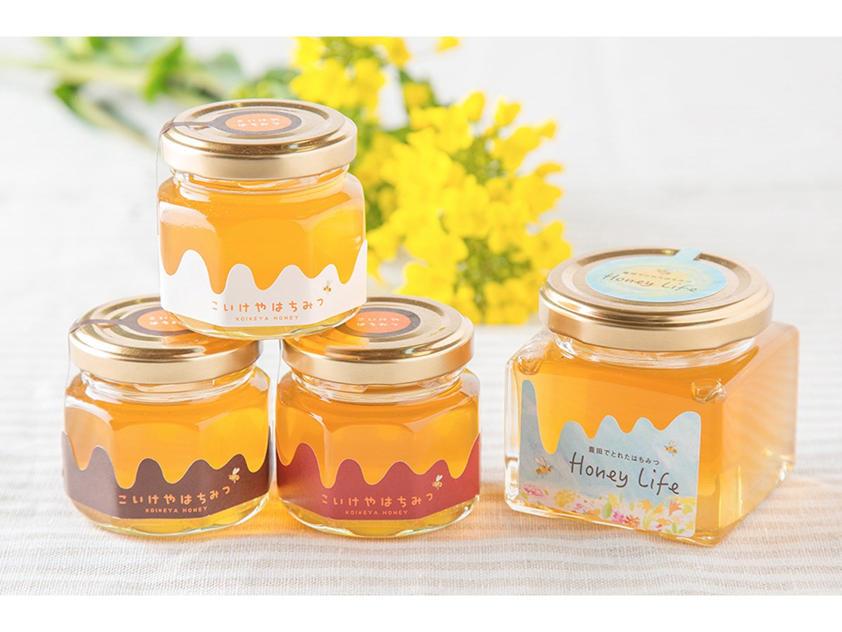
Koikeya Create
Toyota-Area
Koikeya Create is the publisher of Ko Life, a free community magazine that won first priz…
-
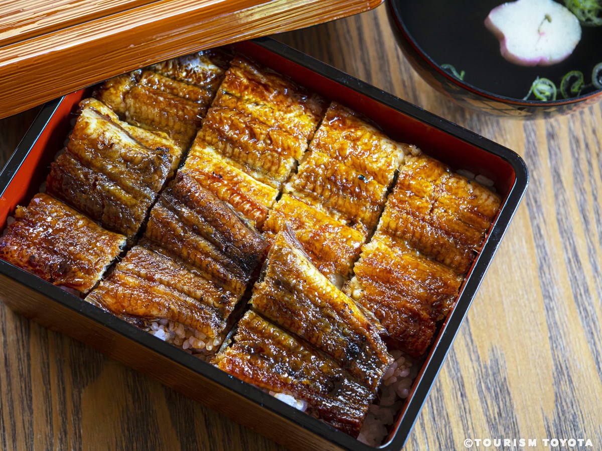
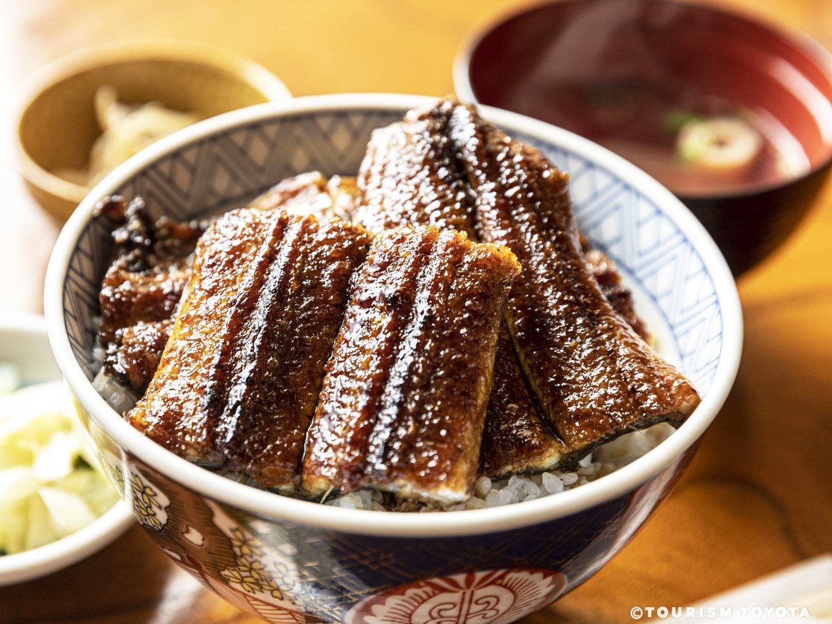
Unagi-no-Mikawa
Shimoyama-Area
We have been serving grilled eel since 1969. Our sauce is made with the same recipe that …
-
Obara-An
Obara-Area
Our dishes are made with fresh, local sansai vegetables, bamboo shoots, wild sweetfish, m…
-
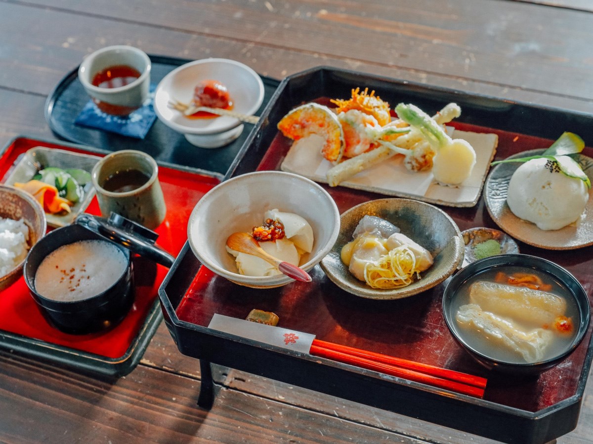
Country Restaurant Keiryu-so (cuisine)
Asahi-Area
-
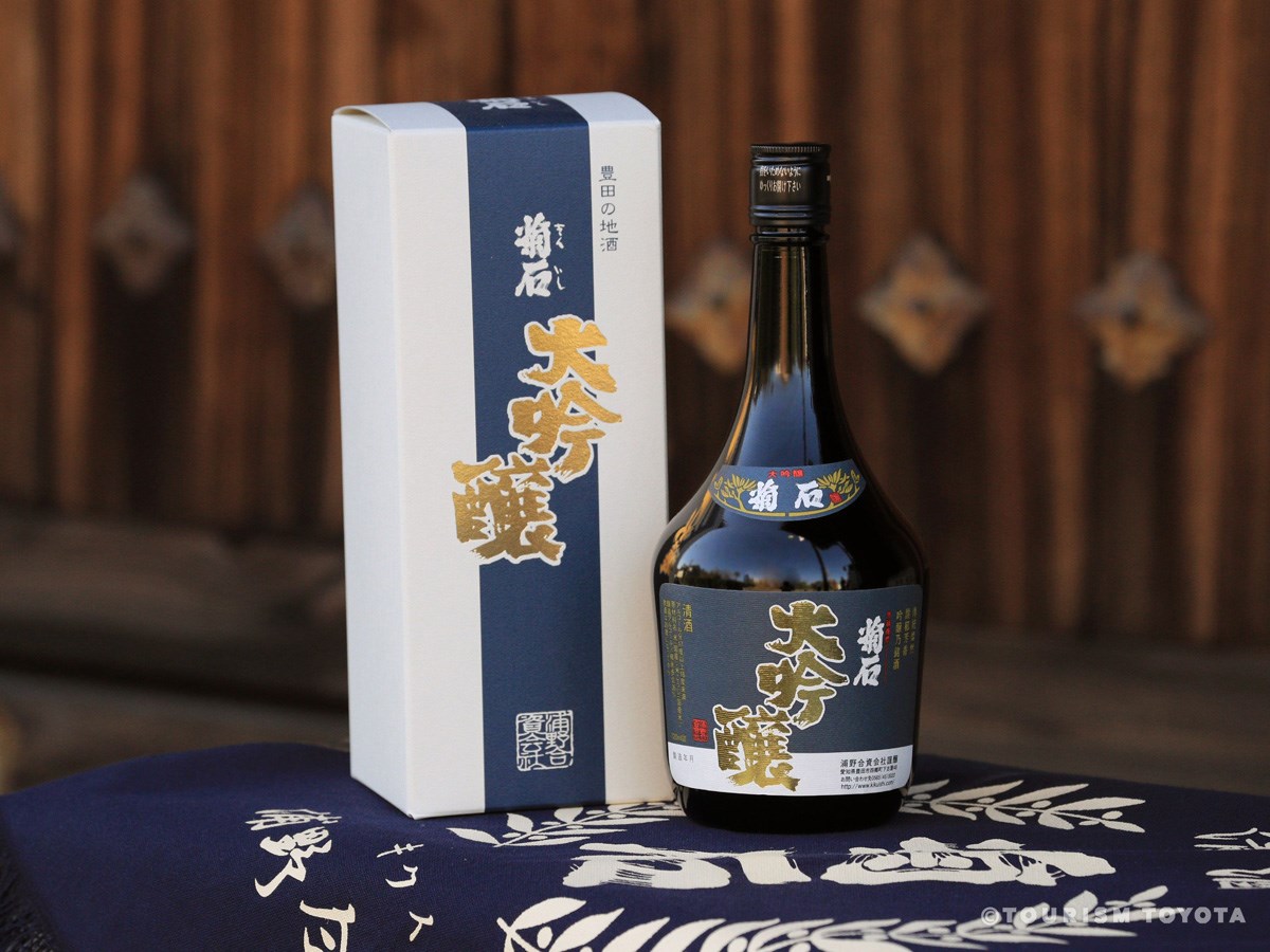
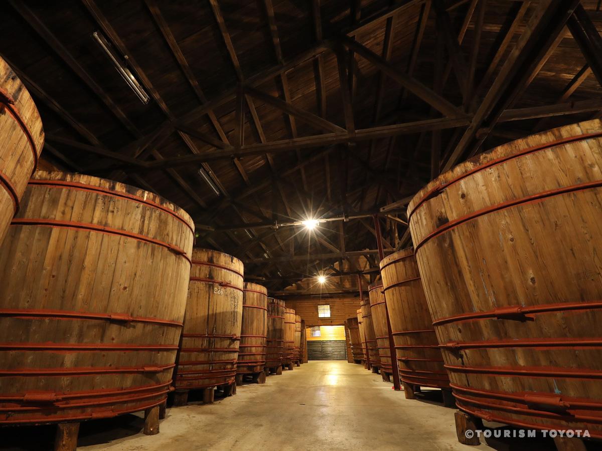
Urano Sake Brewery
Toyota-Area
Urano Sake Brewery was established in 1864. Seishu Kikuishi, the brewery’s signature prod…
-
Toyota Stadium
Toyota-Area
-
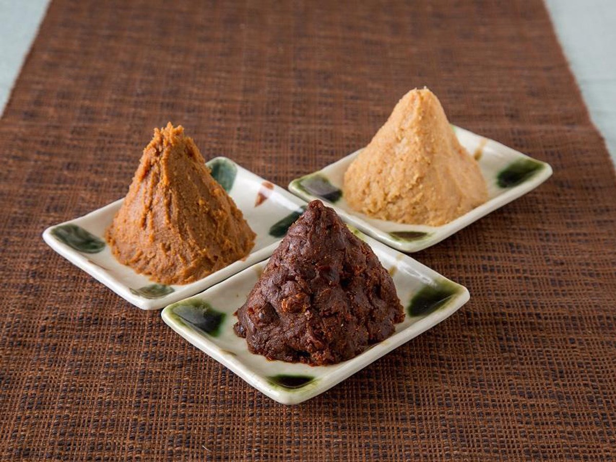
Masuzuka Miso Noda Miso Co.
Toyota-Area
Noda Miso Co. cerebrates its 90th anniversary this year. We make our miso the same way we…
-
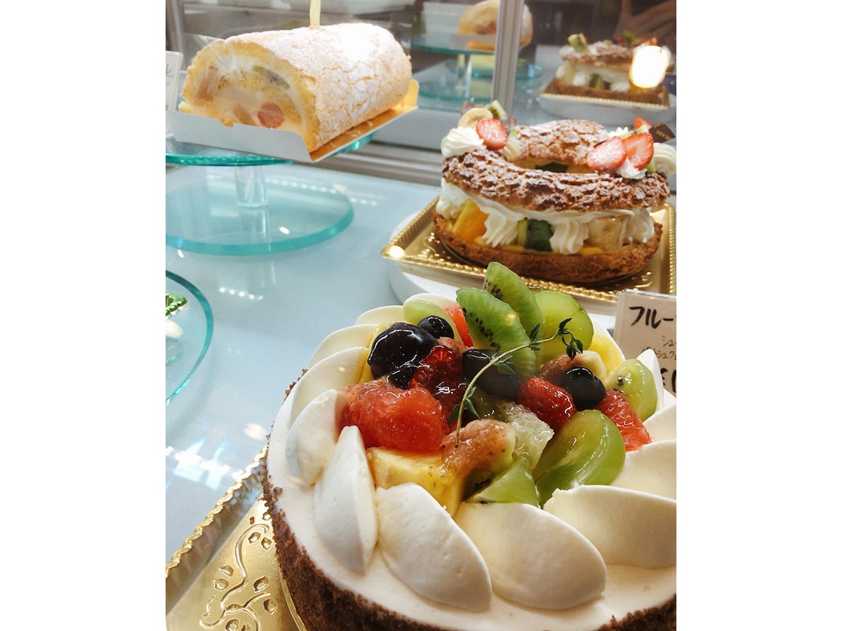
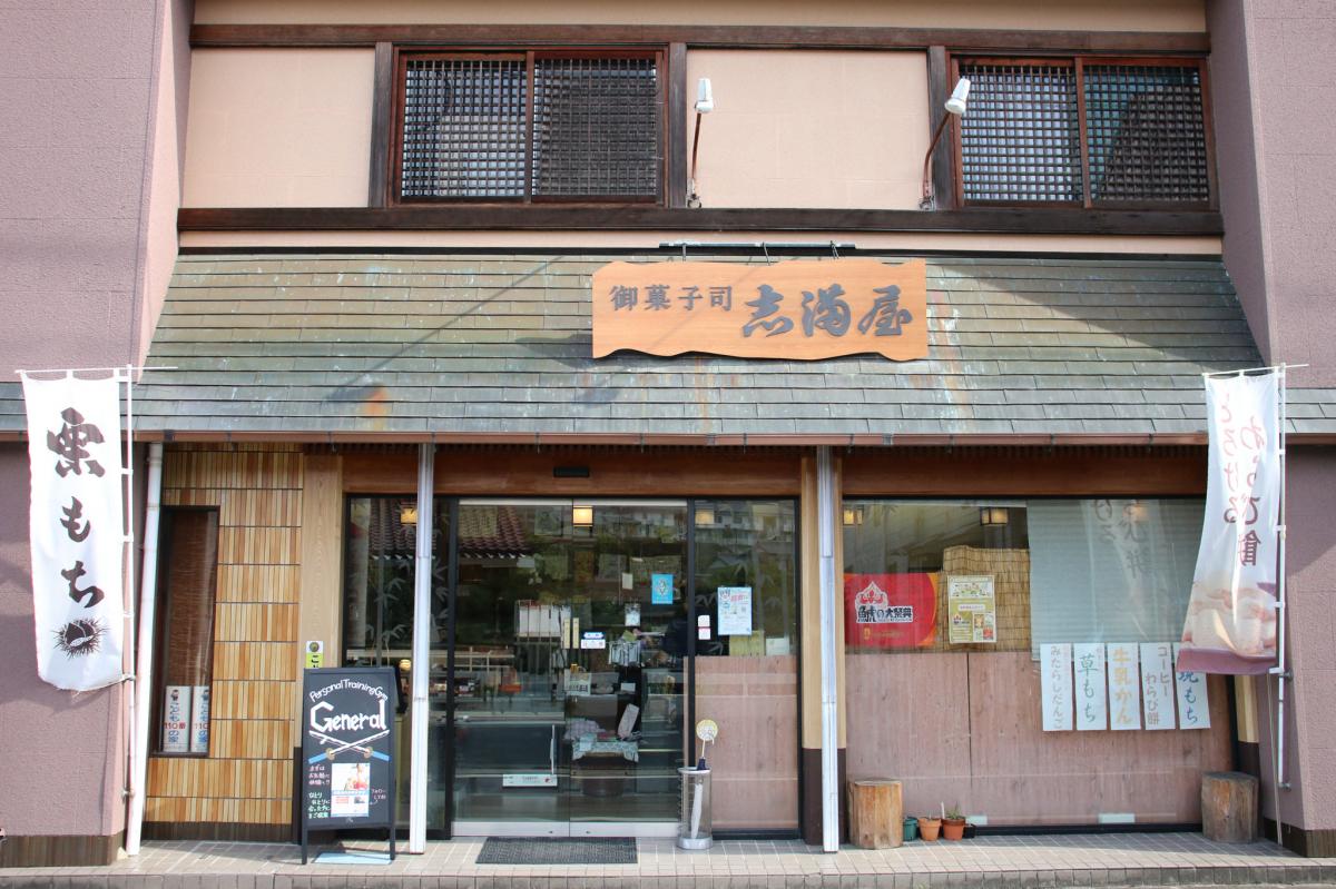
FUKU JU EN
Toyota-Area
FUKU JU EN is a Japanese sweets store established in 1970. The store sells seasonal confe…
-
Restaurant Kaede
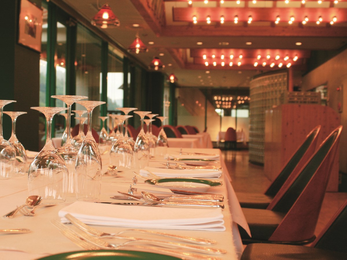
Asuke-Area
Enjoy an authentic French meal made by a top chef using an abundance of local and seasona…
-
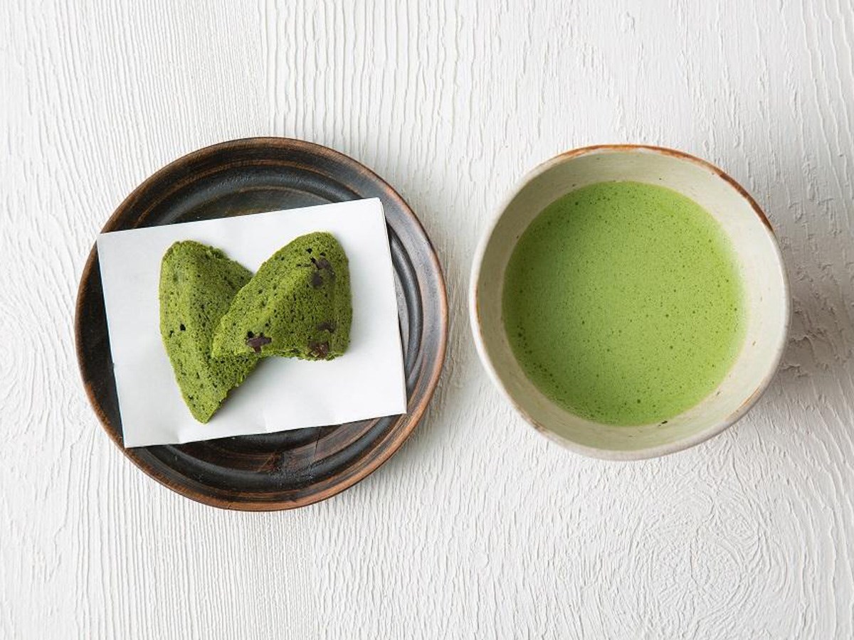
Kokaen
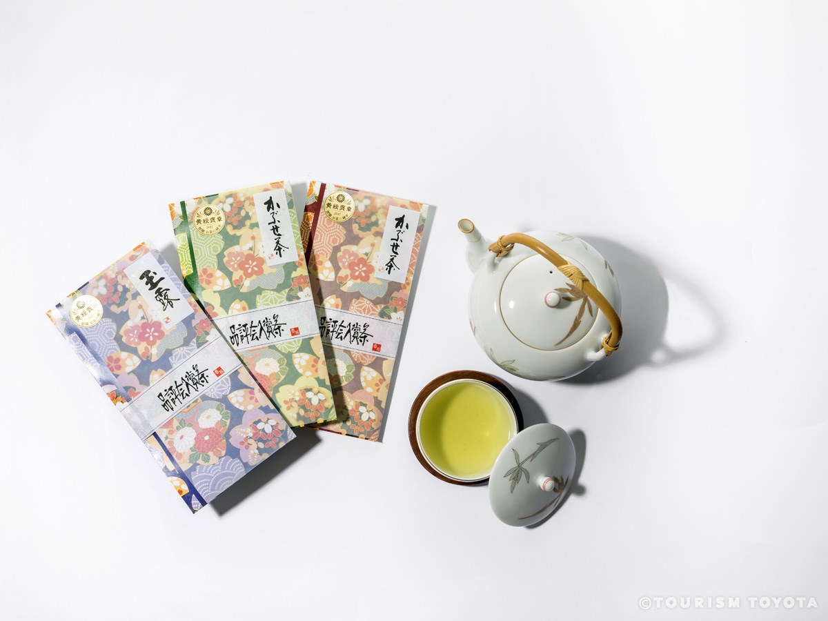
Toyota-Area
Yoshiwara-cho, Toyota City, Aichi Prefecture has been a tea-producing region since the Ed…
-
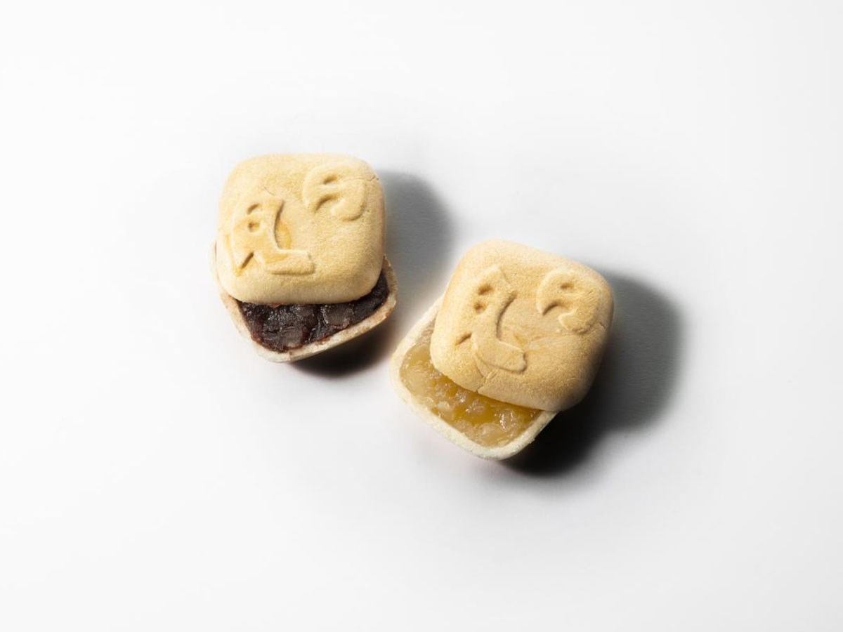
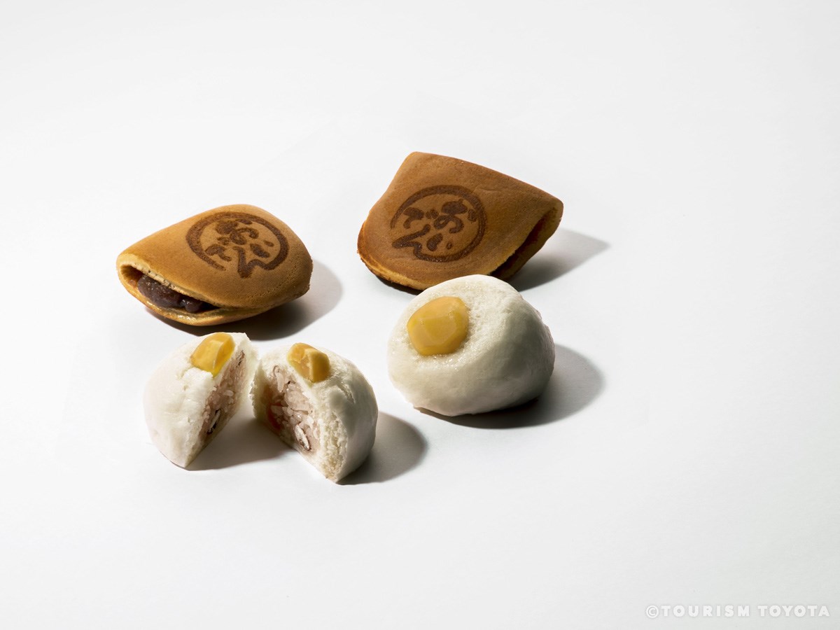
Nichigetsu-Monaka Sohonpo Kawamuraya
Asuke-Area
This confectionery has been producing its Nichigetsu-Monaka sweets since its establishmen…
-
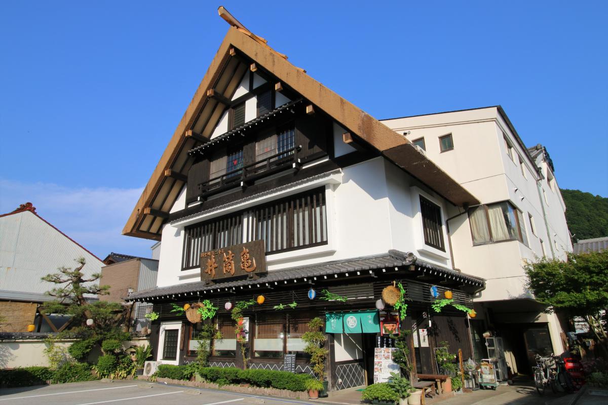
Izukame
Asuke-Area
The Asuke region in Toyota is known for Korankei Gorge, a spot famous for its autumn foli…
-
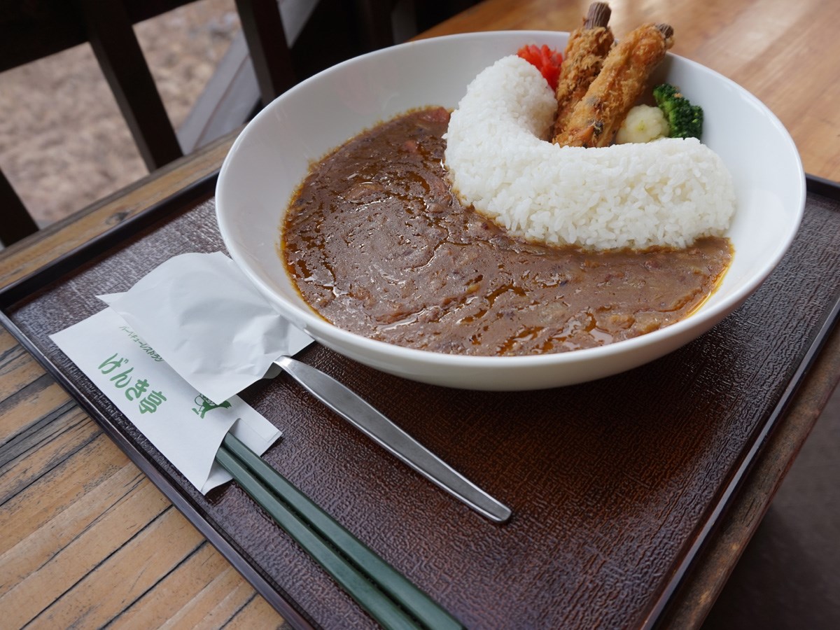
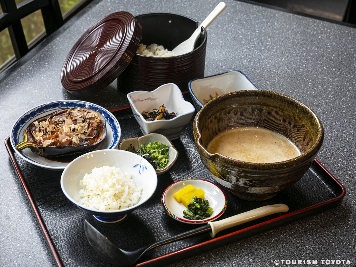
Restaurant Genki-Tei
Asahi-Area
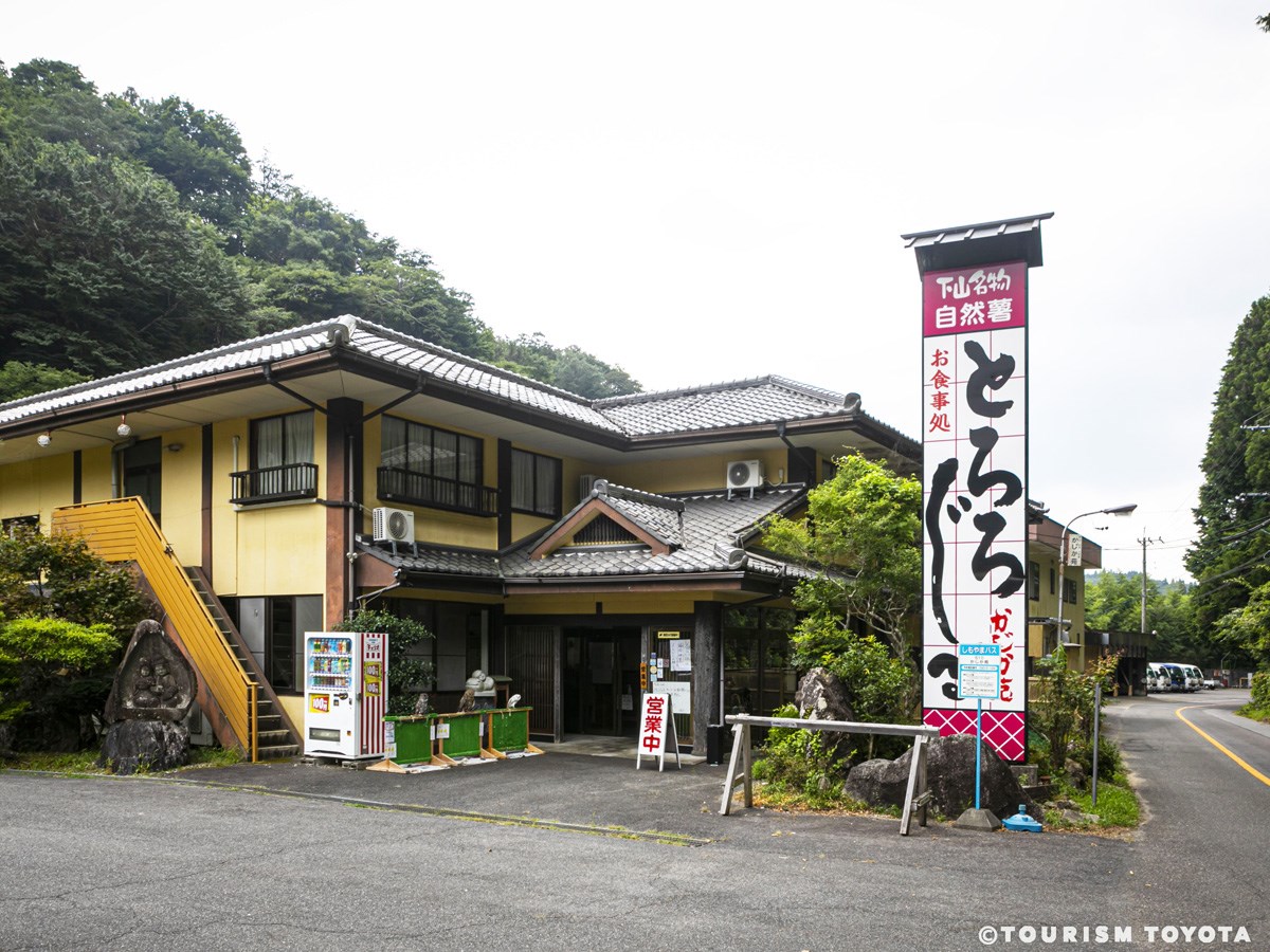
Restaurant Genki-Tei serves dishes prepared with yumetororo—a type of mountain yam that’s…
-

Seasonal Kitchen Le Bonheur
Toyota-Area
The restaurant offers an all-you-can-eat lunch buffet by day, and serves casual à la cart…
-
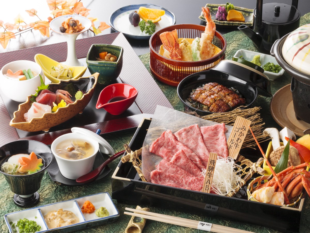
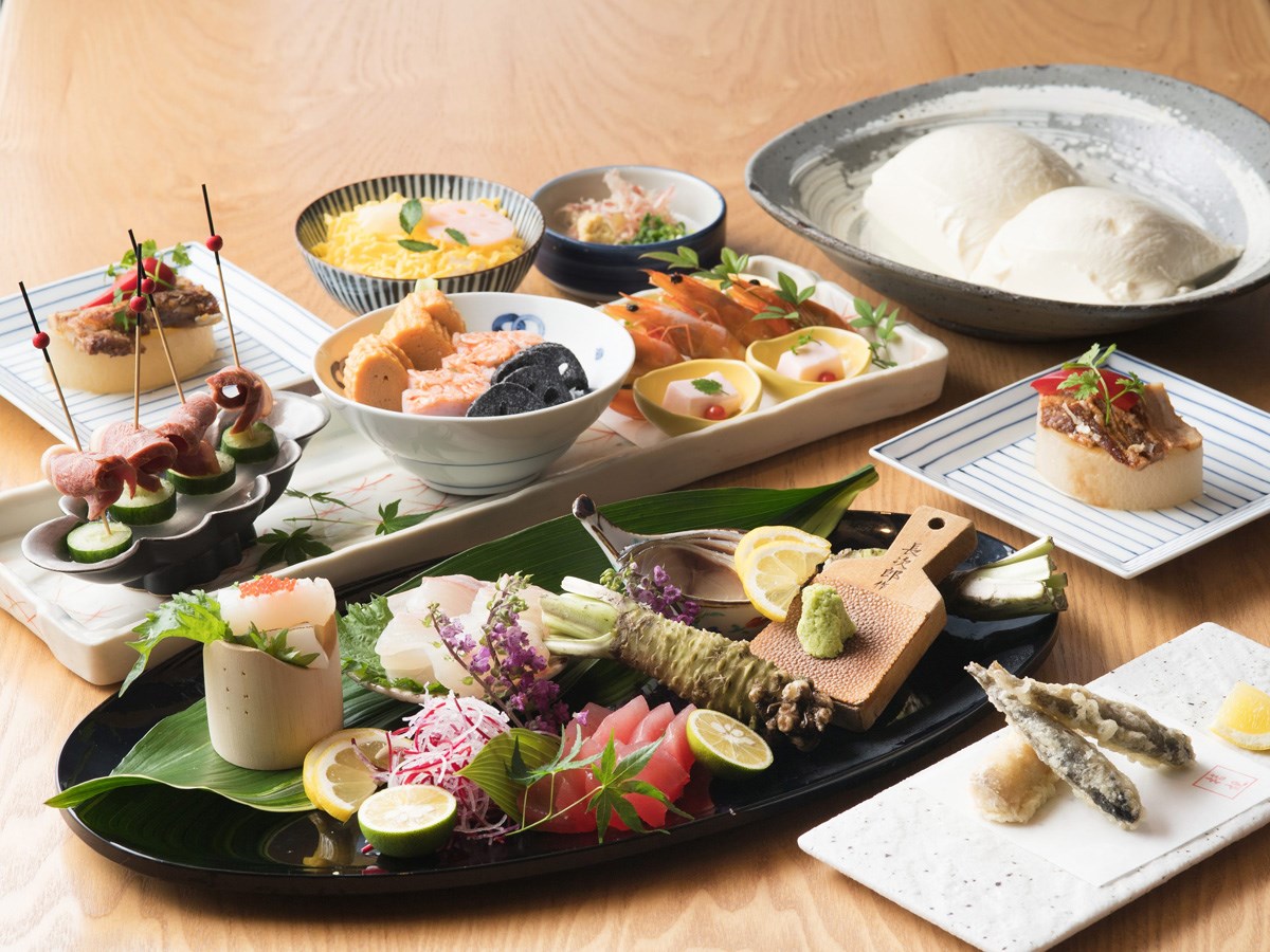
Japanese Cuisine Mikawa
Toyota-Area
We serve reasonably priced lunches and authentic full-course kaiseki meals. Private roo…
-
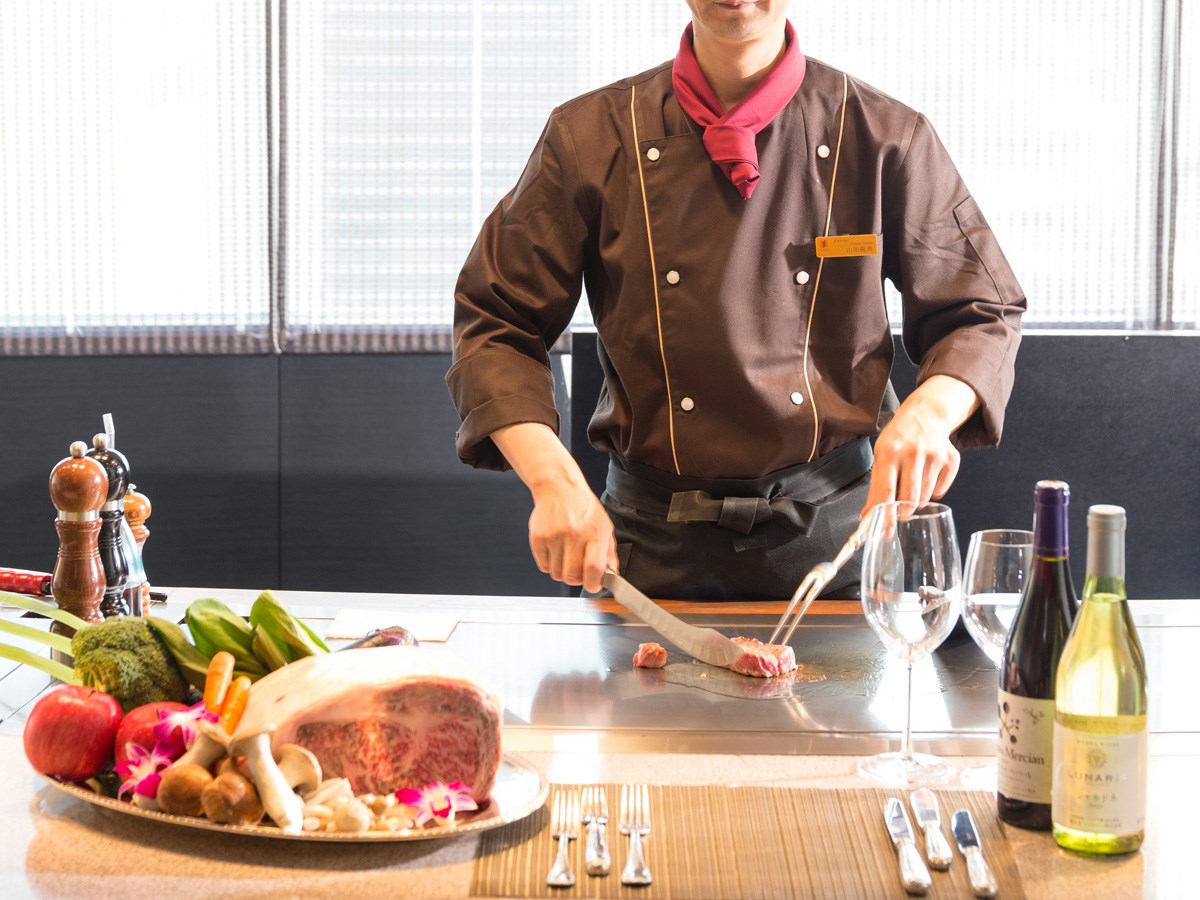
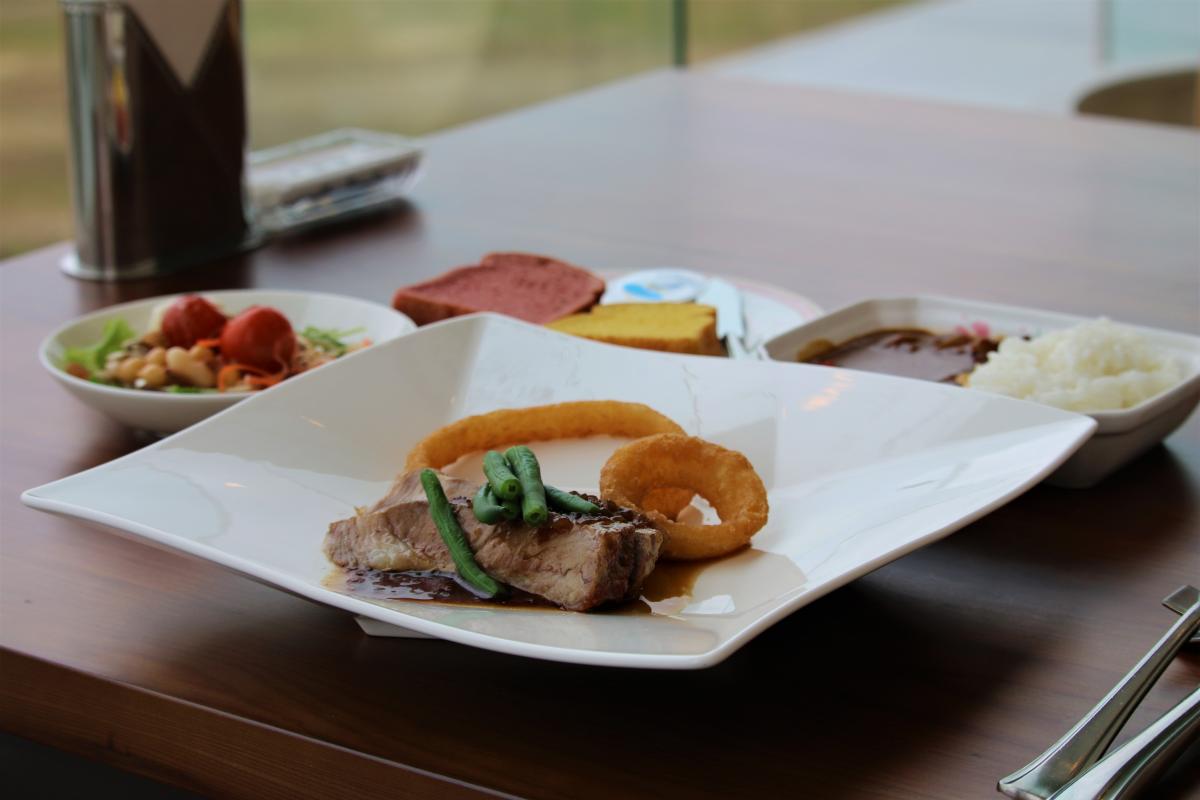
Teppan Keyaki
Toyota-Area
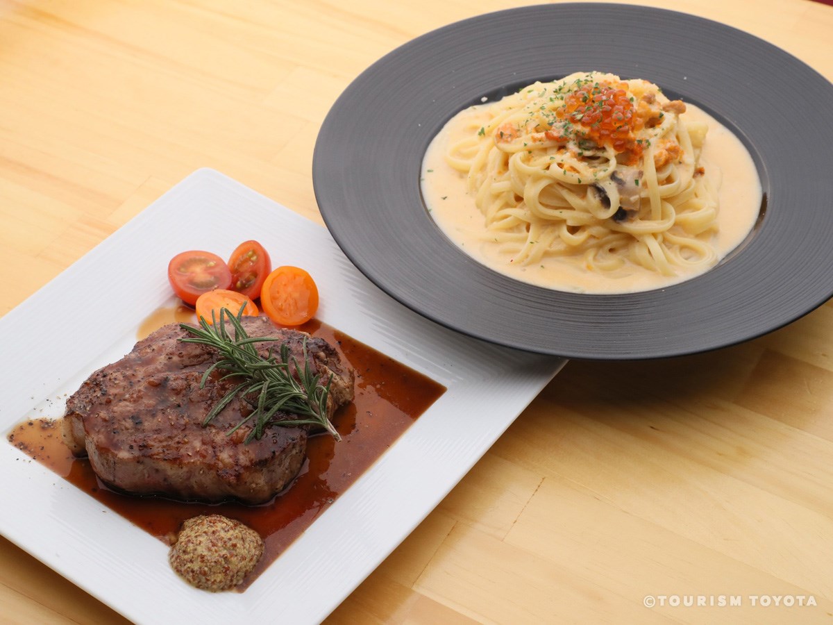
Savor fresh-off-the-grill steak cooked by the hotel chefs right in front of you.
-
HARU
Toyota-Area
We serve fresh fish straight from the ports! Aside from fish, Hobi pork—a premium brand…
-
Toyota Stadium Restaurant Verde Rosso
Toyota-Area
From 30 meters above ground, on the fourth floor of Toyota Stadium, Verde Rosso commands …
-
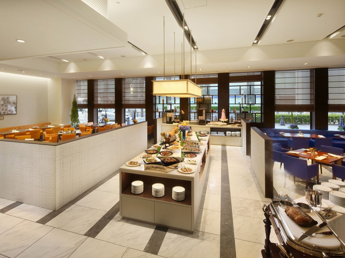
All Day Dining WINDSOR
Toyota-Area
A modern interior with simple wood-print pillars, rays of light coming in from the window…
-
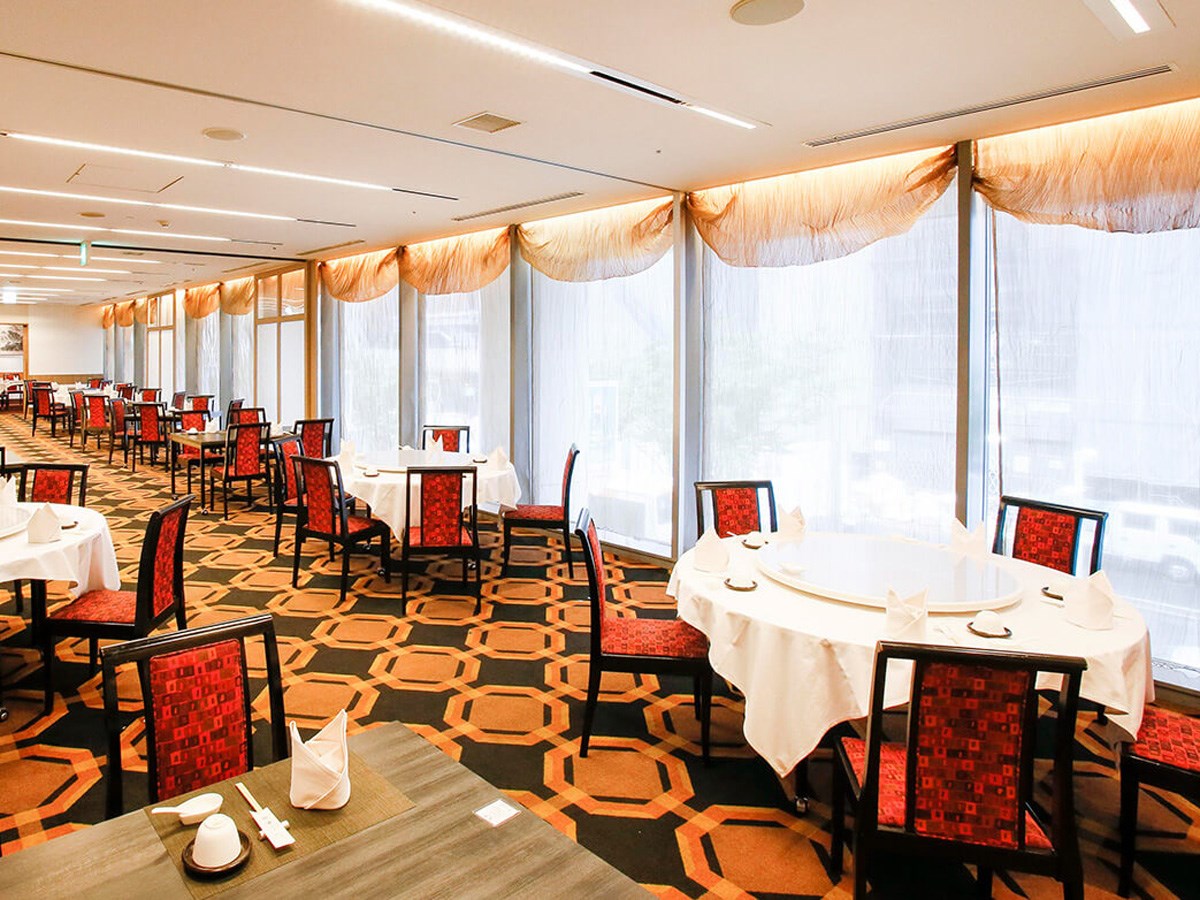
Chinese TAOYUAN
Toyota-Area
The interior of the restaurant is simple yet elegant—perfect for our traditional Chinese …
-
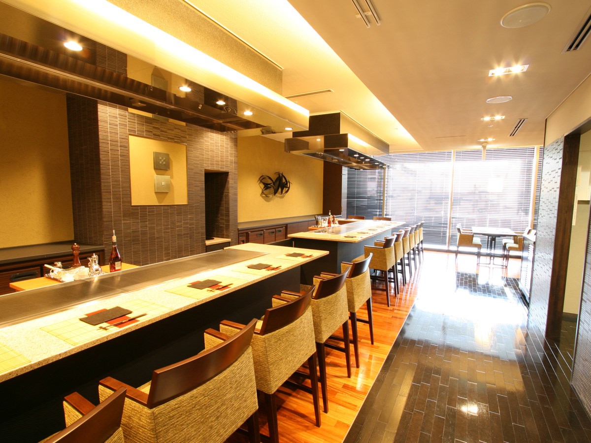
Teppanyaki Dan
Toyota-Area
-
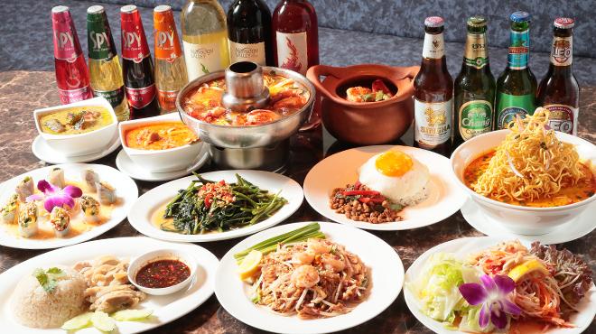
Thai Restaurant Thanisara
Toyota-Area
This Thai restaurant serves authentic Thai cuisine prepared by a Thai chef with over 10 y…
-
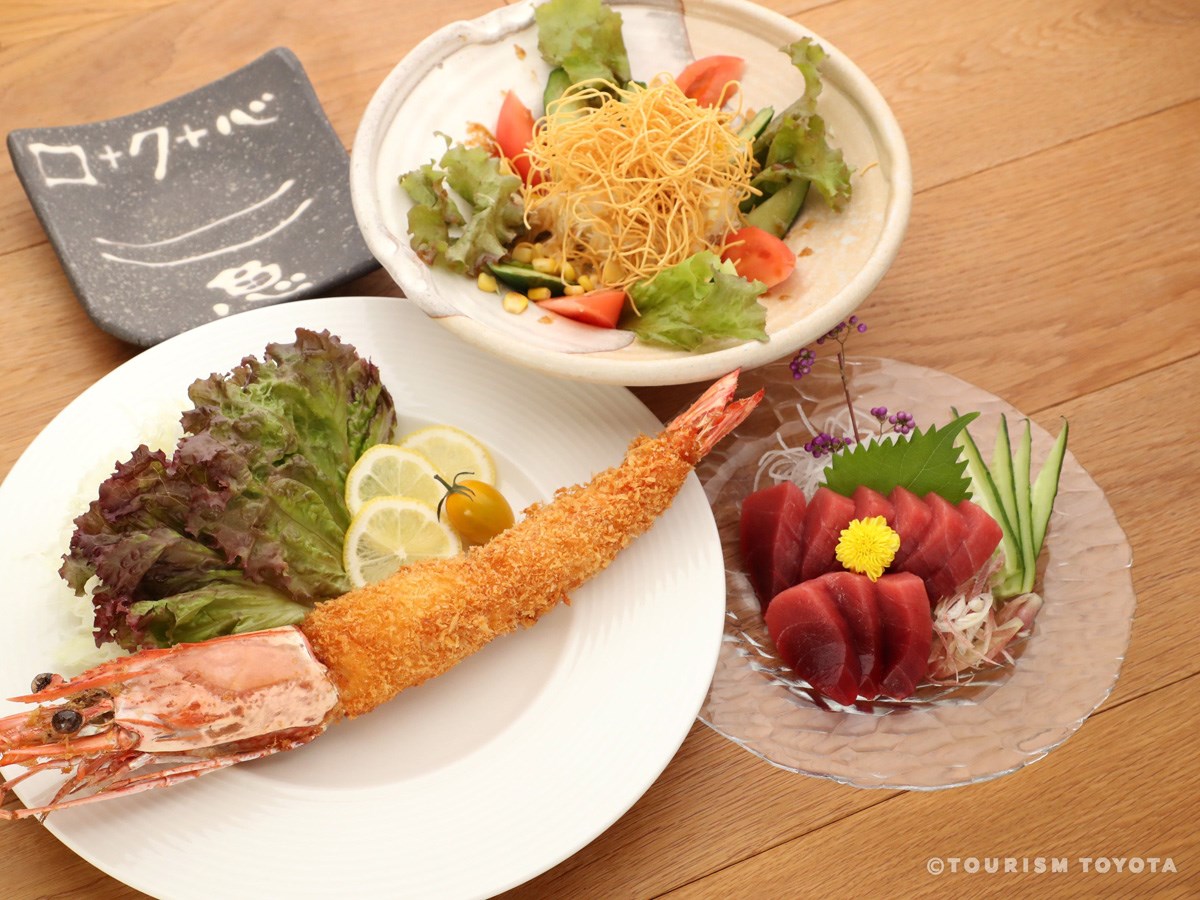
ROKU KANDA
Toyota-Area
We serve sashimi and other fish dishes, as well as meat and cheese. It’s a perfect place …
-
Kajika-en Inn (cuisine)
Shimoyama-Area
Enjoy comfort food made with love and care surrounded by the beautiful mountain scenery o…
-
Hearth and Lodge Kikko-en (cuisine)
Inabu-Area
This restaurant is run directly by a farm that raises Kogen Cochin chickens, a purebred l…
-
Blueberry-no-Komichi
Inabu-Area
-
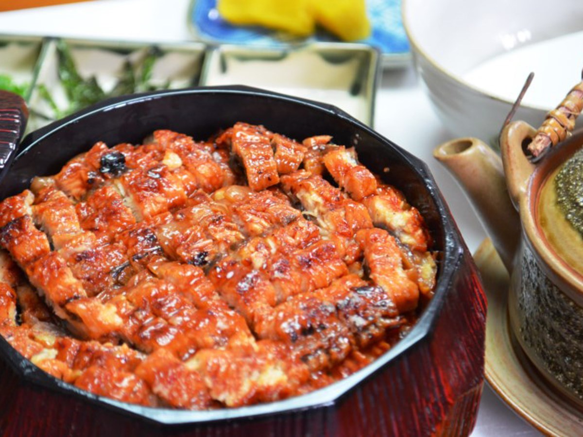
Unagi & Jinenjo Manmaru
Toyota-Area
A restaurant specializing in mountain yam and eel from Mikawa Isshiki. The smell of eel g…
-
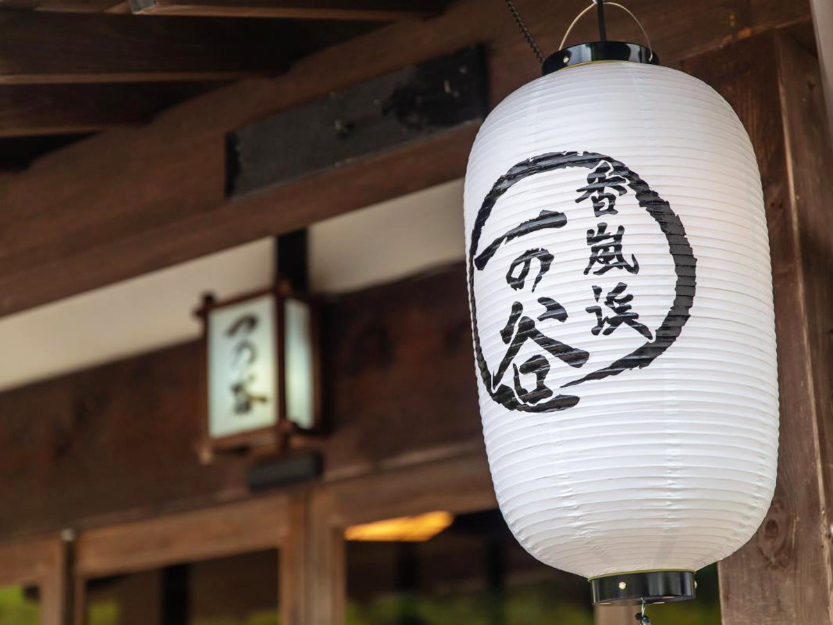
Korankei Ichinotani
Asuke-Area
Founded in 1965 years ago, this restaurant deep inside Korankei Gorge serves traditional …
-
WAKUYA
Toyota-Area
-
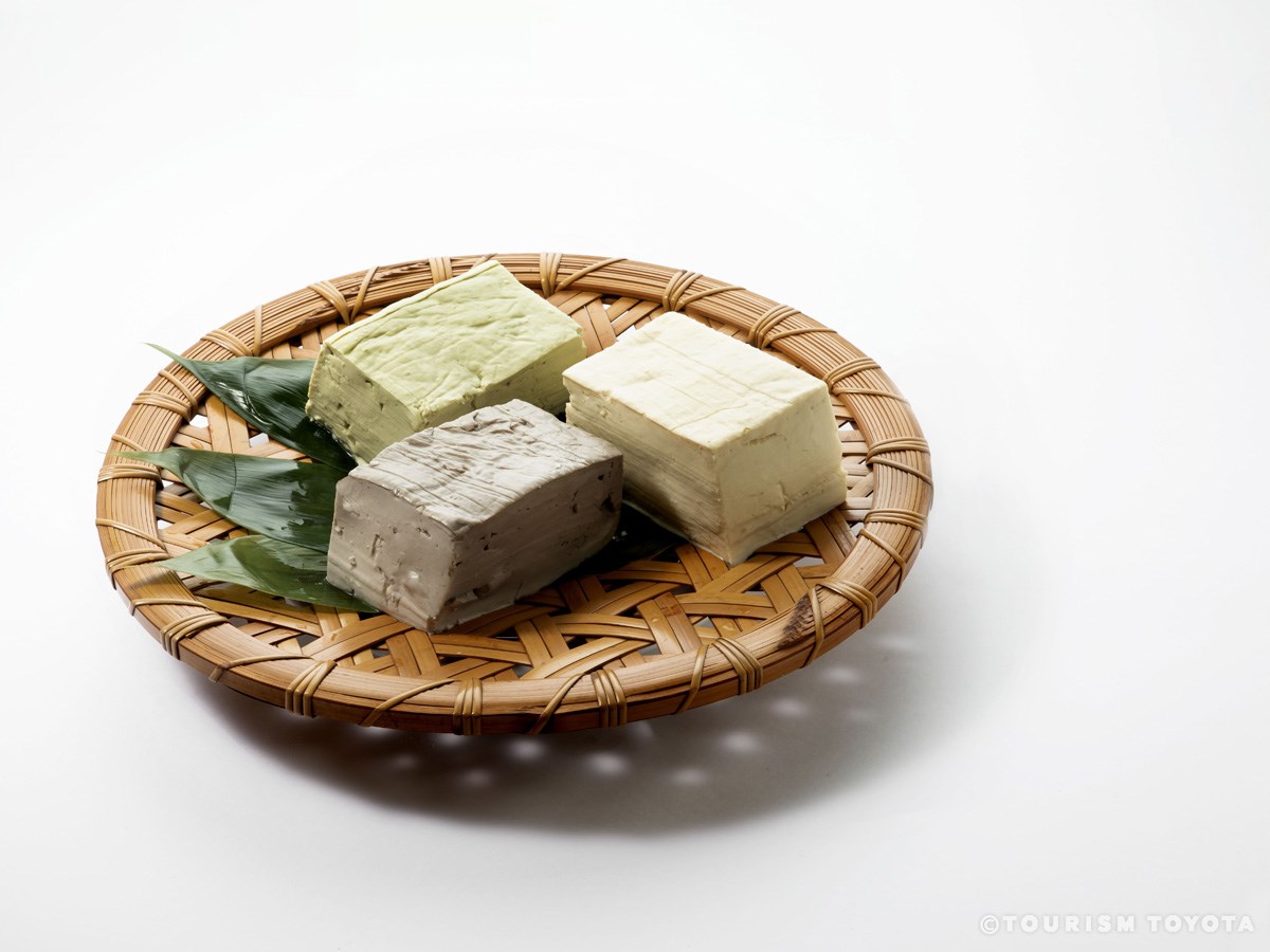
Shibata Tofu Shop
Obara-Area
Our motto is, “Tastier, safer products.” We produce safe food products that will last in …
-
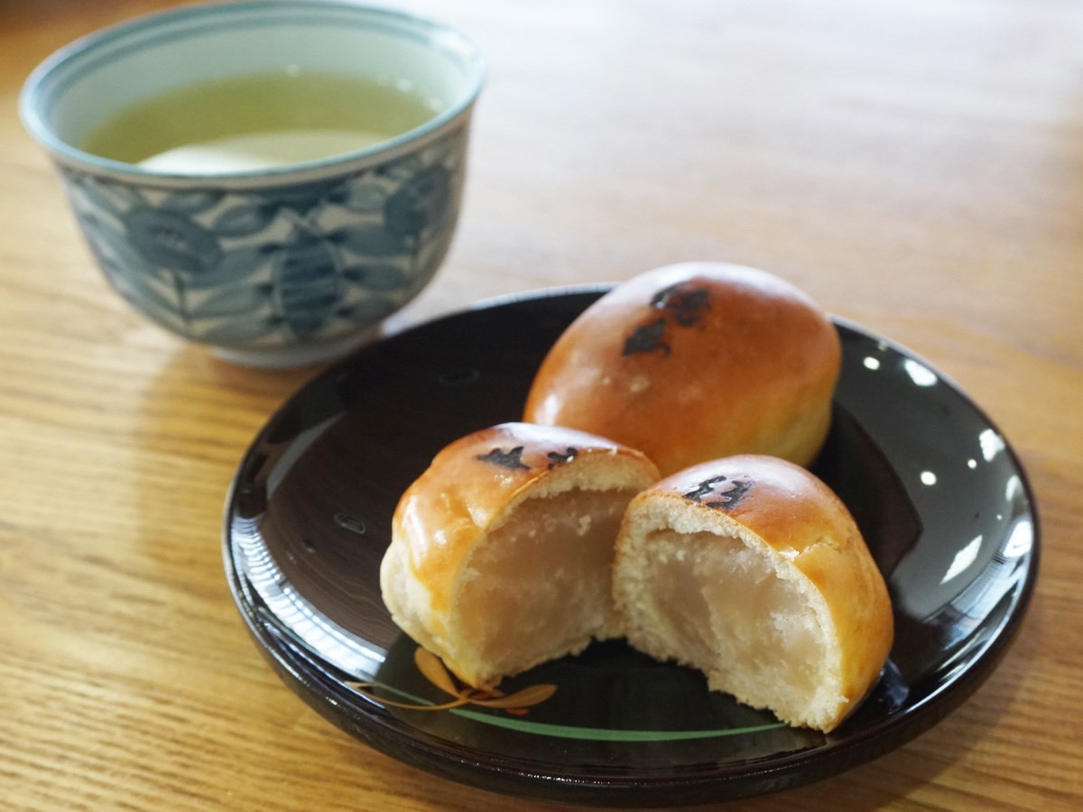
Tokuhon Manju Honpo
Matsudaira-Area
Founded in 1946. This shop was named after Tokuhon Shonin—a Buddhist priest in the mid-Ed…
-
Kura-no-Naka Gallery Manrin Bookshop & Café
Asuke-Area
Along the Old Road of Asuke, a once busy Shio-no-Michi route - as vital backbone trading …
-
Hekien Ocha-no-Junpei
Toyota-Area
In order to make good tea, human hands are essential. First comes the soil in which the…
-
Bullshit
Toyota-Area
Enjoy drinks and good Italian food. Only a three-minute walk away from Toyotashi Statio…
-
Kaho Oumiya
Toyota-Area
We are a long-standing confectioner that has been making sweets in Toyota for over 80 yea…
-
Hyakunensou Barbara House
Asuke-Area
-
Roadside Station "Michi-no-Eki" Donguri-no-Sato Inabu
Inabu-Area
Roadside Station Donguri-no-Sato Inabu is a "Michi-no-Eki" (lit. "Road Station") located …
-
Sanshu Asuke Yashiki Museum
Asuke-Area
-
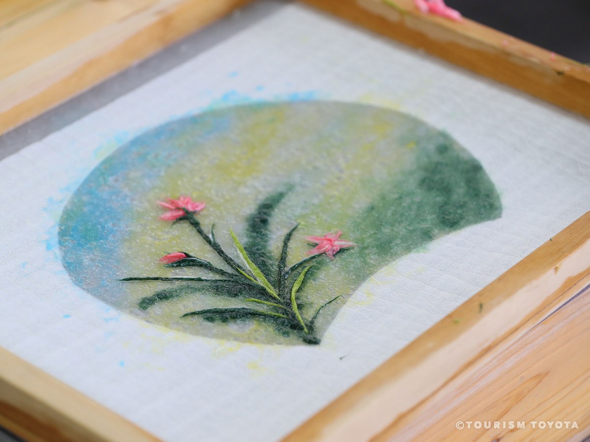
Obara Paper Art Museum (Washi no Furusato)
Obara-Area
-
Shokado Fujioka Shop
Fujioka-Area
Shokado Fujioka Shop takes orders for birthday cakes in your shape of choice, decorated c…
-
Manpuku Shiten
Toyota-Area
We are an eel restaurant with a history of over 50 years. Our eel are grilled to perfecti…
-
Booby's British Pub
Toyota-Area
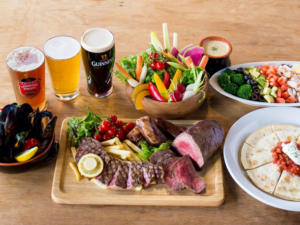
Taste British food and beers from around the world!
-

Mikawaji Inn
Shimoyama-Area
-
Sweet Corns MEGLiA M Park Shop
Toyota-Area
With a comfortable, at-home atmosphere, enjoy morning, lunch, or tea time at Sweet Corns.…
-
Shokado Miyagami Shop
Toyota-Area
Based around seasonal Japanese sweets to take home or give as gifts, Shokado Miyagami Sho…
-
OKATOTOKI
Toyota-Area
Head to OKATOTOKI for delicious Japanese food and drinks in Toyota City! Only 1 minute …
-
Hinoki-Chaya Restaurant
Asuke-Area
Located next to Sanshu Asuke Yashiki Museum, this restaurant serves savory mountain cooki…
-
Katakago Café
Asuke-Area
The fragrant coffee made from beans roasted in-house with charcoal made in Sanshu Asuke Y…
-

Ohashi Engei
Toyota-Area
In the Oshikamo-cho area of Toyota City, Ohashi Engei grows rice, wheat, and soybeans on …
-
Mamean Eki-Minami Shop / Shun-Sen
Toyota-Area
[Japanese Restaurant and Japanese-Style Bar Mamean Eki-Minami] Only a 3-minute walk from…
-
Mamean Eki-Mae Shop
Toyota-Area
Located only a one minute walk away from Toyotashi Station, Mamean Eki-Mae Shop takes gre…
-
Hare-Bare
Toyota-Area
The bounty of land and sea are offered at reasonable prices, including roast chicken and …
-
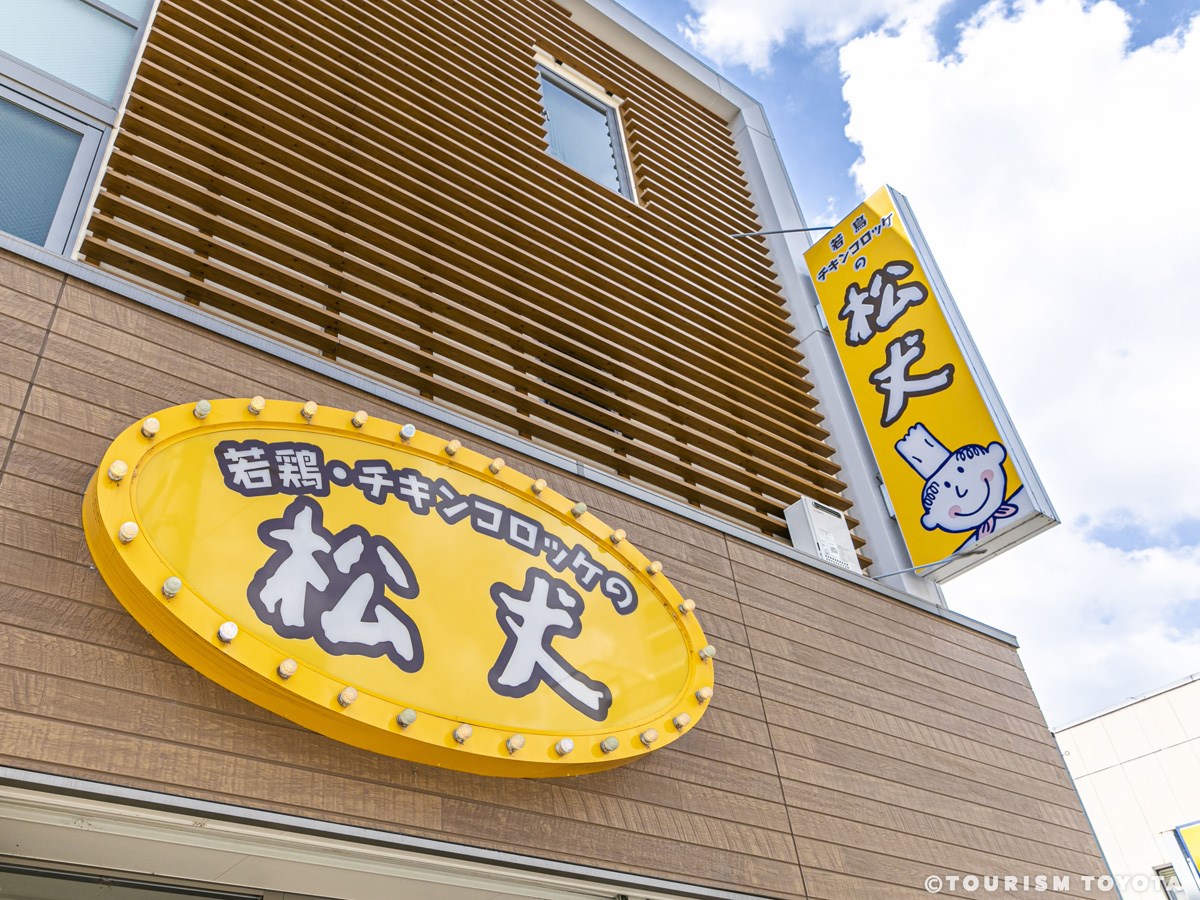
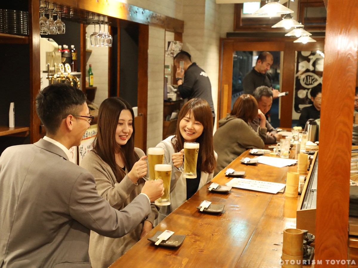
Matsujo
Toyota-Area
Located a short walk away from Toyotashi Station, Matsujo is famous for their croquettes …
-

Shimoyama no Sato Goheimochi and Restaurant
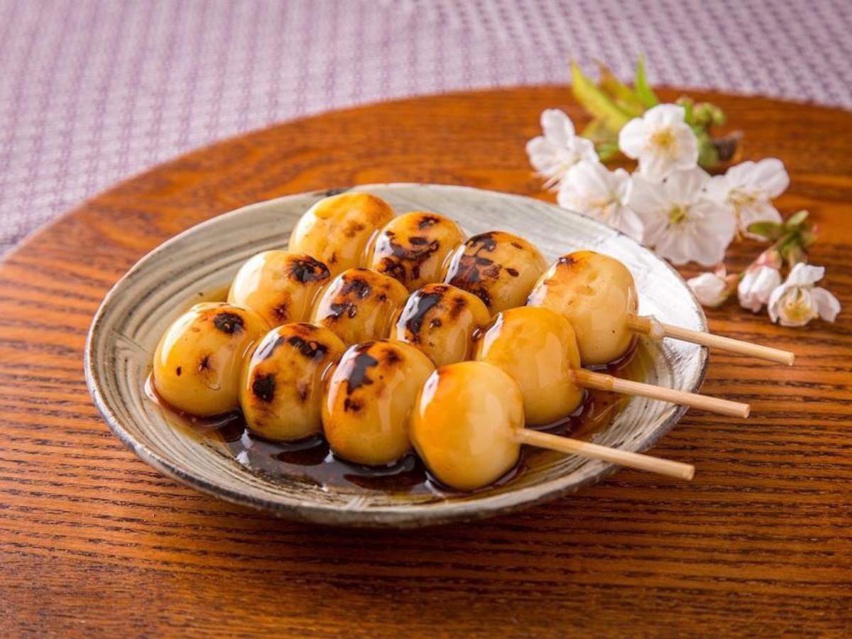
Shimoyama-Area
With a giant statue of goheimochi—a rice cake on a stick, covered in a sweet miso sauce—S…
-
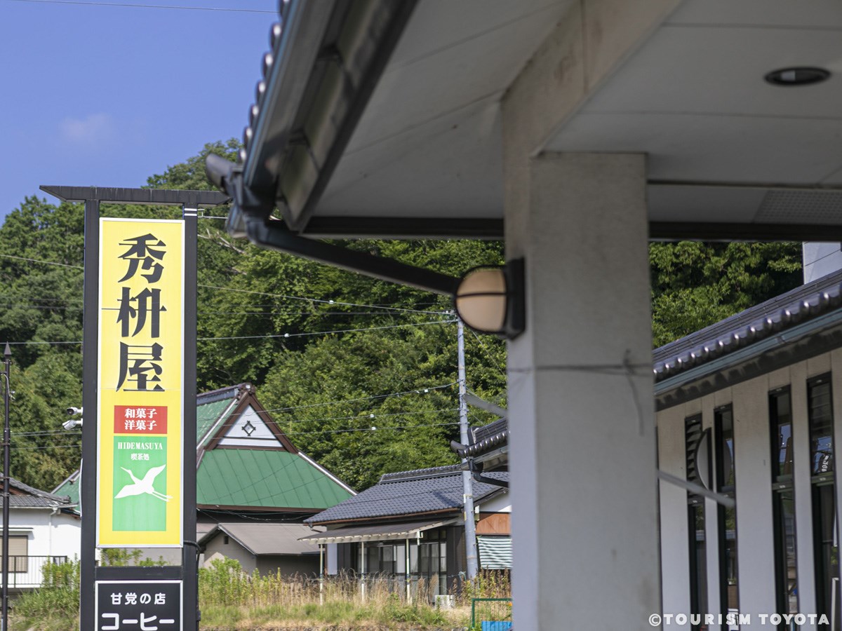
Hidemasuya
Shimoyama-Area
Hidemasuya sells Japanese and Western confections at the gateway to the abundant nature a…
-

Japan Agricultural Cooperatives of Toyota City
Wide-Area
"TOYOTABI Stations", located at various stores around the City of Toyota, offer pamphlets…
-
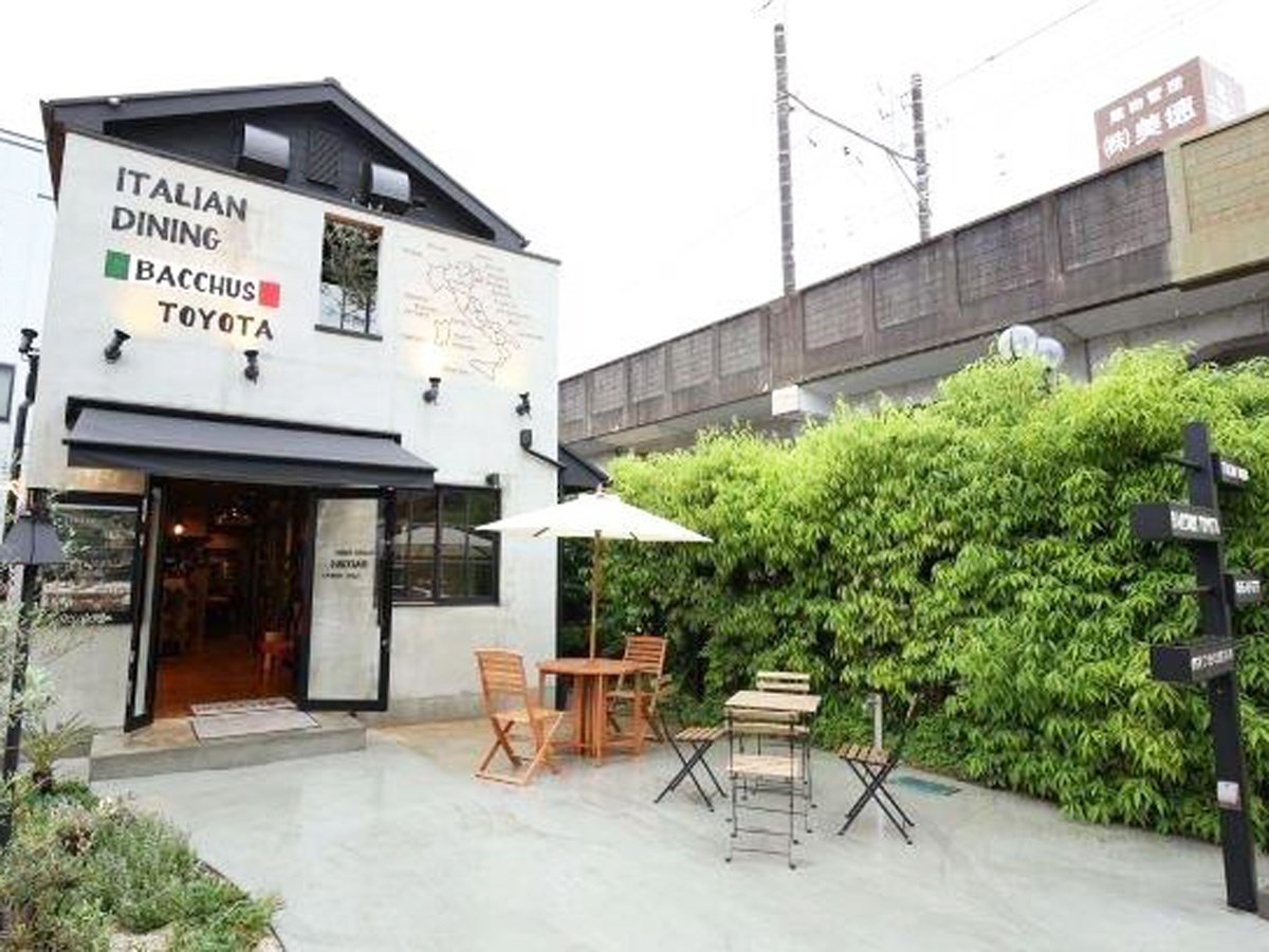
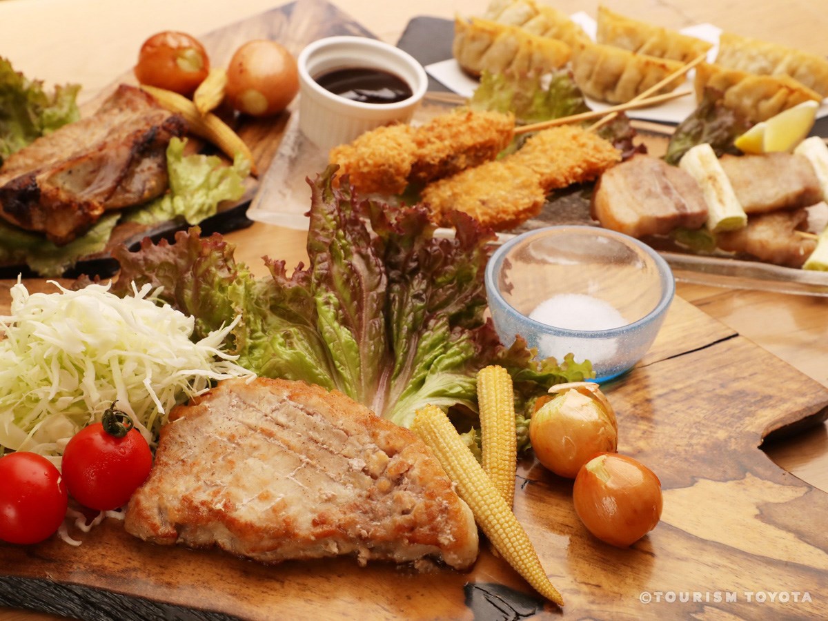
Casual Italian Dining BACCHUS TOYOTA
Toyota-Area
BACCHUS TOYOTA is a bar and restaurant located in a detached house, accessible two minute…
-

Bar Reserva
Toyota-Area
-
Azuki-An Natural Sweets
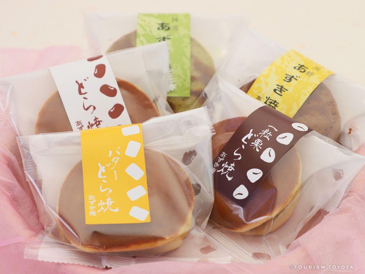
Toyota-Area
Azuki-An is adamant about each and every ingredient used in its carefully created confect…
-

Nakagaki Sake Brewery
Asahi-Area
Nakagaki Shuzo Shikan Refined Sake Brewery brews its spirits with incredibly soft, natura…
-

Hidaya Confectionery
Asahi-Area
This established Japanese confectionery started in the Odo area of Toyota City in 1912. I…
-
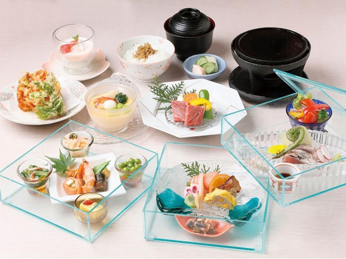
Sakura-Tei Horyukaku Seasonal Cuisine
Toyota-Area
More than 50 years since its establishment in the city of Toyota in Aichi Prefecture, Sak…
-
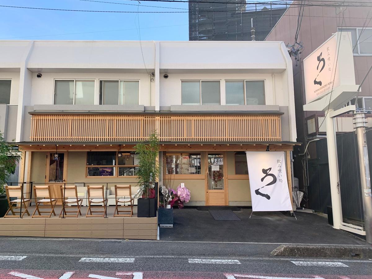
Nomikuidokoro Roku, Nishi-machi Shop
Toyota-Area
Since closing its Nagasaki Goto Rokujo restaurant, beloved by patrons for 11 years, the R…
-
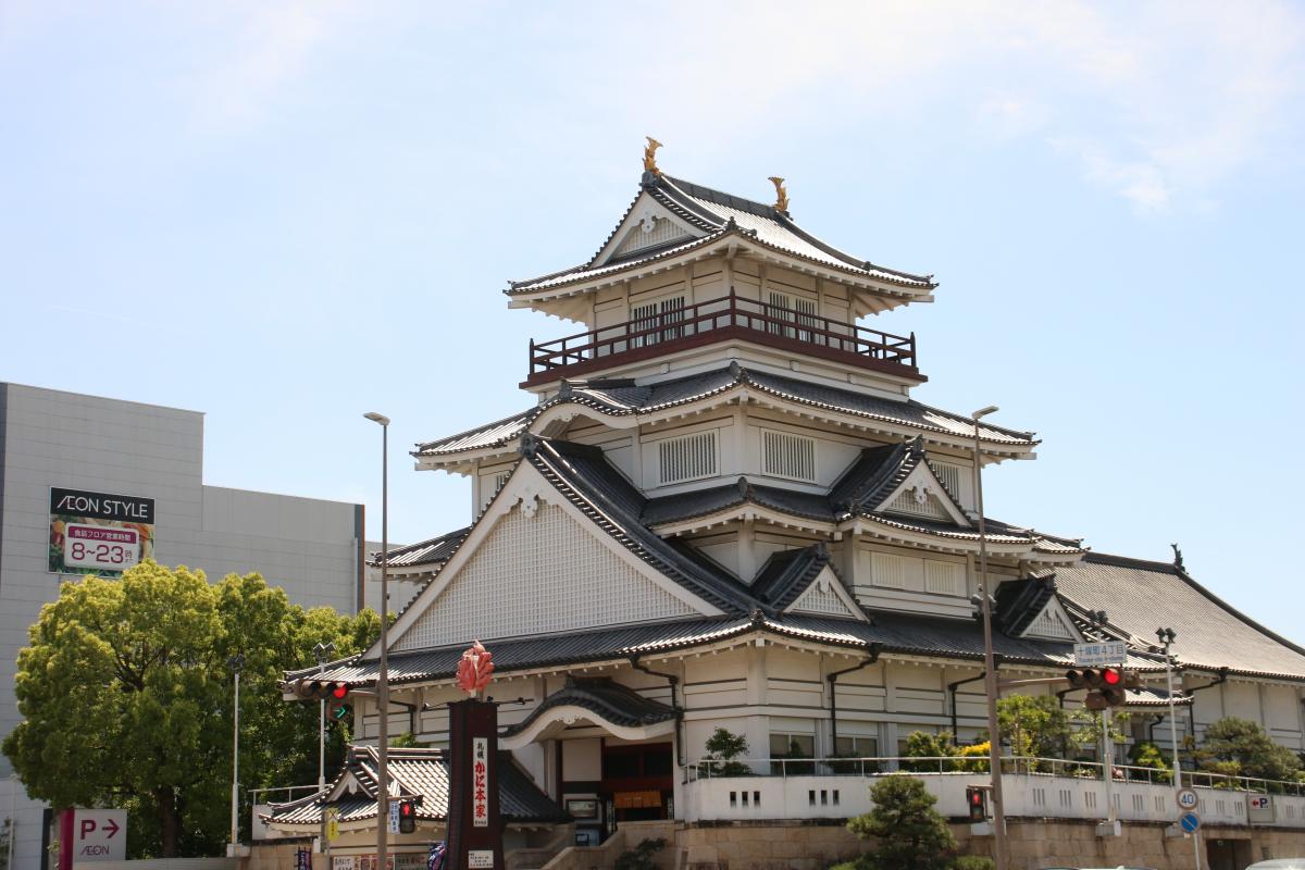
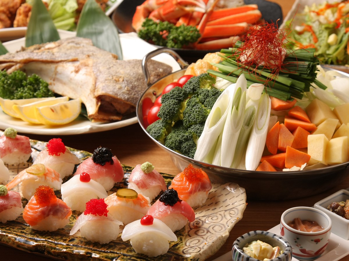
Sapporo Kanihonke, Toyota Castle Location
Toyota-Area
When it comes to crab cuisine in Japan, Sapporo Kanihonke is the place—and with good reas…
-

Butcher shop boars ”BOTAN” and deers ”MOMIJI” YAMAKEI
Asuke-Area
Our job is processing wild game meat and providing fresh wild game meat to our customers.…
-
Shimaya Confectionery
Matsudaira-Area
-
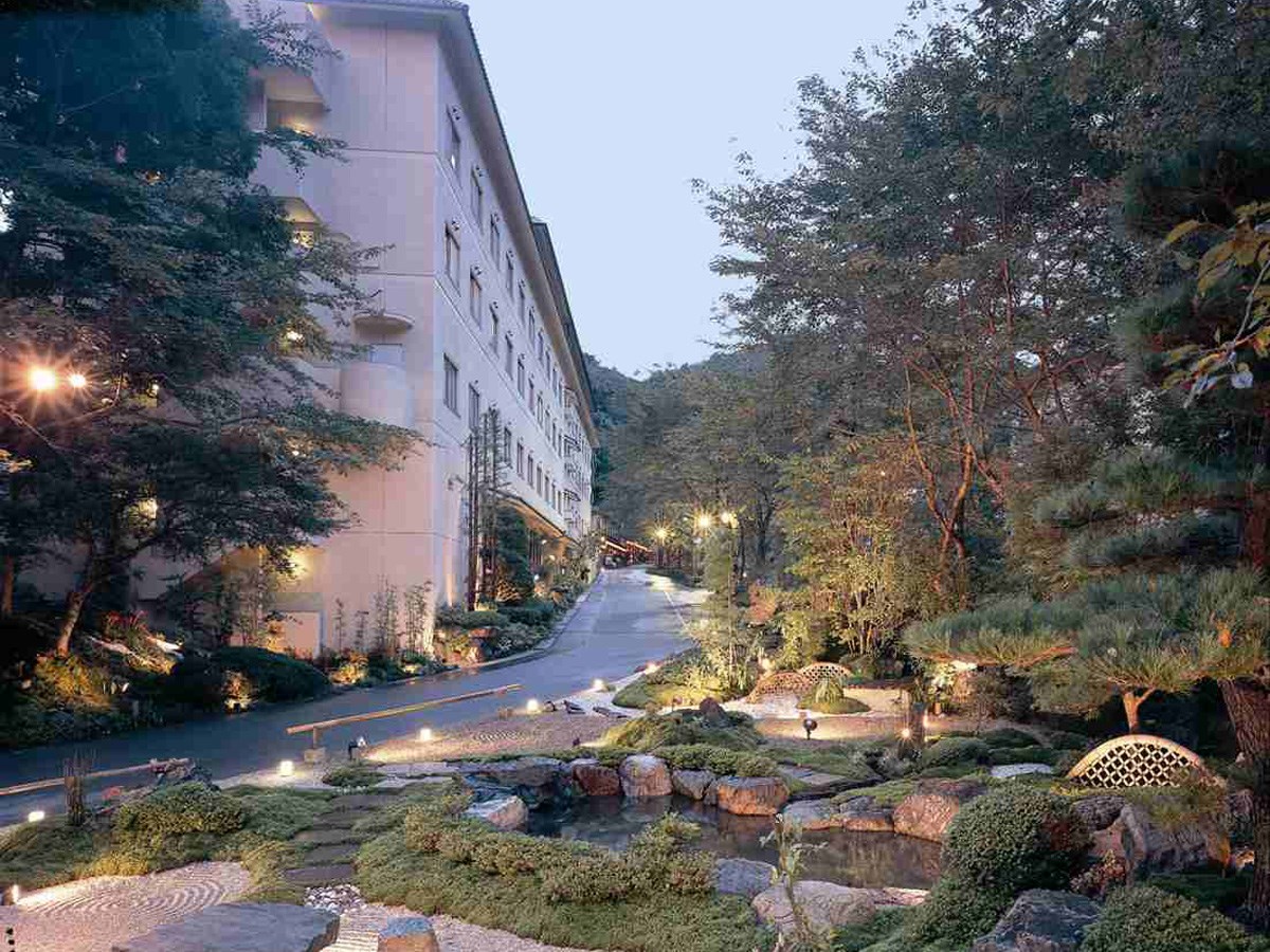
Attaka no Sato Sanage Onsen Hotel Kinsenkaku
Toyota-Area
Sanage Onsen is surrounded by flowers all year round. In spring, the area turns into a …
-
Hotel Matsukaze
Toyota-Area
This affordable business hotel offers the indulgences of an open-air bath made from maifa…
-
Jurakuso Toyota City Hot Spring Recreational Facility for the Elderly
Obara-Area
The hot spring at Jurakuso is one of only a few natural radon hot springs in Japan. The…
-
Hotel Hyakunensou
Asuke-Area
Standing on the banks of the Asuke River, the Hotel Hyakunensou commands a breathtaking v…
-
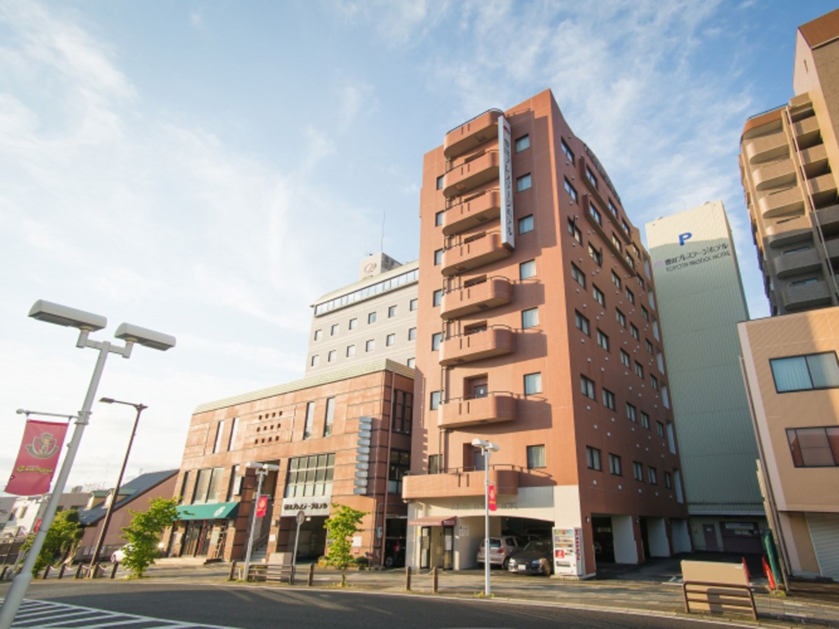
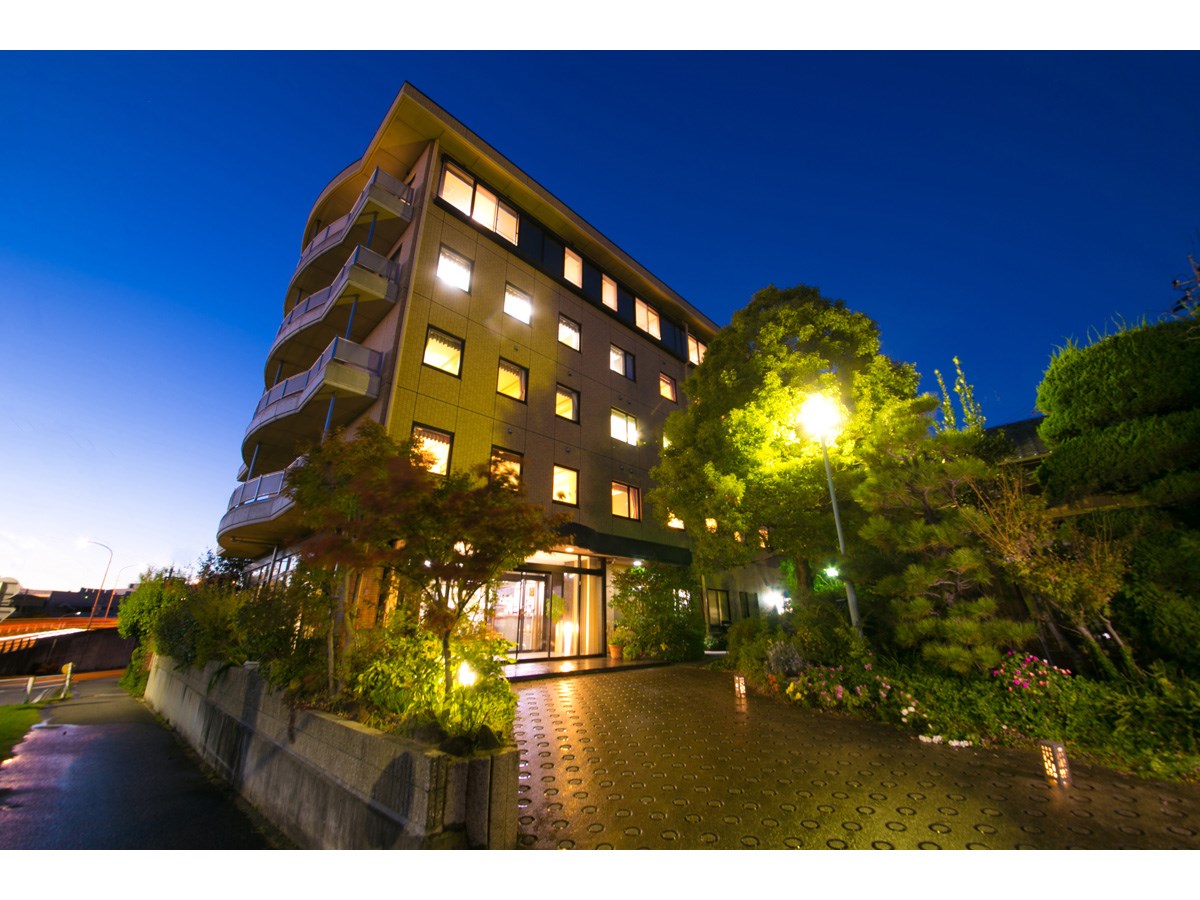
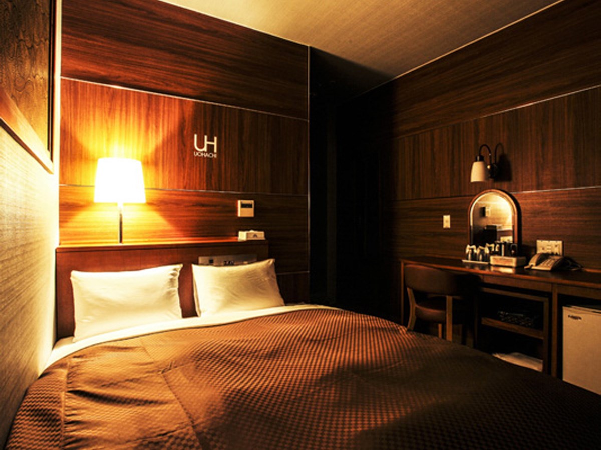
Toyota Prestige Hotel
Toyota-Area
Whether you’re visiting for business or travel, it’s an ideal base of operations. It's …
-
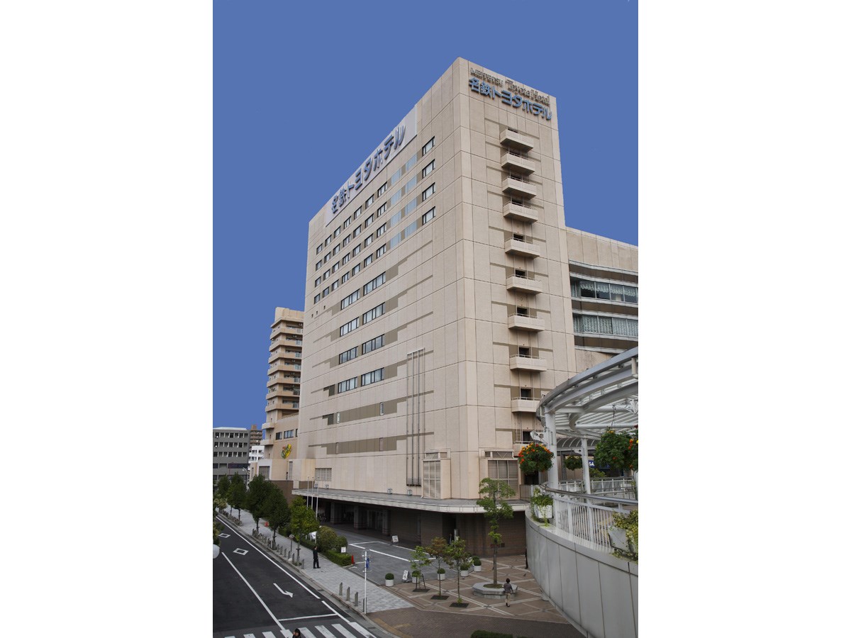
Meitetsu Toyota Hotel
Toyota-Area
A one-minute walk from Meitetsu Toyotashi Station. A perfect base for sightseeing in the …
-
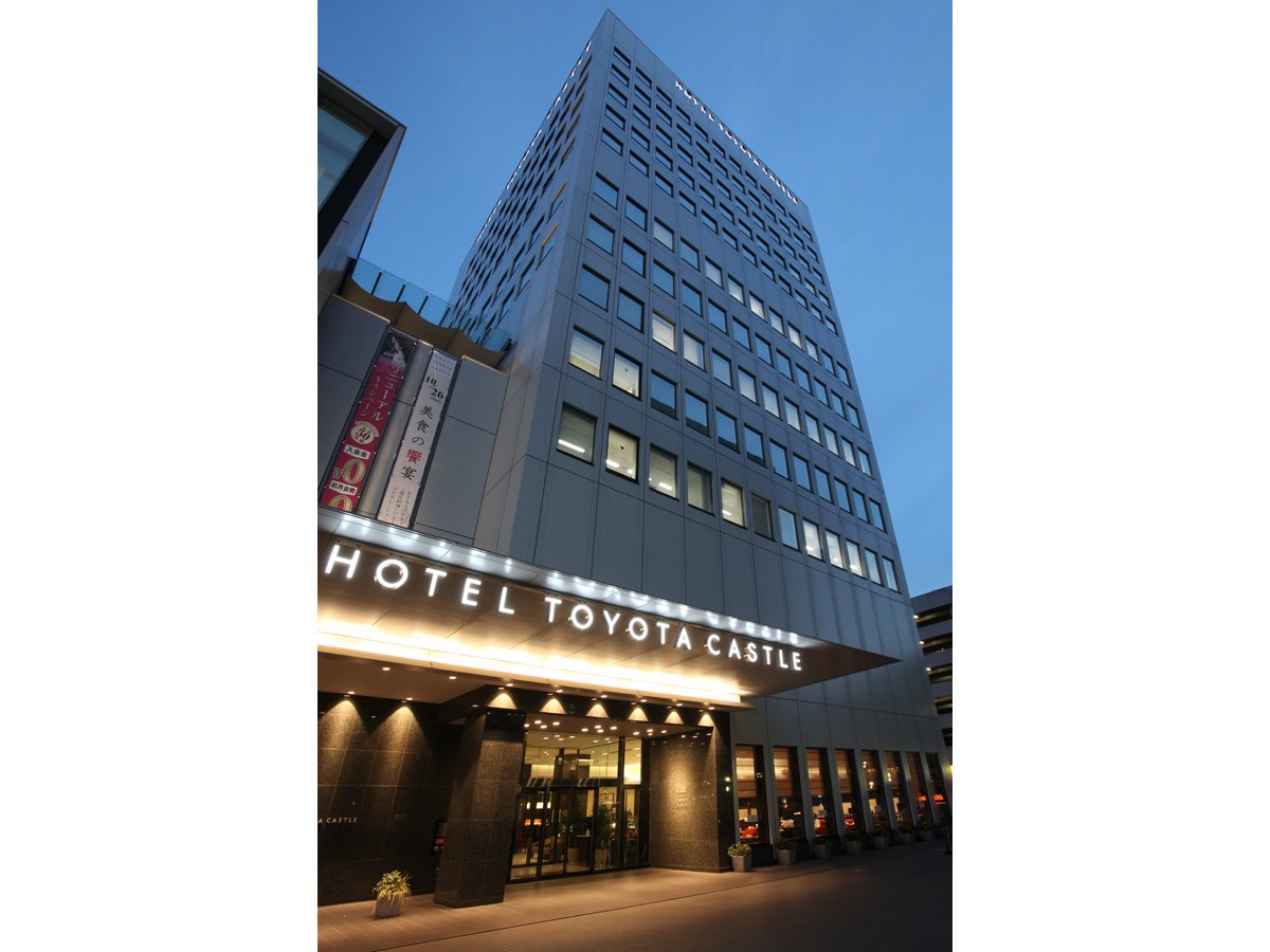
Hotel Toyota Castle
Toyota-Area
In its unbeatable location only a two-minute walk from Meitetsu Toyotashi Station, Hotel …
-
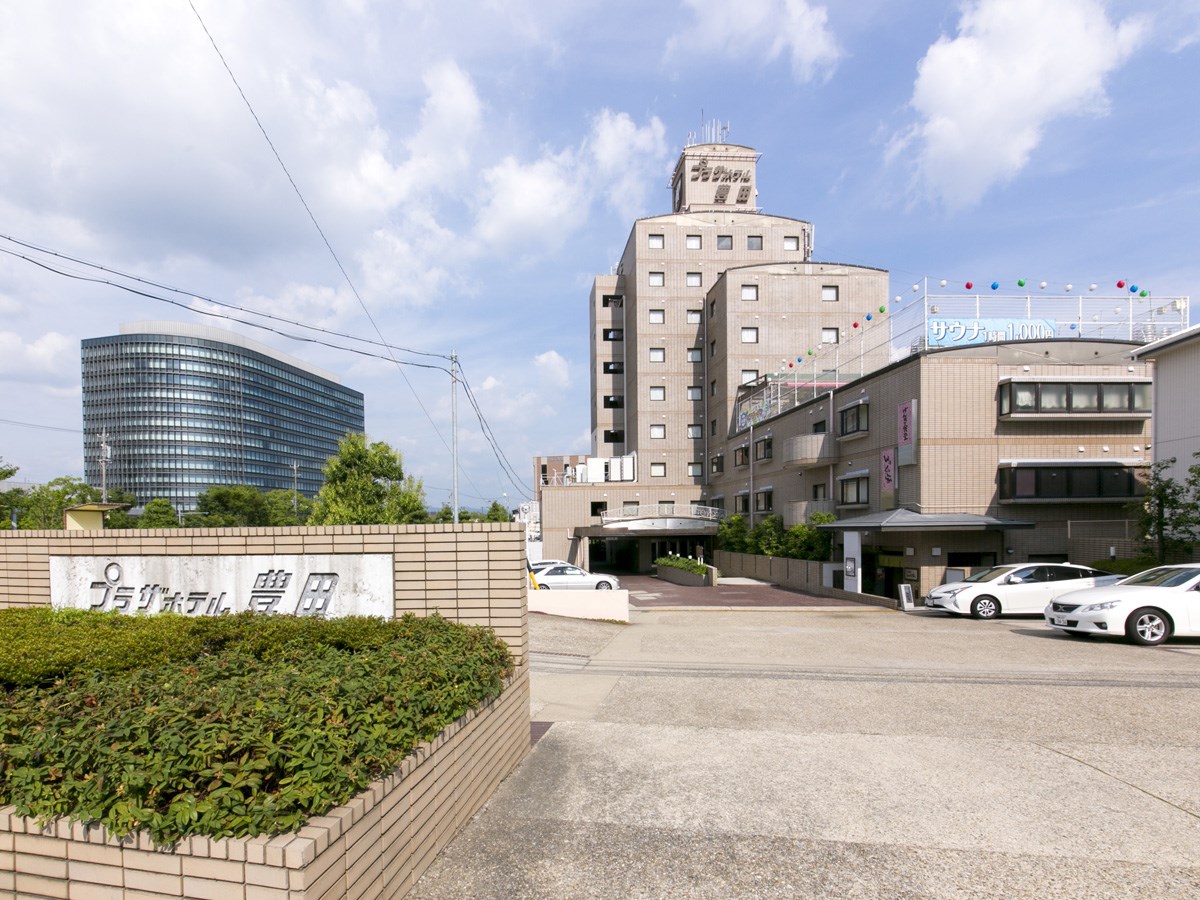
Plaza Hotel Toyota
Toyota-Area
Our rooms were designed with attention to functionality, but still have a natural feel. G…
-
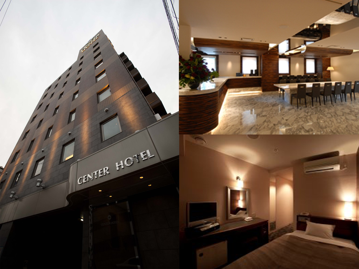
CENTER HOTEL TOYOTA
Toyota-Area
A five-minute walk from Meitetsu Toyotashi Station. A design hotel with free Wi-Fi in eac…
-

Hotel Palace Inn Toyota
Toyota-Area
-
City Hotel Aunties
Toyota-Area
Located just a 4-minute walk from Toyota-shi Station. Toyota Stadium and Sky Hall Toyota …
-
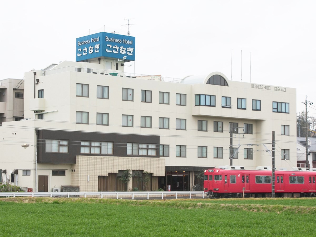
Business Hotel KOSANAGI
Toyota-Area
-
Hotel Okadaya
Inabu-Area
-
The Ninja Mansion
Asuke-Area
Built 150 years ago, this traditional house of a village headman was renovated into a ren…
-
Uohachi Royal Hotel
Toyota-Area
-
Hearth and Lodge Kikko-en
Inabu-Area
-
Kajika-en Inn (accommodation)
Shimoyama-Area
-
Country Restaurant Keiryu-so (accommodation)
Asahi-Area
-
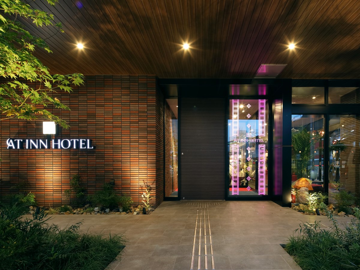
At Inn Hotel, Toyotashi Station
Toyota-Area
-
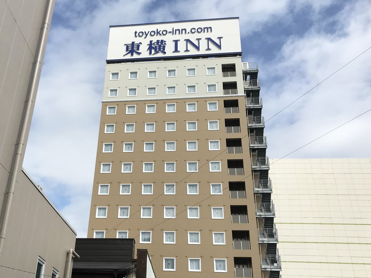
Toyoko Inn, Toyota-shi Ekimae
Toyota-Area
-
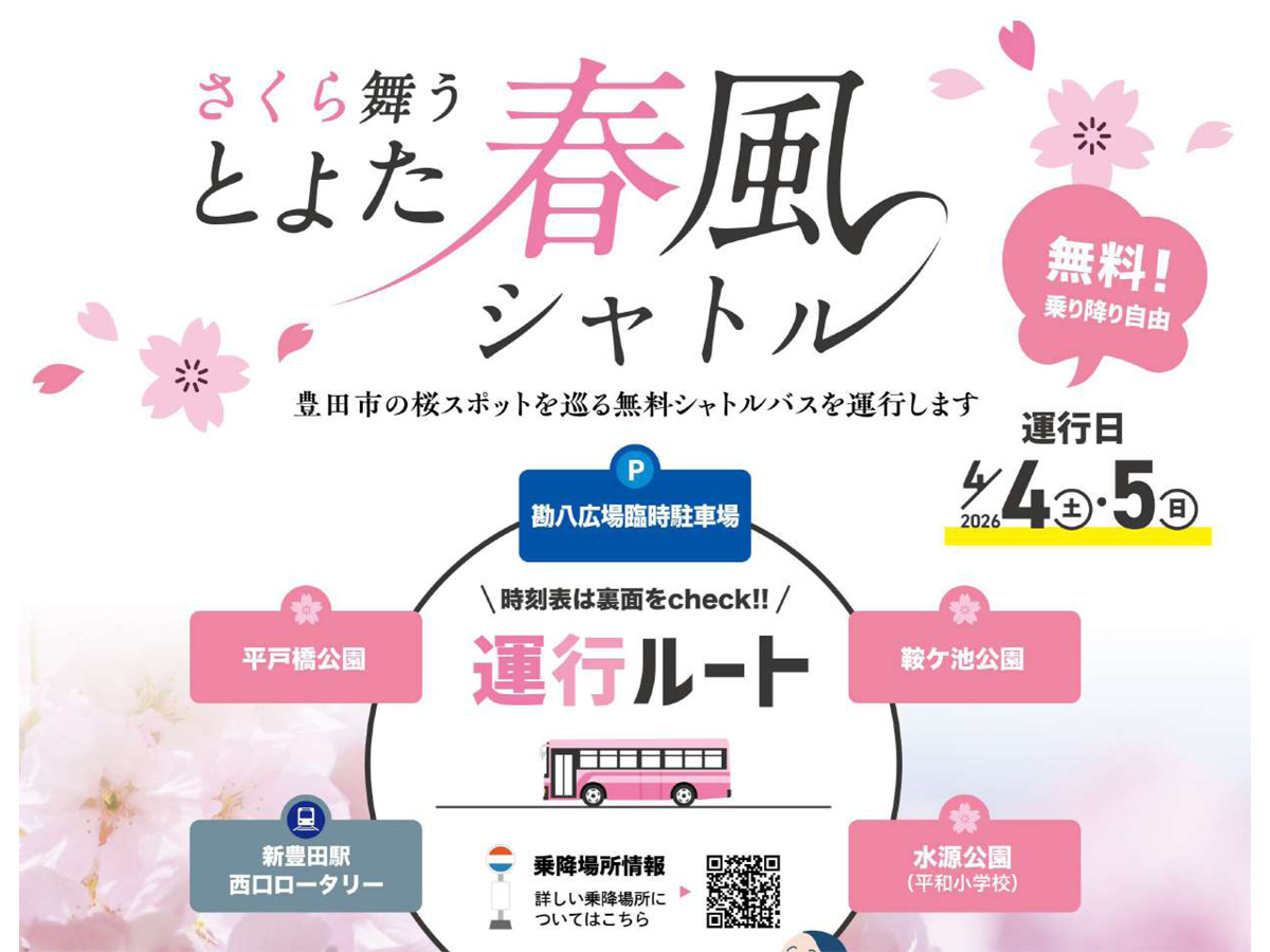
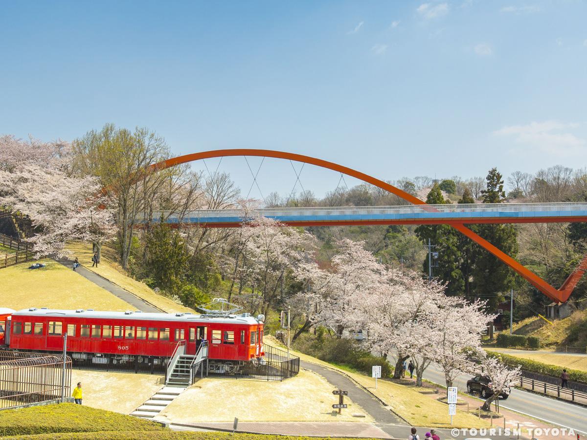
Cherry Blossom Shuttle Bus
Toyota-Area
A shuttle bus service will operate connecting 3 cherry blossom viewing spots—Hiratobashi …